 Lake Mead in Las Vegas, Nevada
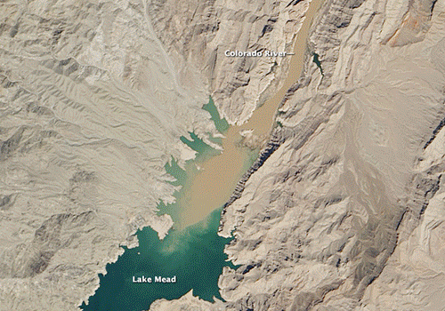
Lake Mead is a lake on the Colorado River, about 39 km from the Las Vegas Strip, southeast of the city of Las Vegas, Nevada, in the states of Nevada and Arizona. It is the largest reservoir in the United States in terms of water capacity. Formed by the Hoover Dam, the reservoir serves water to the states of Arizona, California, and Nevada, providing sustenance to nearly 20 million people and large areas of farmland. At maximum capacity, Lake Mead is 180 km long, 162 m at its greatest depth, has a surface elevation of 372.3 m above sea level and 640 km2 of surface area, and contains 32.22 km3 of water. The lake has not reached full capacity, however, since 1983 due to a combination of drought and increased water demand. As of August 2017, Lake Mead was at approximately 40% of full capacity with 10 million acre-feet of held water. It has been smaller than Lake Powell (the second largest US reservoir when both are full) since 2013. Read more about Lake Mead on Wikipedia. Las Vegas, officially the City of Las Vegas and often known simply as Vegas, is the 28th-most populated city in the United States, the most populated city in the state of Nevada, and the county seat of Clark County. The city anchors the Las Vegas Valley metropolitan area and is the largest city within the greater Mojave Desert. Las Vegas is an internationally renowned major resort city, known primarily for its gambling, shopping, fine dining, entertainment, and nightlife. The Las Vegas Valley as a whole serves as the leading financial, commercial, and cultural center for Nevada. The city bills itself as The Entertainment Capital of the World, and is famous for its mega casino–hotels and associated activities. It is a top three destination in the United States for business conventions and a global leader in the hospitality industry, claiming more AAA Five Diamond hotels than any other city in the world. Today, Las Vegas annually ranks as one of the world's most visited tourist destinations. The city's tolerance for numerous forms of adult entertainment earned it the title of Sin City, and has made Las Vegas a popular setting for literature, films, television programs, and music videos. Las Vegas was settled in 1905 and officially incorporated in 1911. At the close of the 20th century, it was the most populated American city founded within that century (a similar distinction earned by Chicago in the 1800s). Population growth has accelerated since the 1960s, and between 1990 and 2000 the population nearly doubled, increasing by 85.2%. Rapid growth has continued into the 21st century, and according to a 2017 estimate, the population is 648,224 with a regional population of 2,248,390. "Las Vegas" is often used to describe areas beyond official city limits—especially the areas on and near the Las Vegas Strip, which is actually located within the unincorporated communities of Paradise, Winchester, and Enterprise.
Read more about Las Vegas in Wikipedia
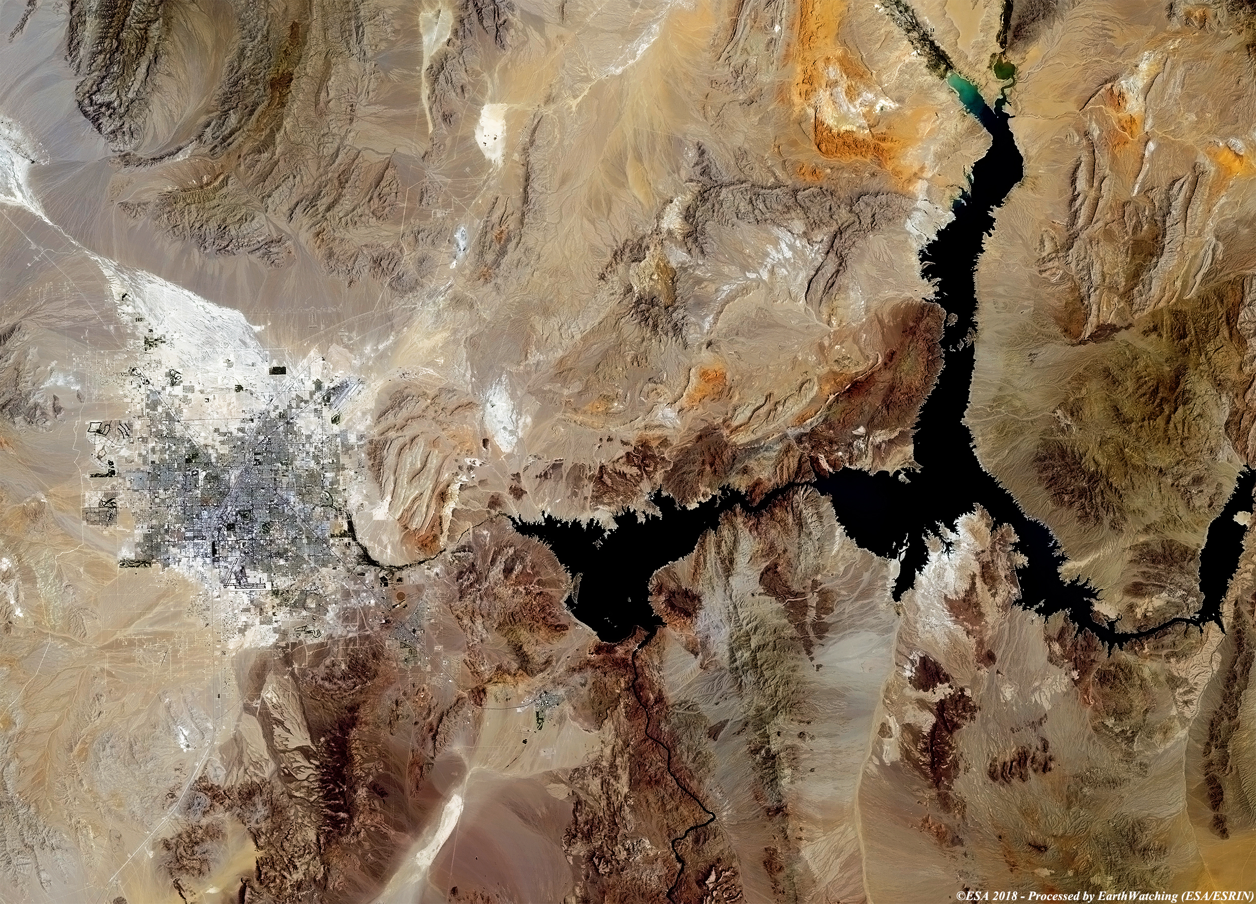
Today our tour focuses on Lake Mead, situated in the state of Nevada near Las Vegas. The image comparison acquired by Landsat 5 and 8 over the period of 27 years, shows the urban development of Las Vegas and assess the water level of Lake Mead. In fact, according to the studies, the lake could completely dry up by 2021. The water level of the lake is continuously decreasing which raises concerns about the desertification of the surrounding area. Such a sudden drop in water level can have a major impact on the urban development of the nearby Las Vegas. Another aim of these images is to promote the opportunity to download Landsat data through the ESA portals (or third party mission free catalogue), where images captured every day are made available in near real time to the users and the scientific community. Landsat full resolution data products are freely available for immediate download at: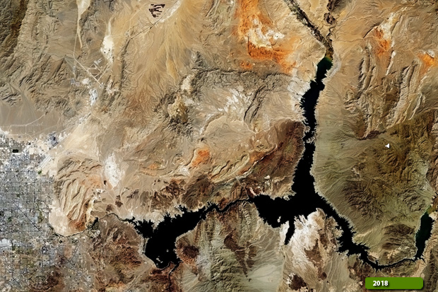 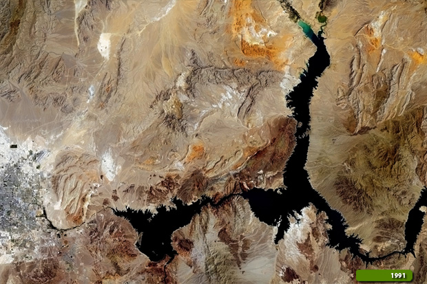 View Landsat 8 OLI high resolution image (JPG 6.1 MB) View Landsat 5 TM high resolution image (JPG 5.4 MB)
|
|||||||||||||||||||||