 La Spezia, Italy
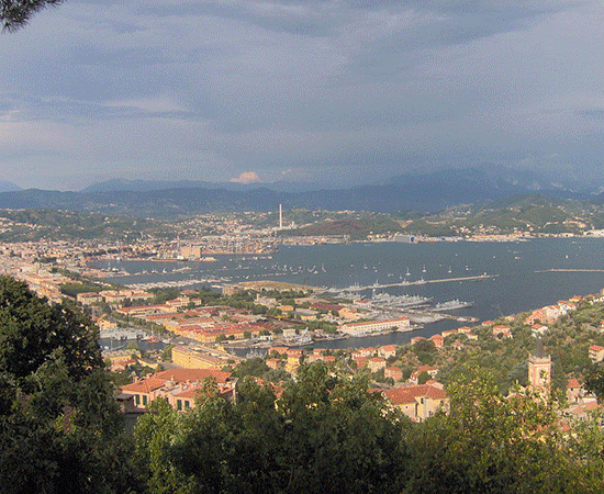
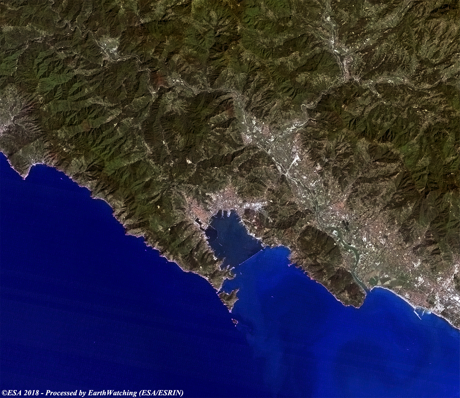
La Spezia, at the head of the Gulf of La Spezia in the southern part of the Liguria region of Northern Italy, is the capital city of the province of La Spezia. In terms of population, La Spezia is the second city in the Liguria region, just after Genoa. Located roughly midway between Genoa and Pisa, on the Ligurian Sea, it is one of the main Italian military and commercial harbours and a major Italian Navy base. A significant railway junction, it is notable for its museums, for the Palio del Golfo rowing race, and for railway and boat links with the Cinque Terre. More information is available on Wikipedia.
The aim of these images acquired by Landsat 8 and 5, in 2018 and 1990, are to show the changes in the city and it's port during the last 28 years. It is possible to see that infrastructural development, particularly to north of the city. This development change is more evident in the image acquired by Sentinel-2 (in higher-10 metres of resolution). Another aim of these images is to promote the opportunity to download Landsat data through the ESA portals (or third party mission free catalogue), where images captured every day are made available in near real time to the users and the scientific community. Landsat full resolution data products are freely available for immediate download at: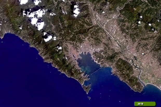 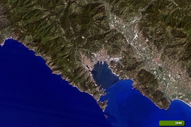 View Landsat 8 OLI high resolution image (JPG 2.0 MB) View Landsat 5 TM high resolution image (JPG 2.4 MB)
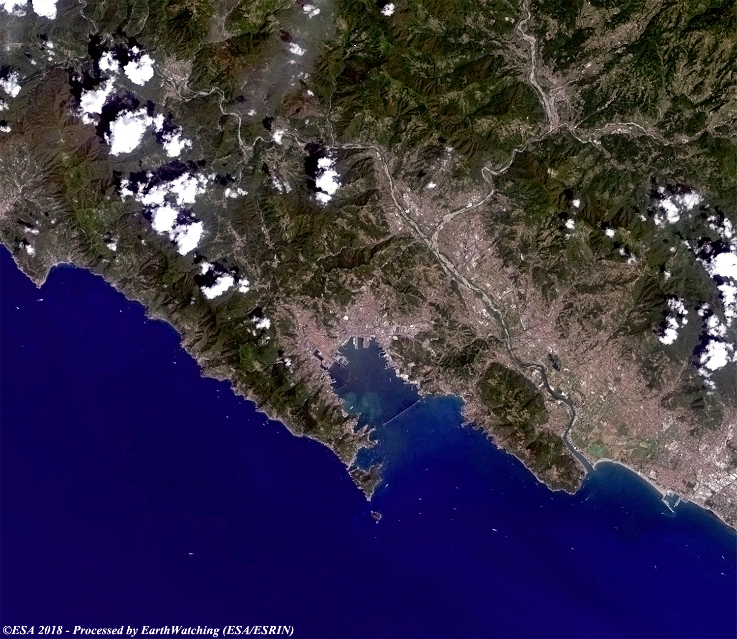
This image below, acquired by the optical sensor on the Copernicus Sentinel-2, aims to show the same area with the same bands combination of Landsat 8, but with different pixel resolution as compared to the Landsat 8.
|
||||||||||||||||||||||||||||||||||
