 Iceberg B09B, Antarctica
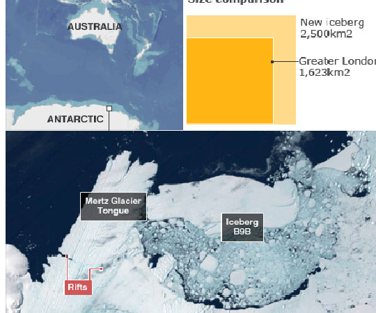
The colossal B09B iceberg, measuring 2900sq km (which The Guardian compared to the size of Rome), grounded in Commonwealth Bay in East Antarctica in December 2010. The Adelie penguin population at the bay's Cape Denison was measured to be about 160,000 in February 2011 but by December 2013 it had plunged to an estimated 10,000, according to research published in the Antarctic Science journal. The iceberg's grounding meant the penguins had to walk more than 60 kilometres to find food, impeding their breeding attempts, said the researchers from the University of New South Wales' (UNSW) Climate Change Research Centre and New Zealand's West Coast Penguin Trust. "The Cape Denison population could be extirpated within 20 years unless B09B relocates or the now perennial fast ice within the bay breaks out," they wrote. Fast ice is sea ice which forms and stays fast along the coast. During their census in December 2013, the researchers said "hundreds of abandoned eggs were noted, and the ground was littered with the freeze-dried carcasses of previous season's chicks". "It's eerily silent now," UNSW's Chris Turney, who led the 2013 expedition, told Fairfax. "The ones that we saw at Cape Denison were incredibly docile, lethargic, almost unaware of your existence. "The ones that are surviving are clearly struggling. They can barely survive themselves, let alone hatch the next generation. We saw lots of dead birds on the ground, it's just heartbreaking to see." In contrast, penguins living on the eastern fringe of the bay just eight kilometres from the fast ice edge were thriving, the scientists said. The researchers said the study had "important implications" for the wider East Antarctic if the current trend of increasing sea ice continued. Sea ice around Antarctica is increasing, in contrast to the Arctic where global warming is causing ice to melt and glaciers to shrink. Scientists believe the growth in Antarctic sea ice is largely driven by changes in wind and local conditions. Source information is available on: News Corp Australia
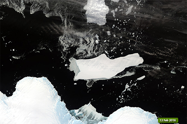 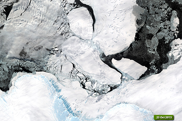 The animation below was created with a merge of six Landsat 8 satellite images, and shows the situation along the area of Cape Deninson and the evolution of the glacier during the time taken as reference. View Landsat 8 OLI high resolution image animation (JPG 1.9 MB)
|
|||||||||||||||||||||