 Helheim Glacier, Greenland
Helheim Glacier is one of Greenland's largest outlet glaciers. It feeds the waters of the Helheim Fjord, a branch of the Sermilik (Egede og Rothes Fjord) system, where there are a number of other glaciers discharging such as the Midgard Glacier. The glacier is named after the world of the dead in Norse Mythology. More information is available on Wikipedia

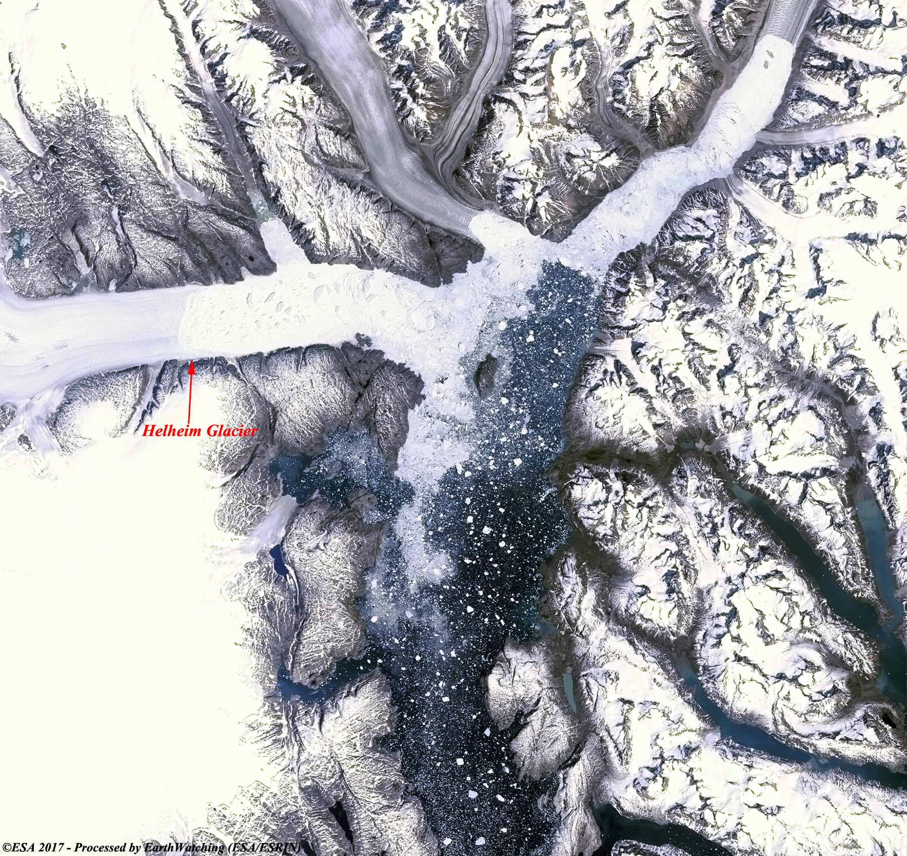
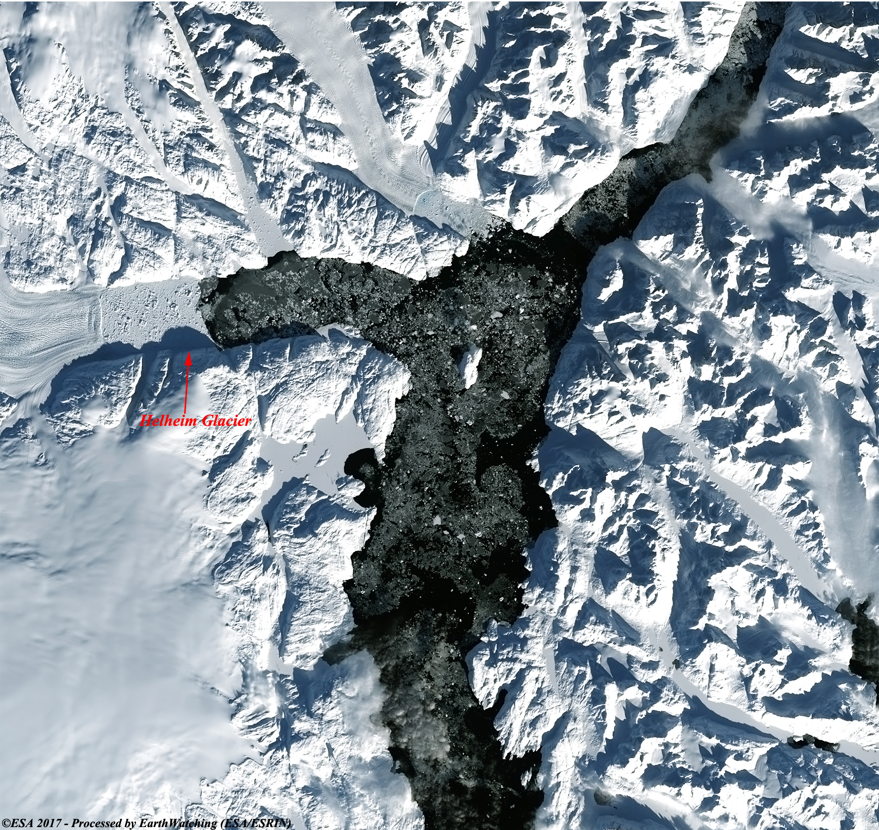
This week our tour around the world stops over the Helheim Glacier in southeastern Greenland. These images acquired by Landsat 5/8 in a time window of thirty-two years ( before/after), aims to shows the dramatic retreat of the glacier from 1985 until today. Scientists working on the Helheim and the fjord it drains into are looking for clues to the decline in hopes of predicting what might happen in the region as the climate rapidly warms. Another aim of these images is to promote the opportunity to download Landsat data through the ESA portals, where images captured every day are made available in near real time to the users and the scientific community. Landsat full resolution data products are freely available for immediate download at: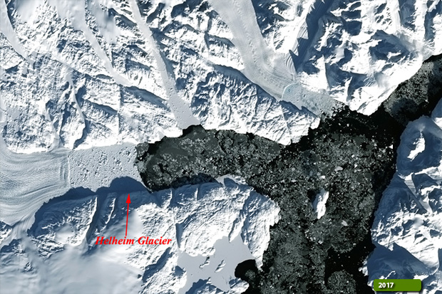 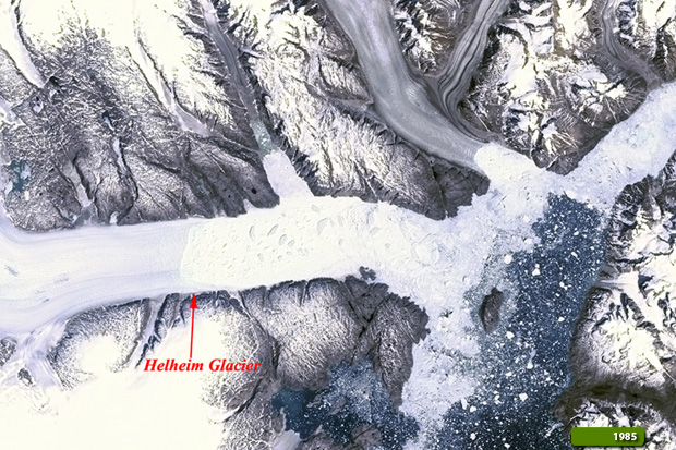 View Landsat 5 TM high resolution image (JPG 3.1 MB) View Landsat 8 OLI high resolution image (JPG 2.7 MB)
|
|||||||||||||||||||||