 Havana, Cuba
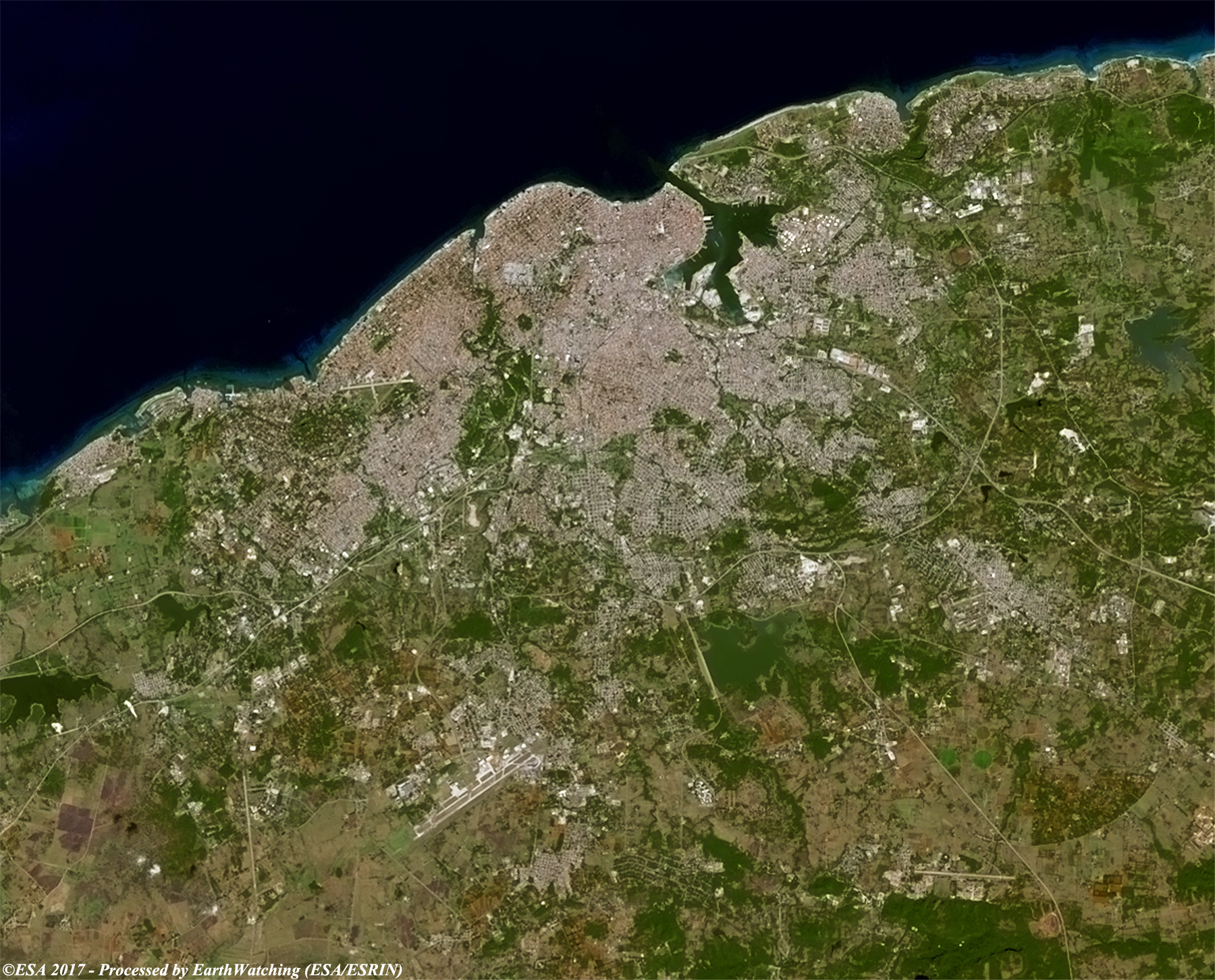
Havana is the capital city, a largest province, a major port, and a leading commercial centre of Cuba. The city has a population of 2.1 million inhabitants, and it spans a total of 728.26 km2, making it the largest city by area, the most populous city, and the fourth largest metropolitan area in the Caribbean region. The city extends mostly westward and southward from the bay, which is entered through a narrow inlet and divides into three main harbours: Marimelena, Guanabacoa and Atarés. The sluggish Almendares River traverses the city from south to north, entering the Straits of Florida a few miles west of the bay. The city of Havana was founded by the Spanish in the 16th century and due to its strategic location it served as a springboard for the Spanish conquest of the continent, becoming a stopping point for treasure-laden Spanish galleons returning to Spain. King Philip II of Spain granted Havana the title of City in 1592. Walls as well as forts were built to protect the old city. The sinking of the U.S. battleship Maine in Havana's harbor in 1898 was the immediate cause of the Spanish–American War. Contemporary Havana can essentially be described as three cities in one: Old Havana, Vedado and the newer suburban districts. The city is the center of the Cuban government, and home to various ministries, headquarters of businesses and over 90 diplomatic offices. The current mayor is Marta Hernández of the Communist Party of Cuba (PCC). In 2009, this city had the third highest income in the country. The city attracts over a million tourists annually; the Official Census for Havana reports that in 2010 the city was visited by 1,176,627 international tourists, a 20% increase from 2005. Old Havana was declared a UNESCO World Heritage Site in 1982. The city is also noted for its history, culture, architecture and monuments. As typical of Cuba, Havana also features a tropical climate. In May 2015, Havana was selected as one of the so-called New7Wonders Cities together with Beirut, Doha, Durban, Kuala Lumpur, La Paz, and Vigan. More information is available on Wikipedia
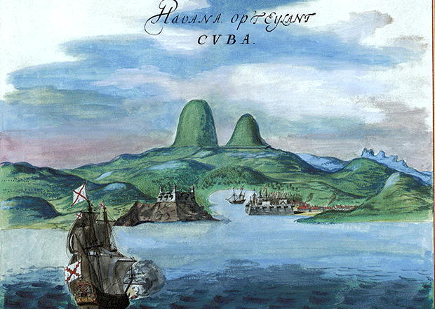
We continue our tour around the world in 2017 and today look at Havana city. Havana is the capital, and chief seaport of Cuba, in western part of the island. The largest city in the West Indies, Havana is on the western side of the Bay of Havana, on the northern coast of the island, south of Key West, Florida. The Bay of Havana is one of the safest harbours in the world; a narrow strait affords entrance to the bay, which is navigable by ocean-going vessels. The eastern side of the outer entrance is dominated by Morro Castle, a 16th-century fortress. Castillo de la Punta, another old fortress, is on the western side of the strait. In these images acquired by the Landsat 5 and 8 satellites with a time window (before/after) of 19 years, we aim to show how the city has evolved over time. The comparison images show only a few changes in the centre of city, along the north coast and in the suburbian area. Another aim of these images is to promote the opportunity to download Landsat data through the ESA portals and third party mission catalogue, where images captured every day are made available in near real time to the users and the scientific community. Landsat full resolution data products are freely available for immediate download at: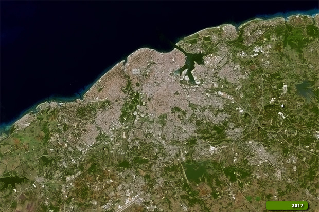 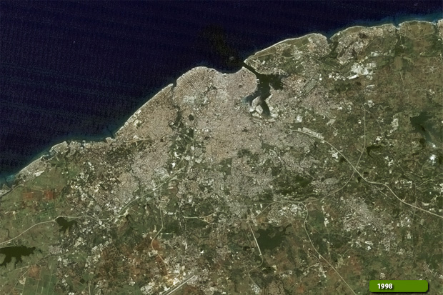 View Landsat 5 TM high resolution image (JPG 2.3 MB) View Landsat 8 OLI high resolution image (JPG 2.3 MB)
|
|||||||||||||||||||||