 Gibraltar, United Kingdom
Gibraltar is a British Overseas Territory located on the southern end of the Iberian peninsula. It has an area of 6.7 km2 and shares its northern border with Spain. The Rock of Gibraltar is the major landmark of the region. At its foot is a densely populated city area, home to over 30,000 Gibraltarians and other nationalities. An Anglo-Dutch force captured Gibraltar from Spain in 1704 during the War of the Spanish Succession on behalf of the Habsburg pretender to the Spanish throne. The territory was subsequently ceded to Britain "in perpetuity" under the Treaty of Utrecht in 1713. During World War II it was an important base for the Royal Navy as it controlled the entrance and exit to the Mediterranean Sea, which is only 13 km wide at this point. Today Gibraltar's economy is based largely on tourism, online gambling, financial services, and shipping. The sovereignty of Gibraltar is a major point of contention in Anglo-Spanish relations as Spain asserts a claim to the territory. Gibraltarians overwhelmingly rejected proposals for Spanish sovereignty in a 1967 referendum and again in 2002. Under the Gibraltar constitution of 2006, Gibraltar governs its own affairs, though some powers, such as defence and foreign relations, remain the responsibility of the Government of the United Kingdom. Source information from Wikipedia
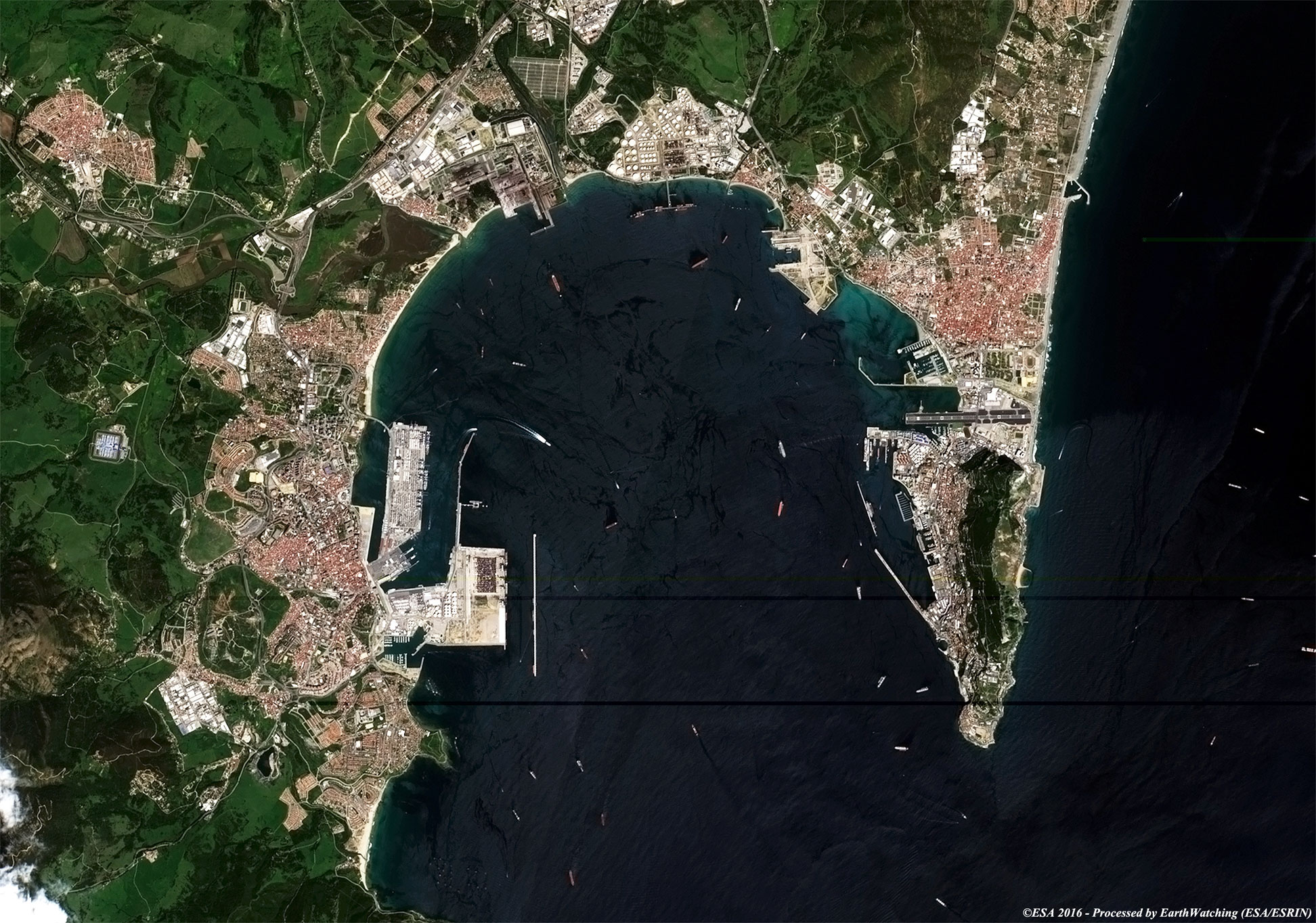
Our tour today stops over the city of Gibraltar, administrative centre of the British dependency of Gibraltar, located on the west coast of the Iberian Peninsula. The city is located on a safe enclosed harbour on the coast. The town is a free port, one that encourages tourism and trade. The harbour was a key naval base during World Wars I and II. Today, an important use of the harbour is for ships to transfer oil on tankers (see the Sentinel-2 image). The image shows a large number of tankers into the harbour. Another item note in Gibraltar is the airport. Gibraltar has an extremely small size (about 6,4 sq km) and the airport actually occupies a good part of this, and so it was inevitable that a main road, which leads from the English territory to Spain, intersects the runway. For this reason traffic on the road is interrupted when a aircraft needs to land and take off. This is a very unusual situation and helped earn the airport a place in the top ten of the most dangerous in the world, and is regarded by some of the most dangerous in Europe. The airport was constructed during World War II upon the territory's race course (introduced by the Maltese), when Gibraltar was an important naval base for the British. Originally opened in 1939, it was only an emergency airfield for the Royal Navy's Fleet Air Arm. However, the runway was later extended by reclaiming some land from the Bay of Gibraltar using rock blasted from the Rock of Gibraltar while carrying out works on military tunnels. This last major extension of the runway allowed larger aircraft to land at Gibraltar. With this small demostration of images taken by the Sentinel-1 (Radar7 SAR instrument) and Sentinel-2 (optical sensor), satellites of the Copernicus project family, we want to show to the scientific community the large field of application that this satellite family can cover. 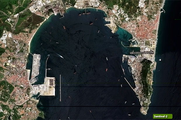 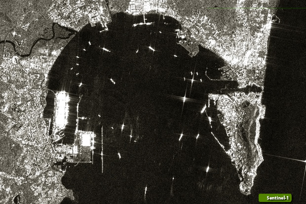 View Sentinel-1 high resolution image (JPG 1.2 MB) View Sentinel-2 high resolution image (JPG 644 KB)
|
|||||||||||||||||||