 Diavik Diamond Mine
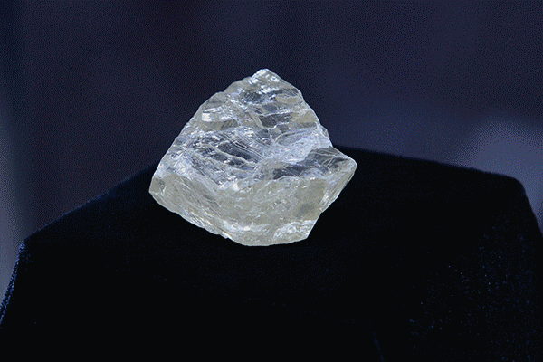
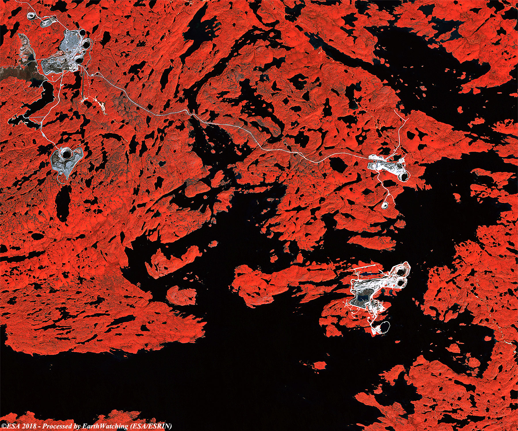
The Diavik Diamond Mine (Diavik) is an unincorporated joint venture between Diavik Diamond Mines (2012) Inc. (a Rio Tinto company) and Dominion Diamond Diavik Limited Partnership, both headquartered in Yellowknife, Northwest Territories. The mine is 300 kilometres northeast of Yellowknife and consists of three kimberlite pipes. The mine is on a 20-km2 island under the waters of Lac de Gras. Construction of the mine started in 2000, and commercial production of the mine's rough diamonds commenced in January 2003. Mining operations are expected to continue beyond 2020. More information is available from Natural Resources Canada
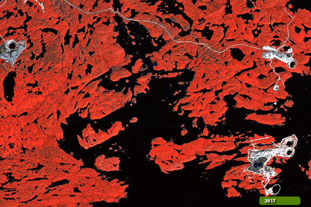
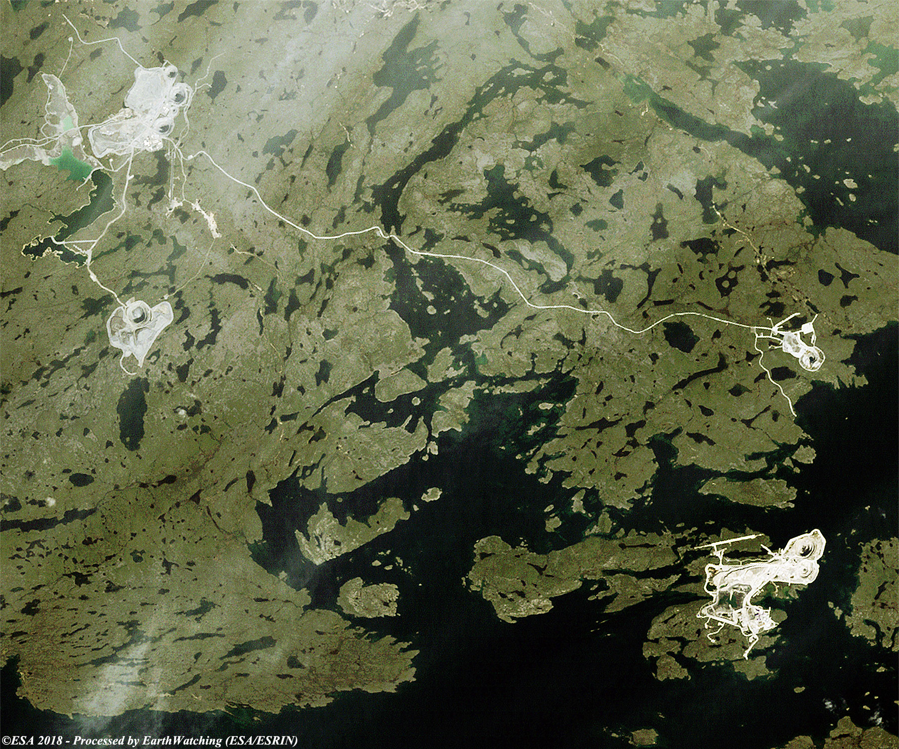
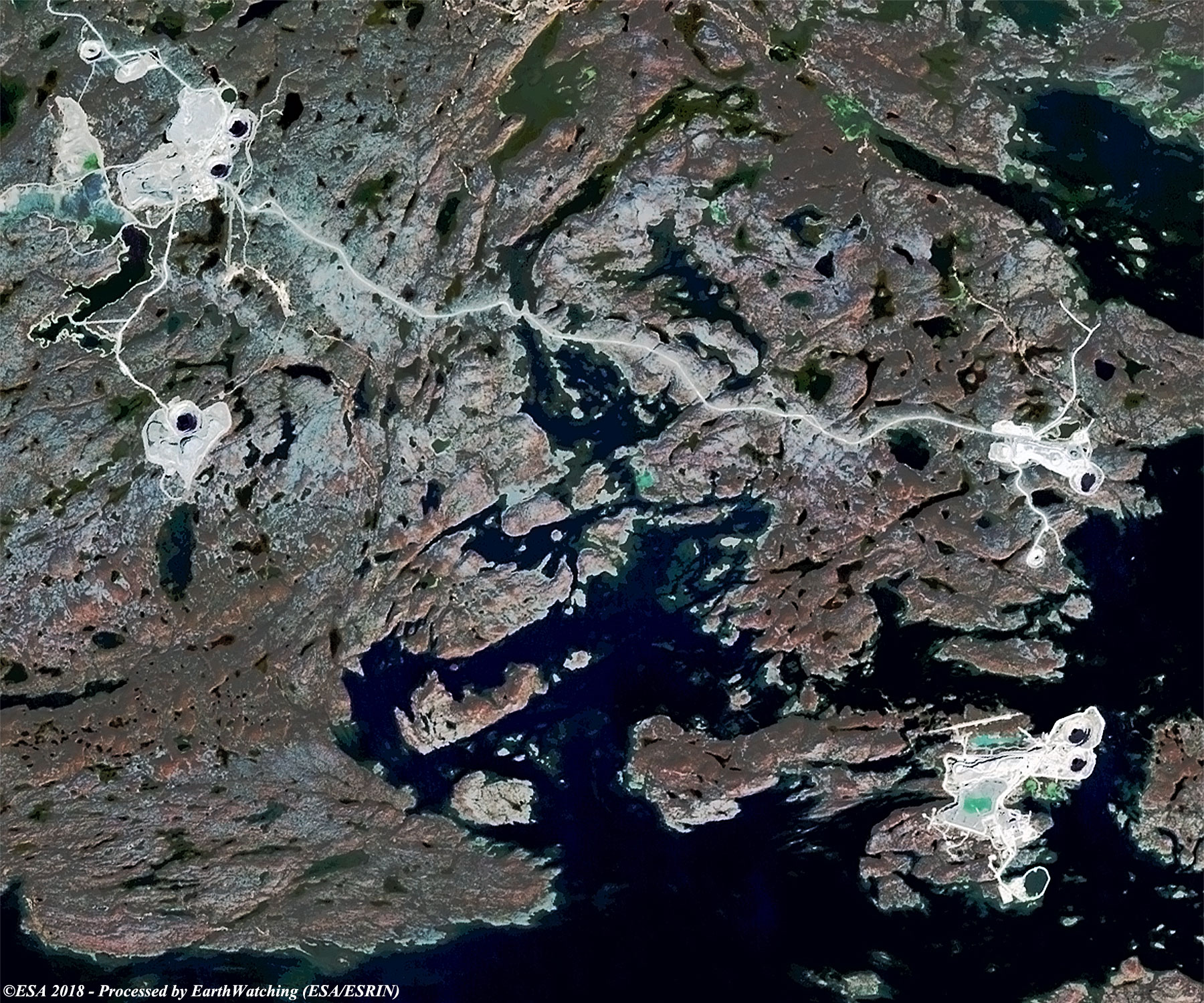
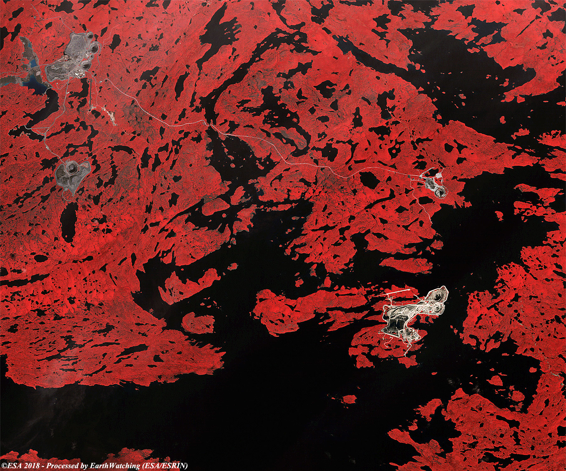
Our tour around the world in 2018 is focused over one of the most remote places on the planet, 220 kilometres from the Arctic Circle, one finds one of the most "precious" places on Earth. This unusual "stepped hole" on the Canadian Lac de Gras, in fact, is a diamond mine. A road made entirely of ice connects the mine with Yellowknife, the capital of the Canadian Northwest Territories, as well as the airport. The area is off-limits, and 700 people currently work there, but the mine opened in 2003 and had an estimated life of 16 to 22 years which means that soon there may be no more diamonds to extract. While the quarry would remain, the area would be left uninhabited. These series of images, acquired by the Landsat 5 and 8 satellites, were processed using bands in visible colour or natural colour and false colour or near infrared colour and show the area (holes) where tghe mine is situated. In the images acquired in 2009 and 2017, we can see the holes grow deeper as the mine develops. Compared the image acquired in 2009 and 2017 the users are be able to see how the holes in this time window are always deeper than the original soil formology. Another aim of these images is to promote the opportunity to download Landsat data through the ESA portals (or third party mission free catalogue), where images captured every day are made available in near real time to the users and the scientific community. Landsat full resolution data products are freely available for immediate download at: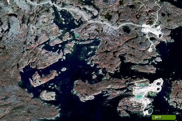 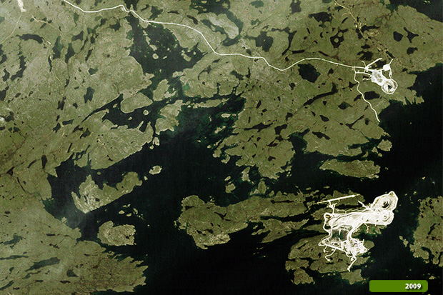 View large format slider in Visible Colour View Landsat 5 TM high resolution image (JPG 1 MB) View Landsat 8 OLI high resolution image (JPG 763 KB)
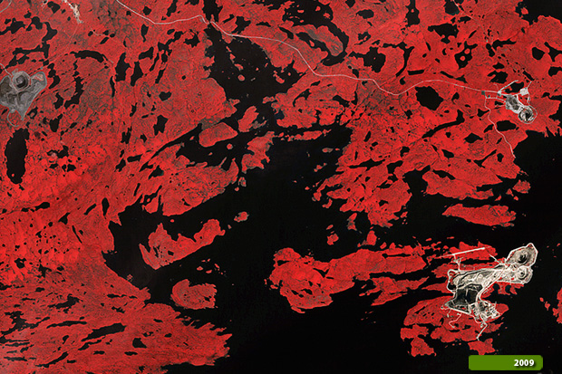  View large format slider in Infrared Colour View Landsat 5 TM high resolution image (JPG 1 MB) View Landsat 8 OLI high resolution image (JPG 1 MB)
|
|||||||||||||||||||||||||||||||||||