 Damascus, Syria
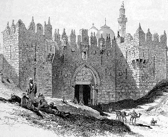
Damascus is the capital of the Syrian Arab Republic; it is likely also the country's largest city, following the decline in population of Aleppo due to the battle for the city. It is colloquially known in Syria as ash-Sham and titled the City of Jasmine. In addition to being one of the oldest continuously inhabited cities in the world, Damascus is a major cultural centre of the Levant and the Arab world. The city has an estimated population of 1,711,000 as of 2009. Located in south-western Syria, Damascus is the centre of a large metropolitan area of 2.6 million people (2004). Geographically embedded on the eastern foothills of the Anti-Lebanon mountain range 80 kilometres inland from the eastern shore of the Mediterranean on a plateau 680 metres above sea level, Damascus experiences a semi-arid climate because of the rain shadow effect. The Barada River flows through Damascus. First settled in the second millennium BC, it was chosen as the capital of the Umayyad Caliphate from 661 to 750. After the victory of the Abbasid dynasty, the seat of Islamic power was moved to Baghdad. Damascus saw a political decline throughout the Abbasid era, only to regain significant importance in the Ayyubid and Mamluk periods. Today, it is the seat of the central government and all of the government ministries. More information is available on Wikipedia.
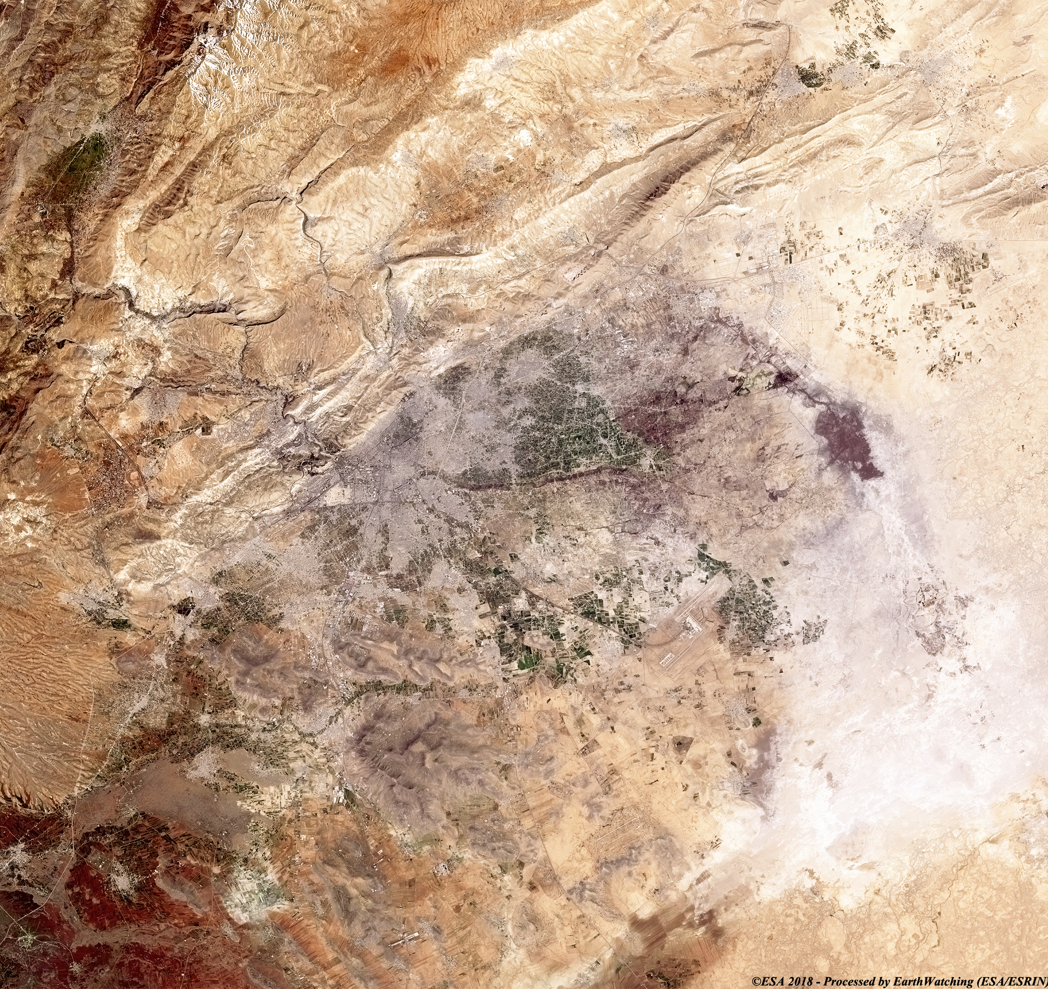
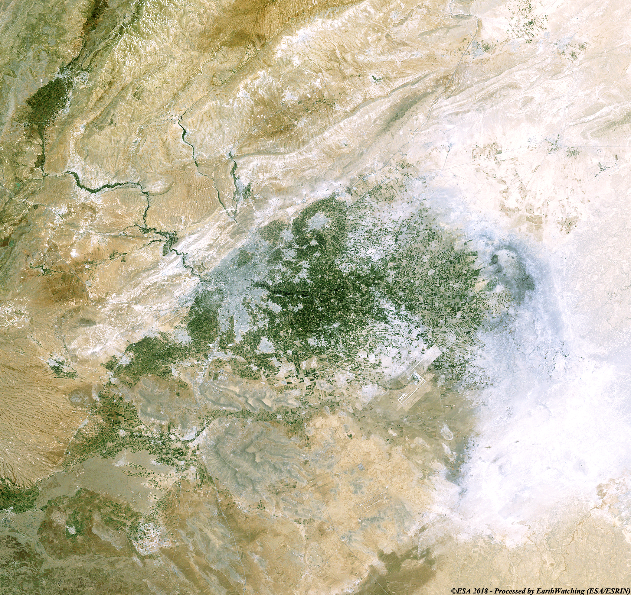
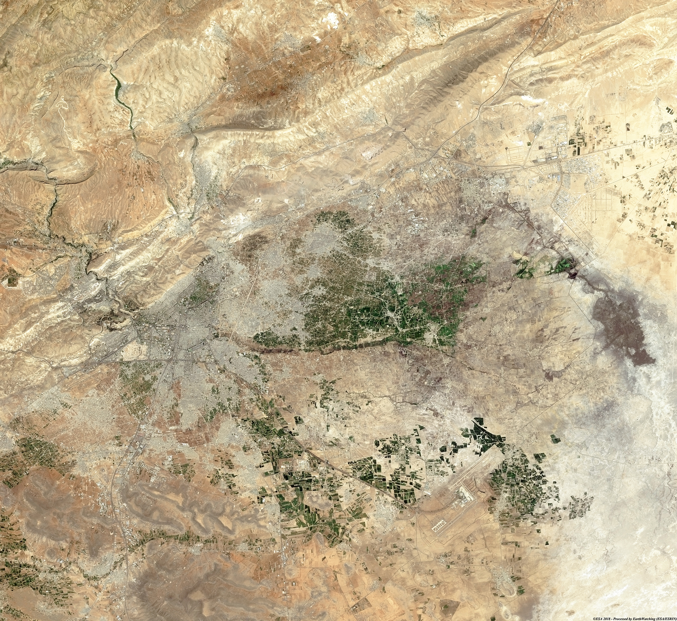
Today our tour focuses on the city of Damascus in Syria. The aim of these images acquired by Landsat 5 and 8, in 1987 and 2018, to show the extent of the urban development in Damascus, over the course of 31 years. The user can clearly see that this city has undergone a majority infrastructural development in the Northern and Eastern areas. This development change is more evident from the image acquired by the Copernicus Sentinel-2, due to the presence of a higher (10 metres) resolution sensor as compared to the Landsat-8 and -5 (30 metres). Another aim of these images is to promote the opportunity to download Landsat data through the ESA portals (or third party mission free catalogue), where images captured every day are made available in near real time to the users and the scientific community. Landsat full resolution data products are freely available for immediate download at: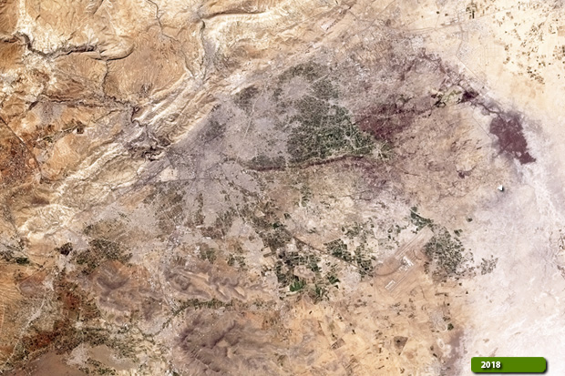 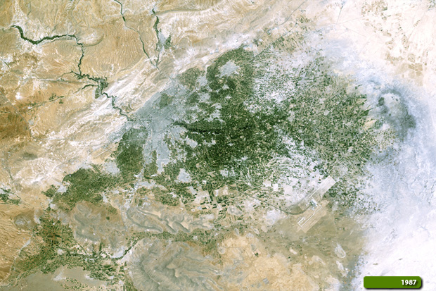 View Landsat 8 OLI high resolution image (JPG 5.1 MB) View Landsat 5 TM high resolution image (JPG 5.9 MB)
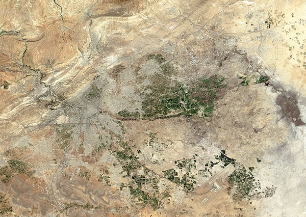
This image below, acquired by the optical sensor on the Copernicus Sentinel-2, aims to show the same area, but with the higher resolution as compared to the Landsat 8.
View Sentinel-2 high resolution image (JPG 4.5 MB)
|
||||||||||||||||||||||||||||||||||