 Aral Sea, Kazakhstan
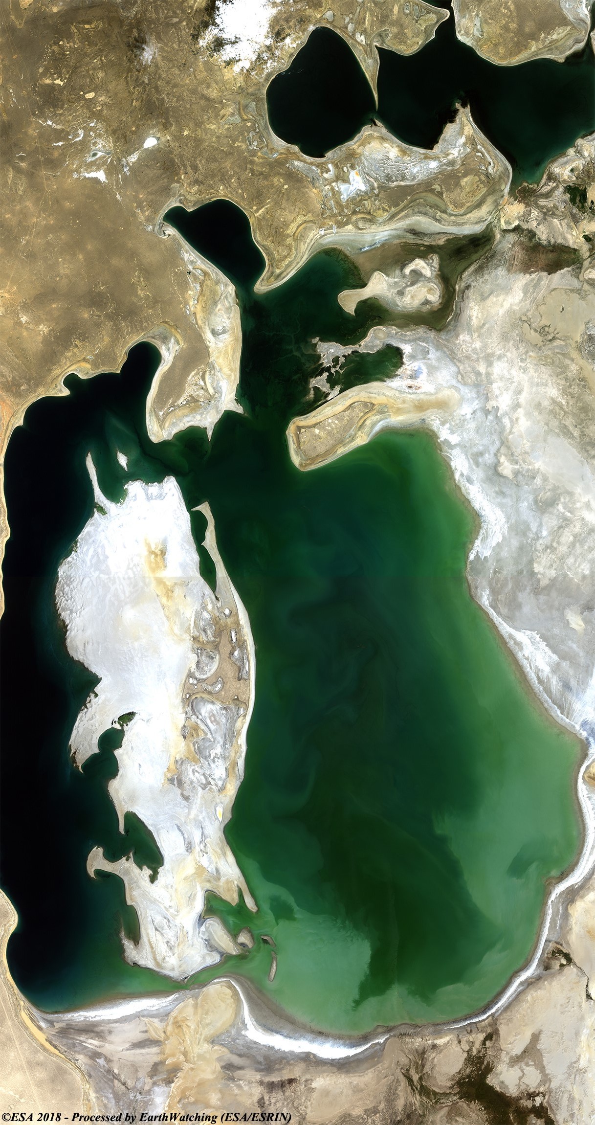
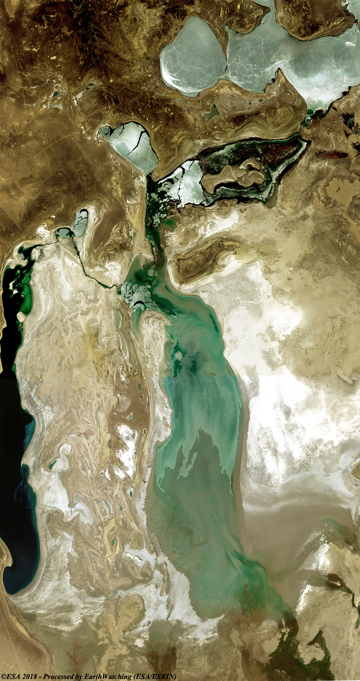
The Aral Sea was an endorheic lake lying between Kazakhstan (Aktobe and Kyzylorda Regions) in the north and Uzbekistan (Karakalpakstan autonomous region) in the south. The name roughly translates as "Sea of Islands", referring to over 1,100 islands that once dotted its waters; in the Turkic languages aral means "island, archipelago". The Aral Sea drainage basin encompasses Uzbekistan and parts of Tajikistan, Turkmenistan, Kyrgyzstan, Kazakhstan, Afghanistan and Iran. Formerly one of the four largest lakes in the world with an area of 68,000 km2, the Aral Sea has been shrinking since the 1960s after the rivers that fed it were diverted by Soviet irrigation projects. By 1997, it had declined to 10% of its original size, splitting into four lakes – the North Aral Sea, the eastern and western basins of the once far larger South Aral Sea, and one smaller intermediate lake. By 2009, the southeastern lake had disappeared and the southwestern lake had retreated to a thin strip at the western edge of the former southern sea; in subsequent years, occasional water flows have led to the southeastern lake sometimes being replenished to a small degree. Satellite images taken by NASA in August 2014 revealed that for the first time in modern history the eastern basin of the Aral Sea had completely dried up. The eastern basin is now called the Aralkum Desert. In an ongoing effort in Kazakhstan to save and replenish the North Aral Sea, a dam project was completed in 2005; in 2008, the water level in this lake had risen by 12 m compared to 2003. Salinity has dropped, and fish are again found in sufficient numbers for some fishing to be viable. The maximum depth of the North Aral Sea is 42 m (as of 2008). The shrinking of the Aral Sea has been called "one of the planet's worst environmental disasters". The region's once-prosperous fishing industry has been essentially destroyed, bringing unemployment and economic hardship. However, about 2 million hectares of desert have been converted into prosperous farmland. The Aral Sea region is also heavily polluted, with consequential serious public health problems. UNESCO added the historical documents concerning the development of the Aral Sea to its Memory of the World Register as a unique resource to study this "environmental tragedy." For more information visit: Wikipedia
Our tour around the world in 2018, revisits and monitors the current state of the Aral Sea, utilising two images acquired by Landsat 7 and 8. This satellite imagery illustrates that the Aral Sea has undergone a significant change over the period of 18 years as evident by the shrinking of the lake. This is considered to be amongst the most serious environmental disasters, as the Aral Sea was the fourth largest lake on the planet, just ten years ago. Today, its surface has reduced by 75%, leaving only rusty ships inside. Another aim of these images is to promote the opportunity to download Landsat data through the ESA portals (or third party mission free catalogue), where images captured every day are made available in near real time to the users and the scientific community. Landsat full resolution data products are freely available for immediate download at: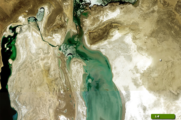 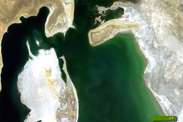 View large format slider in Visible Colour View Landsat 7 ETM high resolution image (JPG 2.2 MB) View Landsat 8 OLI high resolution image (JPG 2.7 MB)
|
|||||||||||||||||||||