 Thinning ice on the Aletsch Glacier
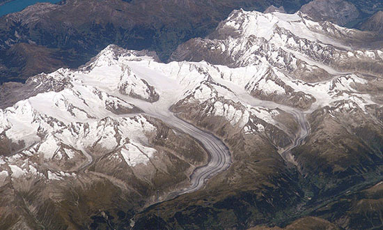
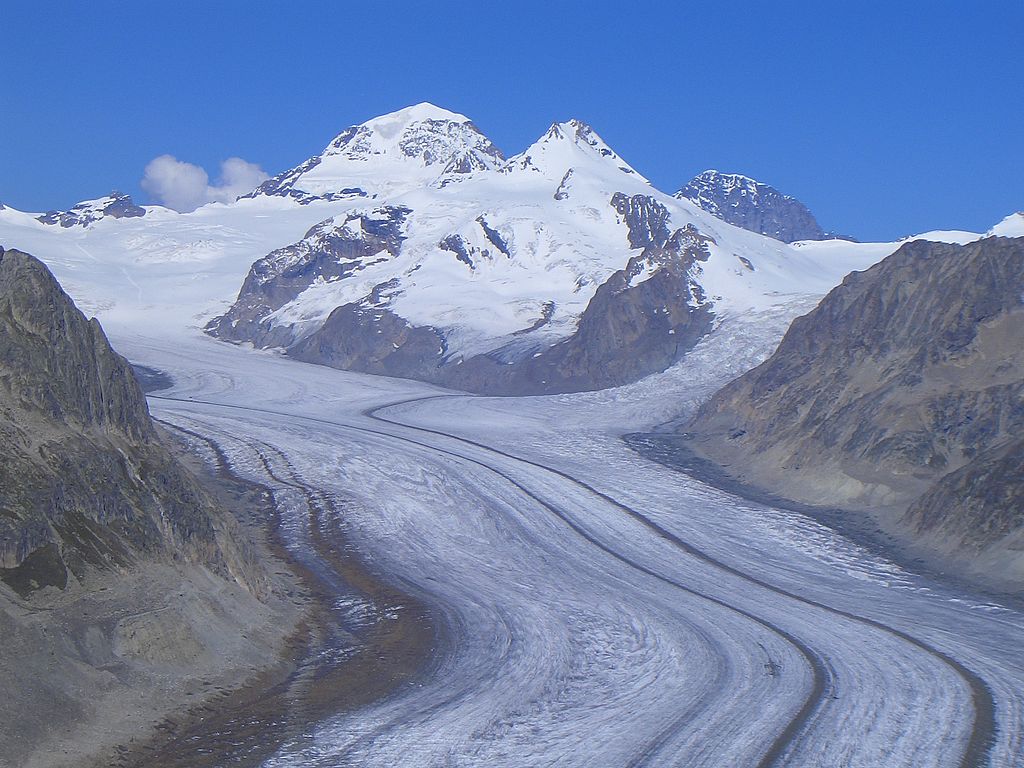
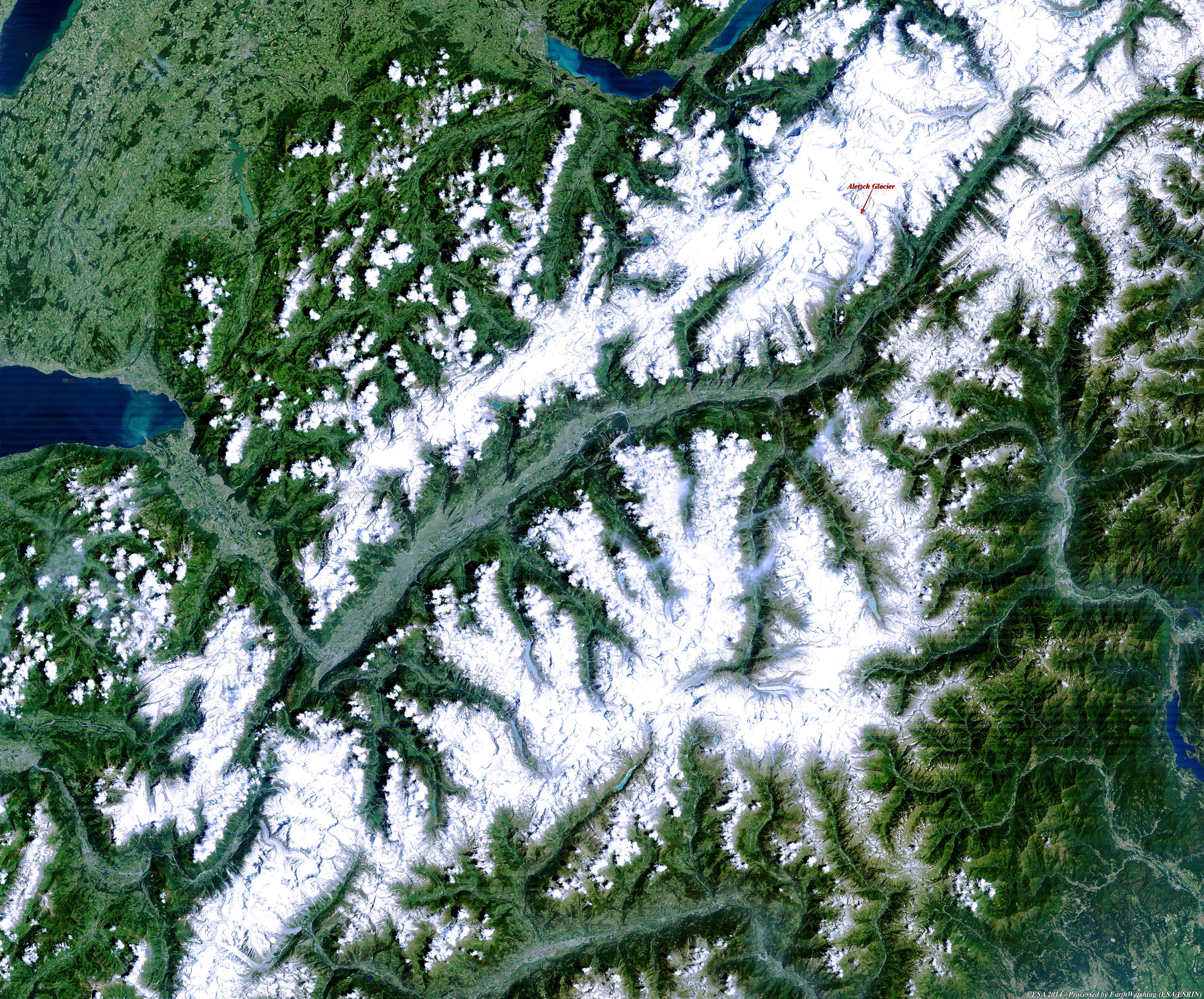
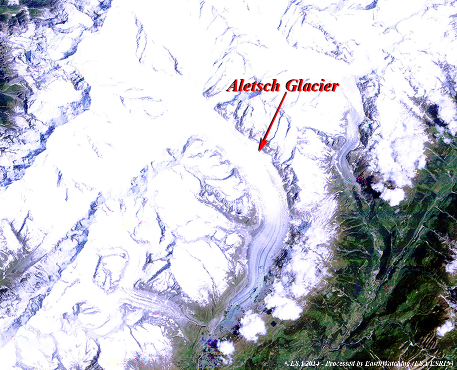
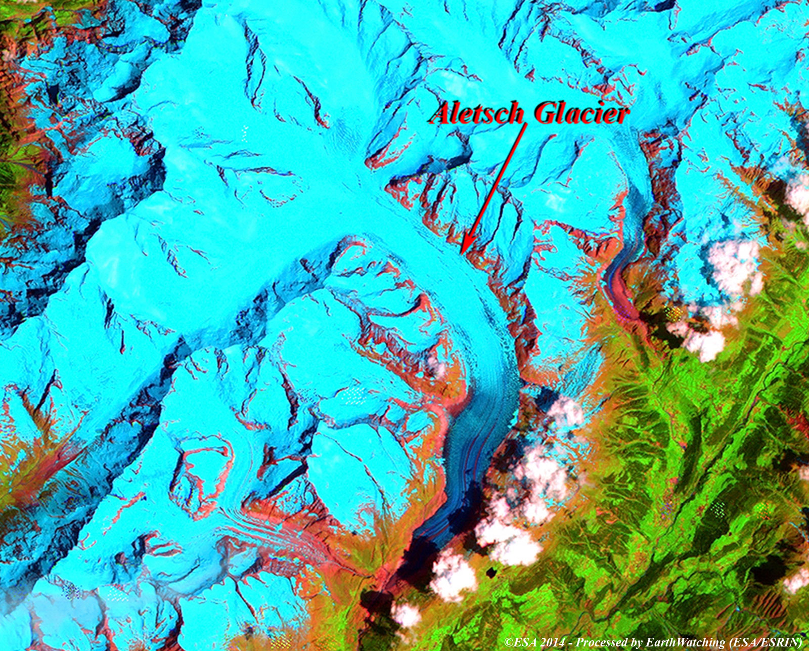
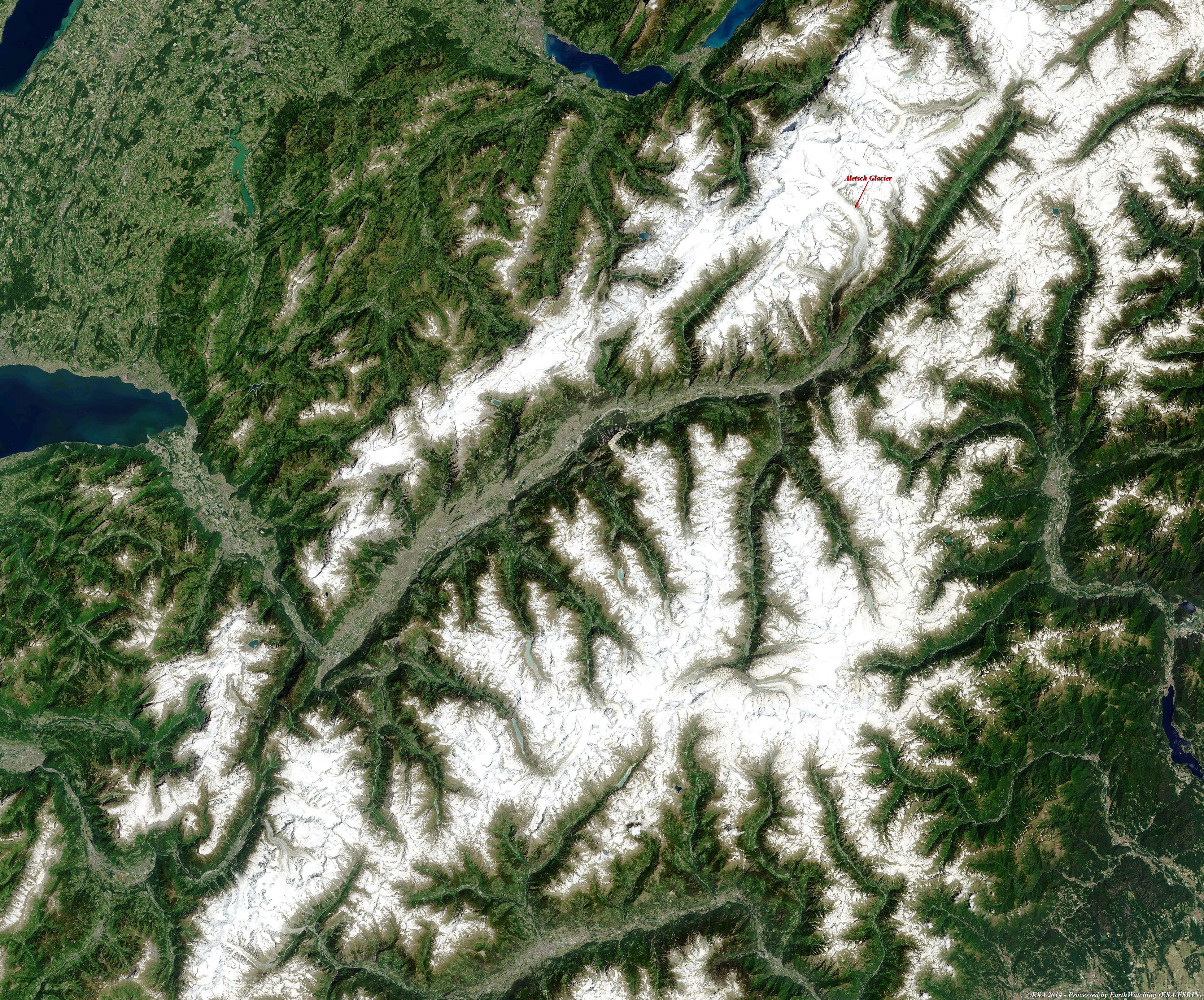
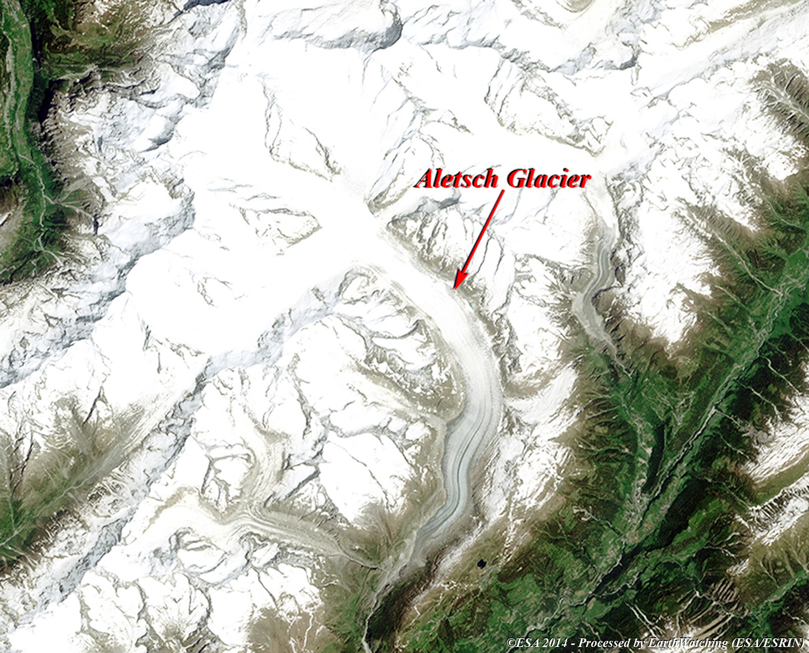
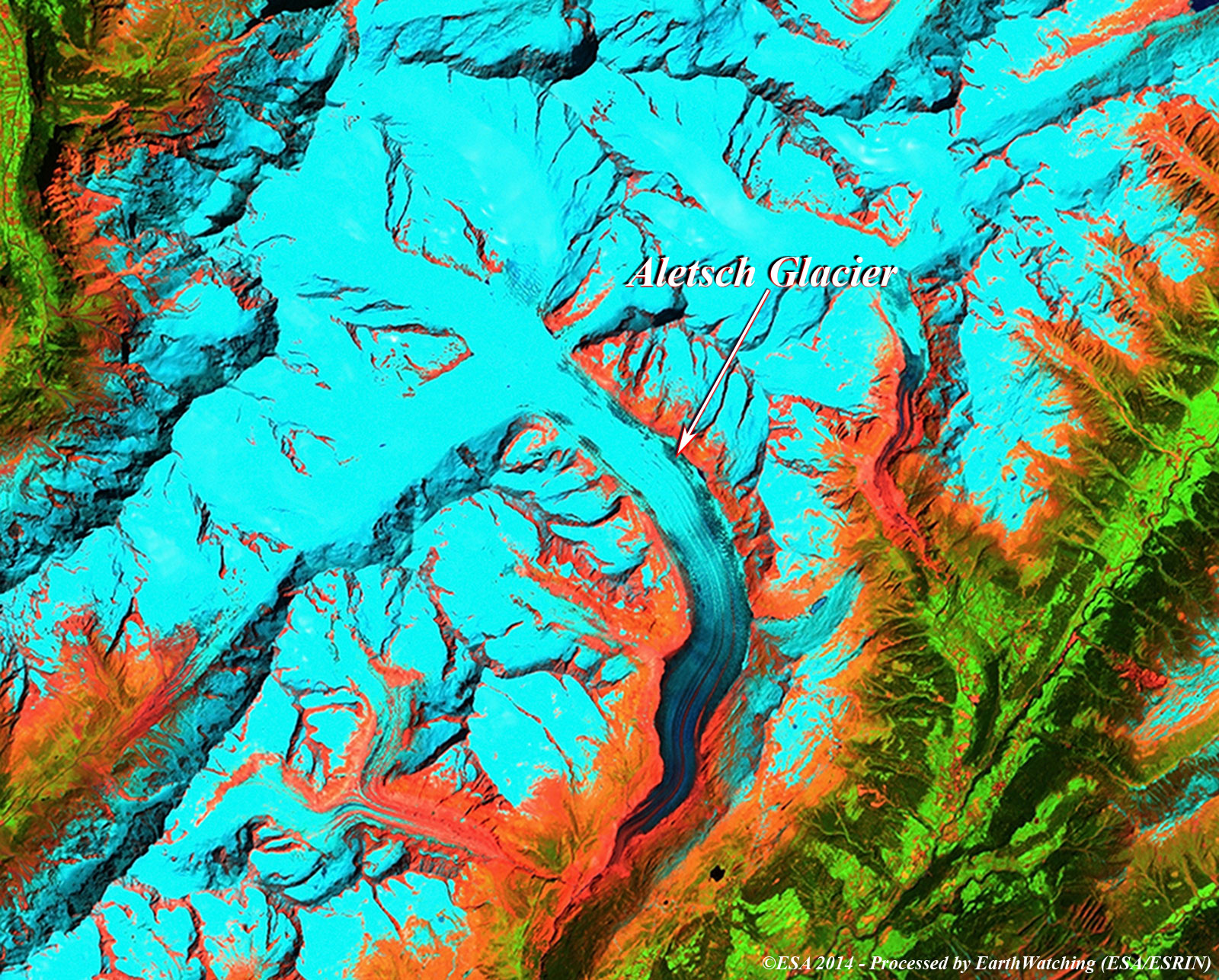
The Aletsch Glacier, or Great Aletsch Glacier, is the largest glacier in the Alps. It has a length of about 23 km and covers more than 120 square kilometres in the eastern Bernese Alps in the Swiss canton of Valais. The Aletsch Glacier is composed of three smaller glaciers converging at Concordia, where its thickness is estimated to be near 1 km. It then continues towards the Rhone valley before giving birth to the Massa River. The whole area, including other glaciers, is part of the Jungfrau-Aletsch Protected Area, which was declared a UNESCO World Heritage site in 2001. The Aletsch Glacier resulted from the accumulation and compaction of snow. Glaciers generally form where snow and ice accumulation exceeds snow and ice melt. As the snow and ice thicken it reaches a point where it begins to move due to a combination of gravity and pressure of the overlying snow and ice. During the last glacial periods, the Aletsch Glacier was much larger than it is now. 18,000 years ago the lower part of the ridge, between Riederalp and the glacier, was completely covered by ice. Only the summits of the Bettmerhorn, Eggishorn and the Fusshörner were above the glacier. After a major retreat, the glacier again advanced 11,000 years ago during the last glacial period. The glacier reached the Rhone valley, and its ice the Riederfurka. Remaining moraines are still visible in the Aletsch Forest. The spectacularity of nature of the place was such that it became famous from the earliest visits of pioneers, and the name was sent to one of the largest glacial cirques himalayas, in the area of K2, called precisely Circus Concordia. On its eastern side is a glacial lake, Lake Märjelen (Gr. Märjelensee) (2,350 meters). To the west lies the Aletschhorn (4,195 meters), which was first climbed in 1859. The Rhone River flows along the southern flank of the mountains.
View large image (JPG 150 KB)
These images acquired over the Alps, in a time window of 27 years by the Landsat 5 and 8 satellites, aim to show the significant thinning in recent times of the Aletsch Glacier (the location of which is highlighted on the images). Another aim of these images is to promote the opportunity to download Landsat data through the ESA portals, where images captured every day are made available in near real time to the users and the scientific community. Landsat full resolution data products are freely available for immediate download at: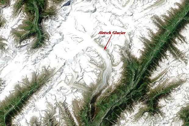 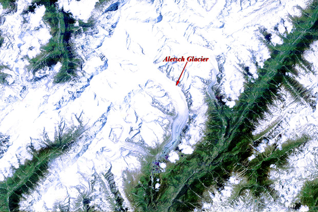 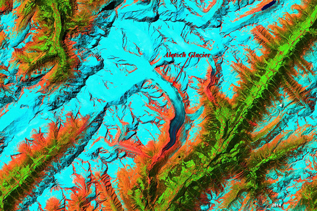 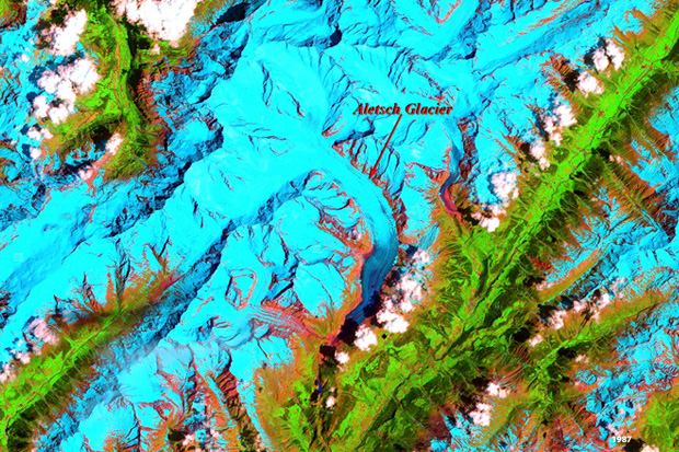
View Landsat 5 TM high resolution image (band 321) (JPG 5.8 MB) | Magnified view of glacier (JPG 443 KB)
View Landsat 8 OLI high resolution image (band 432) (JPG 5.1 MB) | Magnified view of glacier (JPG 449 KB)
|
|||||||||||||||||||||