 Suez Canal, Egypt
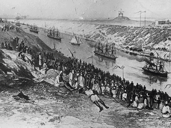
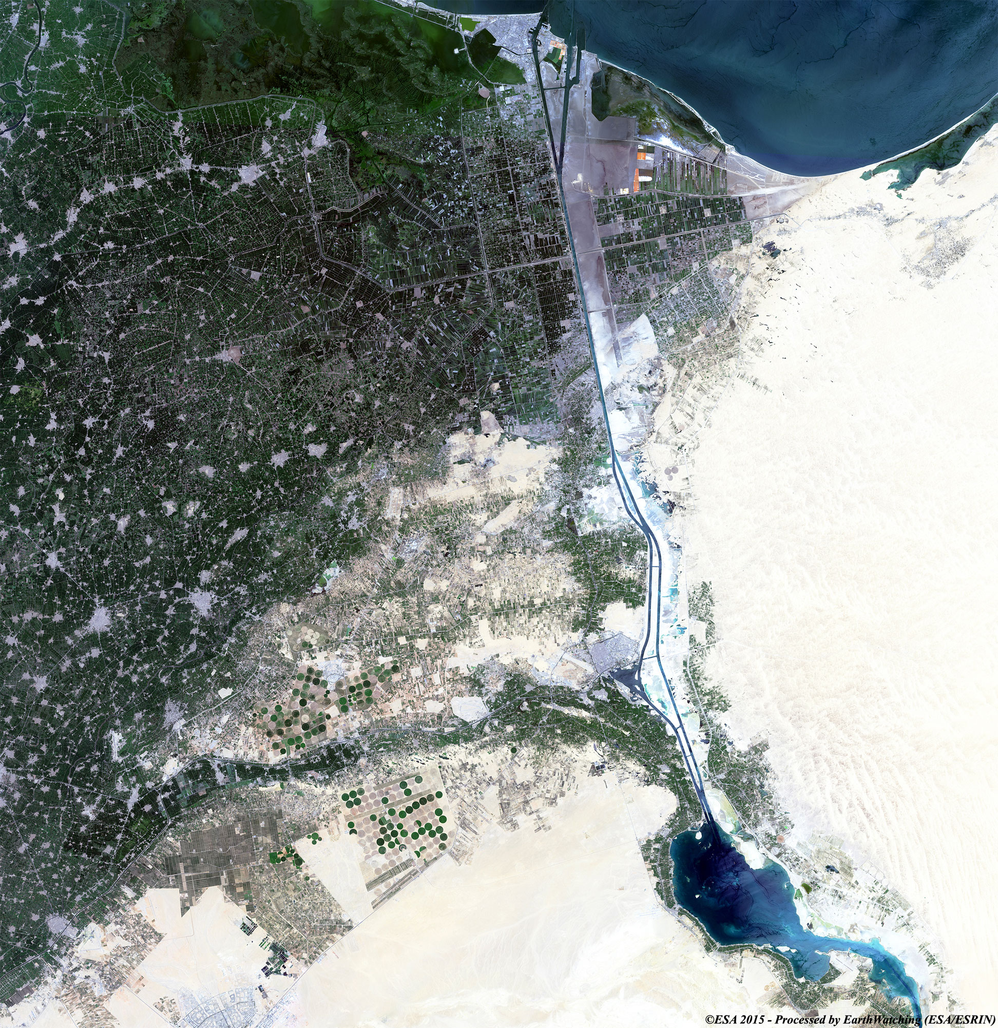
The Suez Canal is an artificial sea-level waterway in Egypt, connecting the Mediterranean Sea to the Red Sea. Opened 17 November 1869, after 10 years of construction, it allows ships to travel between Europe and South Asia without navigating around Africa thereby reducing the sea voyage distance between Europe and India by about 7,000 kilometres. A new stretch of the canal was just opened in 2015. The northern terminus is Port Said, where there are two outlets to the sea; the southern terminus is Port Tewfik at the city of Suez, where there is one outlet to the sea. Ismailia is on its west bank, 3 km from the half-way point. In 2012, 17,225 vessels traversed the canal (47 per day). When built, the canal was 164 km long and 8 m deep. After several enlargements, it is 193.30 km long, 24 m deep and 205 metres wide. It consists of the northern access channel of 22 km, the canal itself of 162.25 km and the southern access channel of 9 km. The canal is single-lane with passing places in the Ballah Bypass and the Great Bitter Lake. It contains no locks; seawater flows freely through it. In general, the canal north of the Bitter Lakes flows north in winter and south in summer. South of the lakes, the current changes with the tide at Suez. The canal is owned and maintained by the Suez Canal Authority (SCA) of Egypt. Under the Convention of Constantinople, it may be used "in time of war as in time of peace, by every vessel of commerce or of war, without distinction of flag." In August 2014, construction was launched to expand and widen the Ballah Bypass, for 35 km (22 mi), costing $8.4 billion, to speed the canal's transit time. Funding was arranged by issuing interest-bearing investment certificates exclusively to Egyptian entities and individuals, and the target amount was collected over six working days. The expansion is expected to double the capacity of the Suez Canal from 49 to 97 ships a day. The "New Suez Canal", as the expansion was dubbed, was opened with great fanfare in a ceremony on 6 August 2015. More information is available on Wikipedia
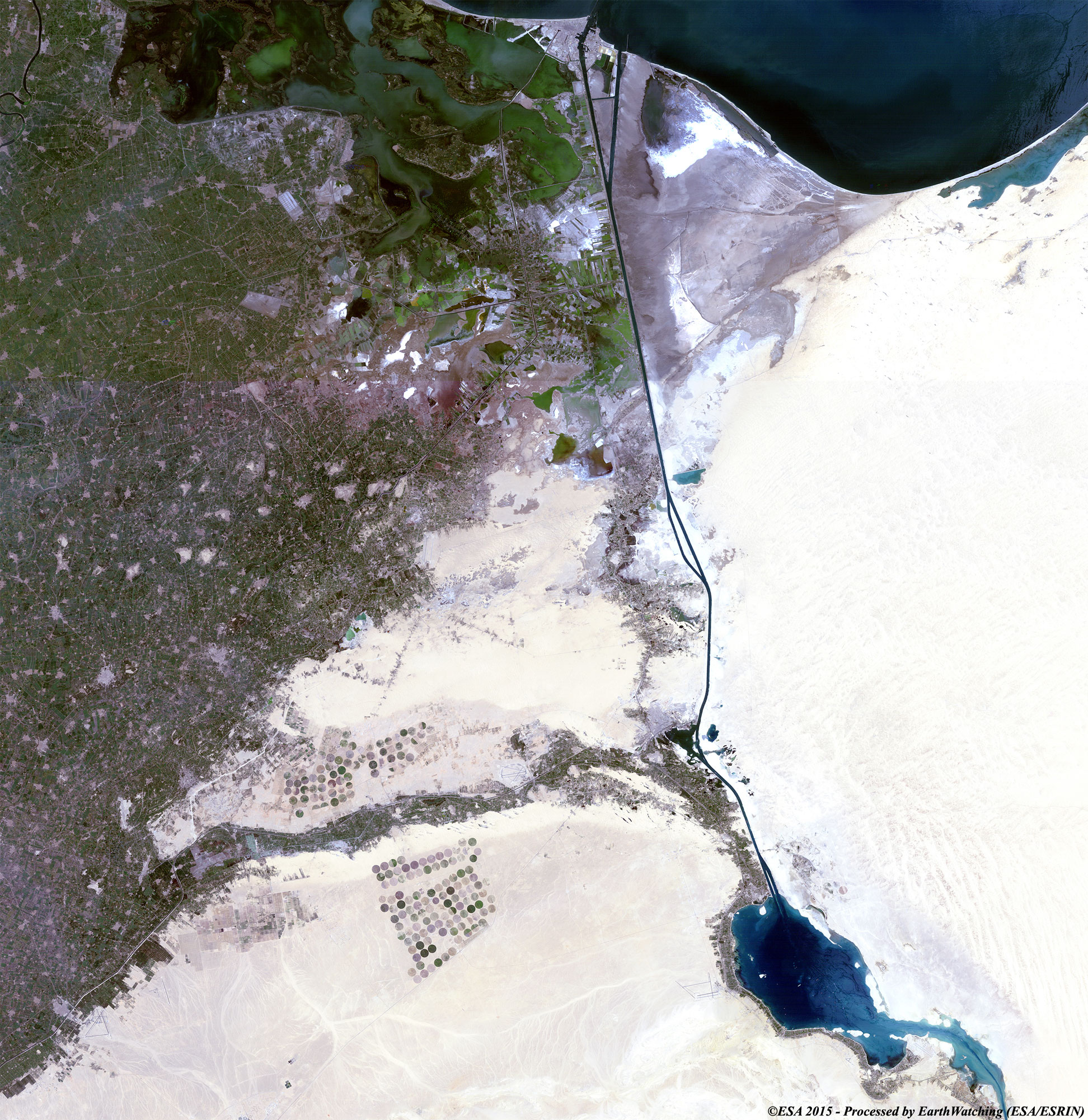
Today we feature the Suez Canal. The canal is an artificial waterway running north to south across the Isthmus of Suez in north-eastern Egypt; it connects Port Said on the Mediterranean Sea with the Gulf of Suez, an arm of the Red Sea. The canal provides a shortcut for ships operating between European or American ports and ports located in southern Asia, eastern Africa, and Oceania, by avoiding the need to sail around Africa. Strategically and economically it is one of the most important waterways in the world. These Landsat 5 and 8 satellite images, acquired with a time window (before/after) of 31 years aim to show the recent doubling of part of the Suez Canal, which was constructed to reduce the transit time and also to avoid the size limit of the ships. Landsat full resolution data products are freely available for immediate download at: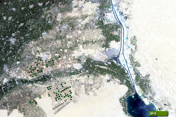 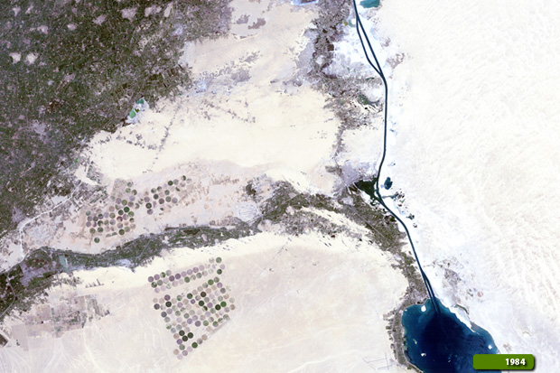
View large format slider View Landsat 8 OLI high resolution image (JPG 1.4 MB)
|
|||||||||||||||||||||