 Odessa, Ukraine
Odessa or Odesa is an international city in Ukraine and a major seaport and transportation hub located on the northwestern shore of the Black Sea. Odessa is also an administrative centre of the Odessa Oblast and a multiethnic major cultural centre. Odessa is the third most populous city in Ukraine and is alternatively known as the "pearl of the Black Sea, "the "South Capital" (under the Russian Empire and Soviet Union), and "Southern Palmyra". The predecessor of Odessa, a small Tatar settlement, was founded by Haci I Giray, the Khan of Crimea, in 1440 and originally named after him as "Hacibey". After a period of Lithuanian control, it passed into the domain of the Ottoman Sultan in 1529 and remained in Ottoman hands until the Ottoman Empire's defeat in the Russo-Turkish War of 1792. In 1794, the city of Odessa was founded by a decree of the Empress Catherine the Great. From 1819 to 1858, Odessa was a free port. During the Soviet period it was the most important port of trade in the Soviet Union and a Soviet naval base. On 1 January 2000, the Quarantine Pier at Odessa Commercial Sea Port was declared a free port and free economic zone for a period of 25 years. During the 19th century, it was the fourth largest city of Imperial Russia, after Moscow, Saint Petersburg and Warsaw. Its historical architecture has a style more Mediterranean than Russian, having been heavily influenced by French and Italian styles. Some buildings are built in a mixture of different styles, including Art Nouveau, Renaissance and Classicist. Odessa is a warm-water port. The city of Odessa hosts both the Port of Odessa and Port Yuzhne, a significant oil terminal situated in the city's suburbs. Another notable port, Illichivsk, is located in the same oblast, to the south-west of Odessa. Together they represent a major transport hub integrating with railways. Odessa's oil and chemical processing facilities are connected to Russian and European networks by strategic pipelines. More information is available on Wikipedia
This week, our tour of European cities takes us over the major city of Odessa in the south of central Ukraine, which is capital of Odessa administrative region. Odessa is the main trading and fishing port of the country and its harbour is kept open all year round, with the use of ice-breakers in winter. It is also a major industrial city, a cultural centre (with several museums and theatres, and an opera house), and owing to its milder climate, a popular resort. The city being a rail junction helps Odessa with some of its exports:
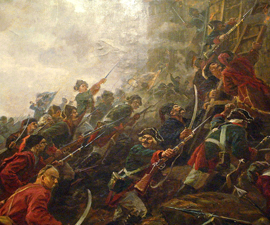
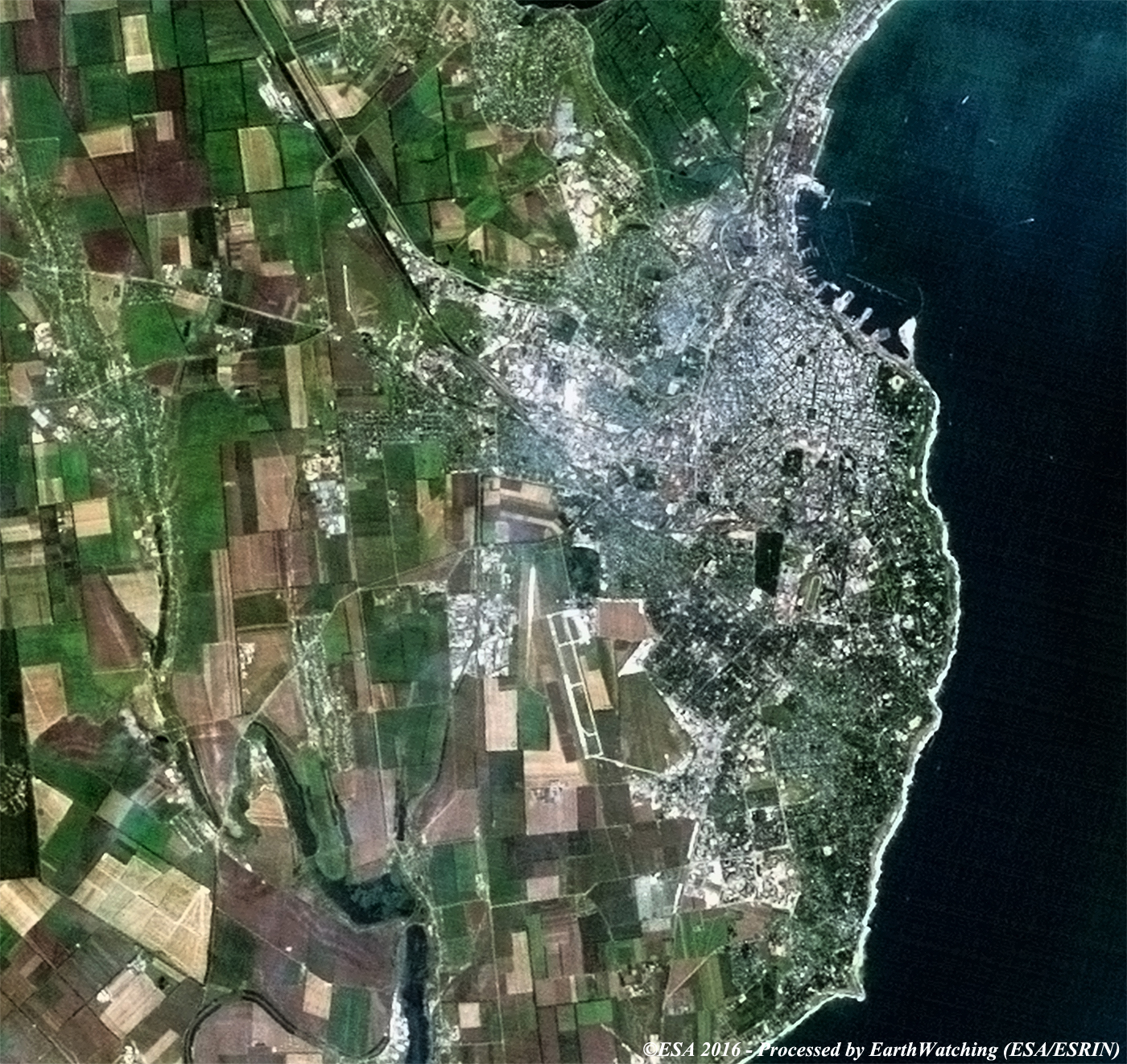
Odessa also is a centre for higher learning, with a university, polytechnic, medical schools, marine academy and a music conservatory. A colony from ancient Greece may have occupied the site of the city once, and Crimean Tatars traded there in the 14th century. Odessa itself was founded in 1794 as a Russian naval fortress on territory annexed from Turkey in 1792. By the early 19th century, the Russian settlement had become an important grain port. During the Crimean War, Odessa was bombarded by both French and British naval forces. In 1905, the city was the site of a workers' uprising; supported by the crew of the Russian battleship Potemkin. Odessa suffered heavy damage during The Second World War, when it was occupied from 1941 to 1944 by German and Romanian forces. During the occupation, many civilians were killed by the occupying forces. These images were acquired by the Landsat 5 and 8 satellites over thirty-one years and aims to show the difference from 1985 until today in Odessa. In these two images, using this comparison, you can see the changing urban development to the west of the city and in the harbour area, where new infrastructure has been built. Another aim of these images is to promote the opportunity to download Landsat data through the ESA portals, where images captured every day are made available in near real time to the users and the scientific community. Landsat full resolution data products are freely available for immediate download at: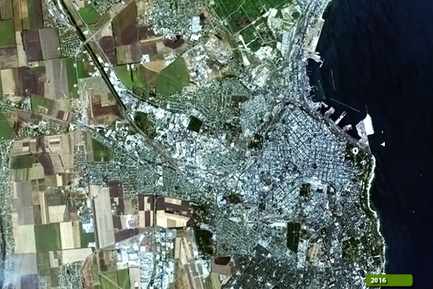 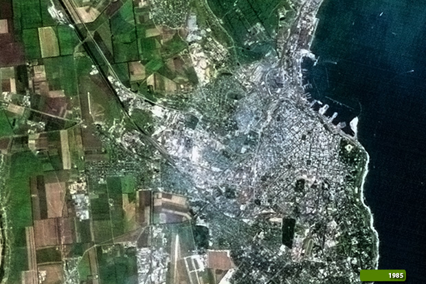 View Landsat 5 TM high resolution image (JPG 1.4MB) View Landsat 8 OLI high resolution image (JPG 1.9MB)
|
|||||||||||||||||||||