 New Delhi, India
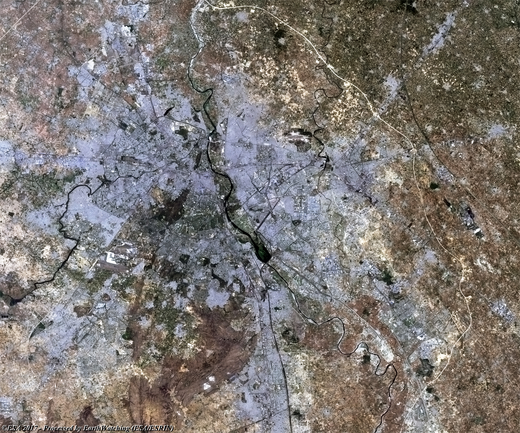
New Delhi is the capital of India and one of Delhi city's 11 districts. Although colloquially Delhi and New Delhi are used interchangeably to refer to the National Capital Territory of Delhi, these are two distinct entities, with New Delhi forming a small part of Delhi. The National Capital Region is a much larger entity comprising the entire National Capital Territory of Delhi along with adjoining districts. The foundation stone of the city was laid by George V, Emperor of India during the Delhi Durbar of 1911. It was designed by British architects, Sir Edwin Lutyens and Sir Herbert Baker. The new capital was inaugurated on 13 February 1931, by Viceroy and Governor-General of India Lord Irwin. New Delhi has been selected as one of the hundred Indian cities to be developed as a smart city under Prime Minister of India Narendra Modi's flagship Smart Cities Mission. With a total area of 42.7 km2, New Delhi forms a small part of the Delhi metropolitan area. Since the city is located on the Indo-Gangetic Plain, there is little difference in elevation across the city. New Delhi and surrounding areas were once a part of the Aravali Range; all that is left of those mountains is the Delhi Ridge, which is also called the Lungs of Delhi. While New Delhi lies on the floodplains of the Yamuna River, it is essentially a landlocked city. East of the river is the urban area of Shahdara. New Delhi falls under the seismic zone-IV, making it vulnerable to earthquakes More information is available on Wikipedia
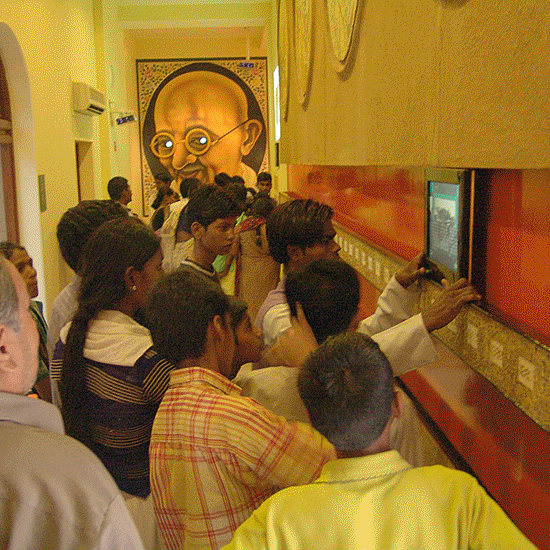
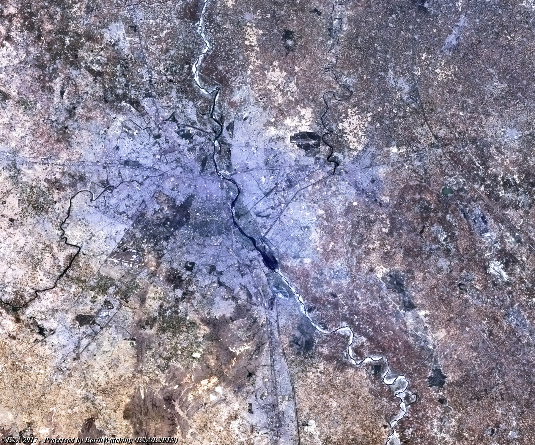
New Delhi is a city in northern India, and capital of the country. It is located in the National Capital Territory of Delhi, on the Yamuna River. New Delhi was built between 1912 and 1929 on a site adjacent to Delhi (or Old Delhi), which had been chosen to replace Calcutta (now Kolkata) as the capital of India in 1911; New Delhi was inaugurated as the new capital in 1931. Predominantly an administrative centre, the city also has textile mills, printing plants, and assorted light industry. Some of the traditional handicrafts for which Delhi was once famous such as ivory-carving and gold and silver jewellery-making still flourish. The streets of New Delhi are laid out symmetrically, according to plans drawn by the English architect Sir Edwin Landseer Lutyens. Lutyens also designed the majestic red sandstone and marble Rashtrapati Bhawan, formerly the palace of the viceroy and now the residence of the president, which is in the centre of the city, along with parliament and other important government buildings. A number of institutions for higher education and research, as well as the National Museum, are located near the city. A prayer ground in the southern section of New Delhi was the scene of the assassination of Mohandas Gandhi in 1948. The Balmiki and Lakshminarayan temples, which he often visited, are in the city's western sector. New Delhi is an important railway junction with three main stations. Five national highways also pass through the city. The Indira Gandhi International Airport is 23 km from the city centre while Palam, the domestic airport, is 15 km away. The public transport system in the city was greatly improved at the end of 2002, when the first section of a modern underground rail network, which is to be completed by 2005, opened to commuters. The aim of these images acquired by the Landsat family, with a time window (before/after) of 18 years, is to show how New Delhi has changed since 1999. The skyline of the city has developed with new areas constructed and new infrastructure around the suburbs of the city. Another aim of these images is to promote the opportunity to download Landsat data through the ESA portals (or third party mission free catalogue), where images captured every day are made available in near real time to the users and the scientific community. Landsat full resolution data products are freely available for immediate download at: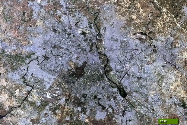 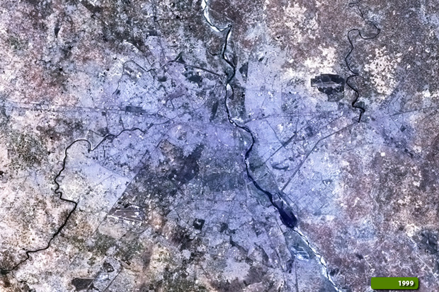 View Landsat 5 TM high resolution image (JPG 3.0 MB) View Landsat 8 OLI high resolution image (JPG 2.9 MB)
|
|||||||||||||||||||||