 Minsk, Belarus
Minsk, is the capital and largest city of Belarus, situated on the Svislach and Nyamiha rivers. It is the administrative centre of the Commonwealth of Independent States (CIS). As the national capital, Minsk has a special administrative status in Belarus and is the administrative centre of Minsk Region (voblast) and Minsk raion (district). In 2013, it had a population of 2,002,600. The earliest historical references to Minsk date to the 11th century (1067), when it was noted as a provincial city within the principality of Polotsk. The settlement developed on the rivers. In 1242, Minsk became a part of the Grand Duchy of Lithuania. It received town privileges in 1499. From 1569, it was a capital of the Minsk Voivodship in the Polish–Lithuanian Commonwealth. It was part of a region annexed by the Russian Empire in 1793, as a consequence of the Second Partition of Poland. From 1919 to 1991, after the Russian Revolution, Minsk was the capital of the Byelorussian Soviet Socialist Republic within the Soviet Union. More information is available on Wikipedia
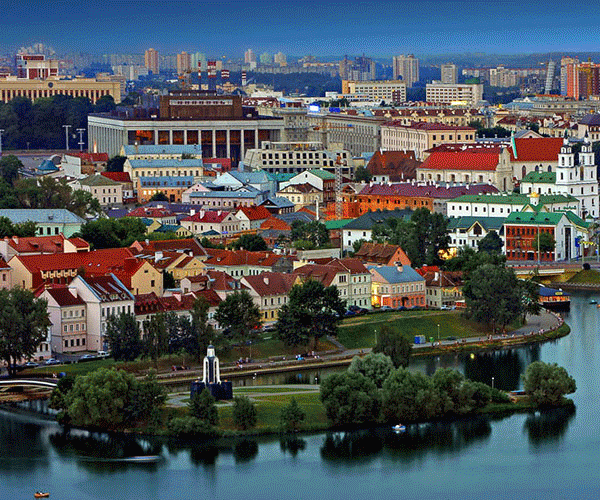
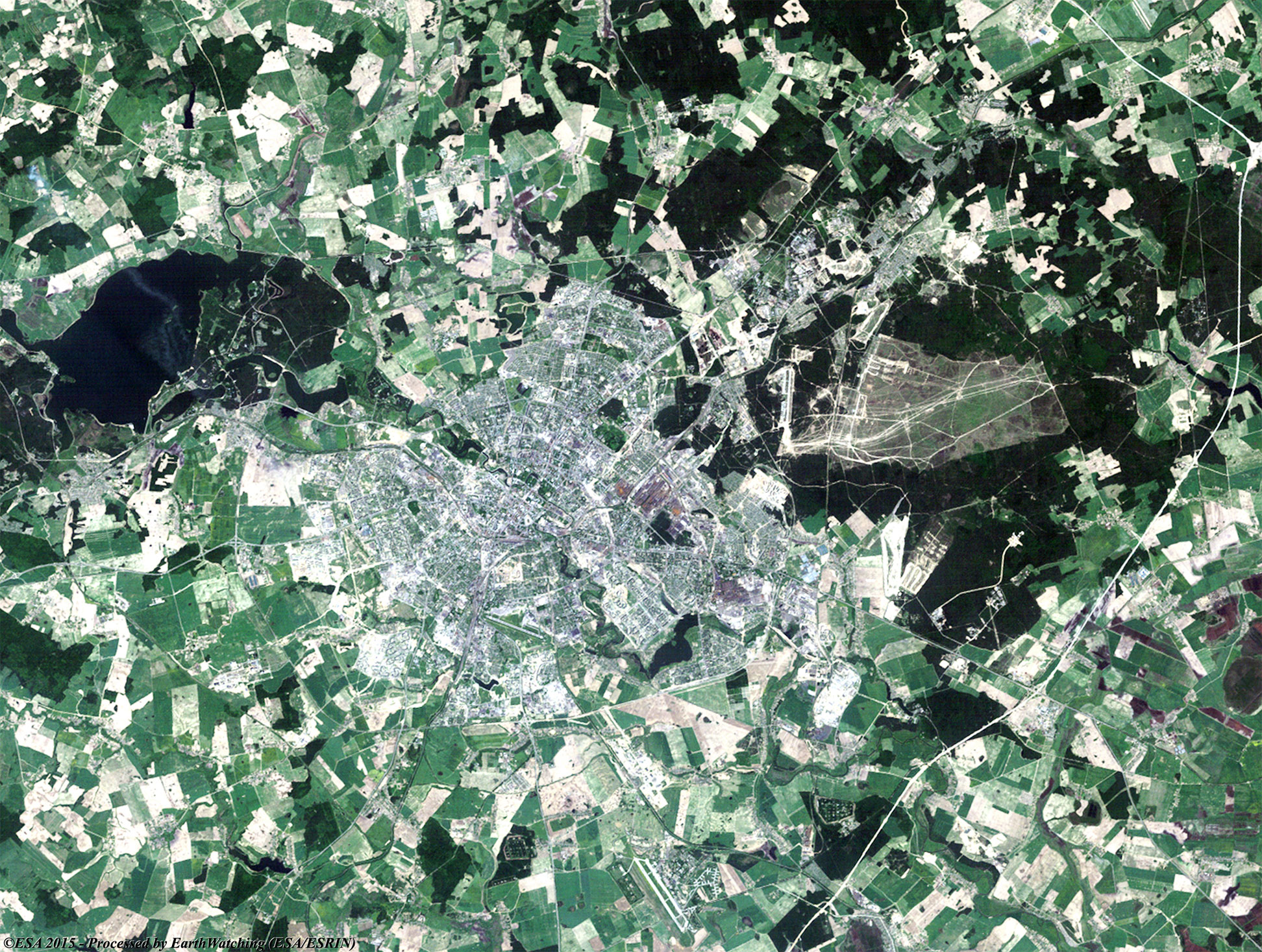
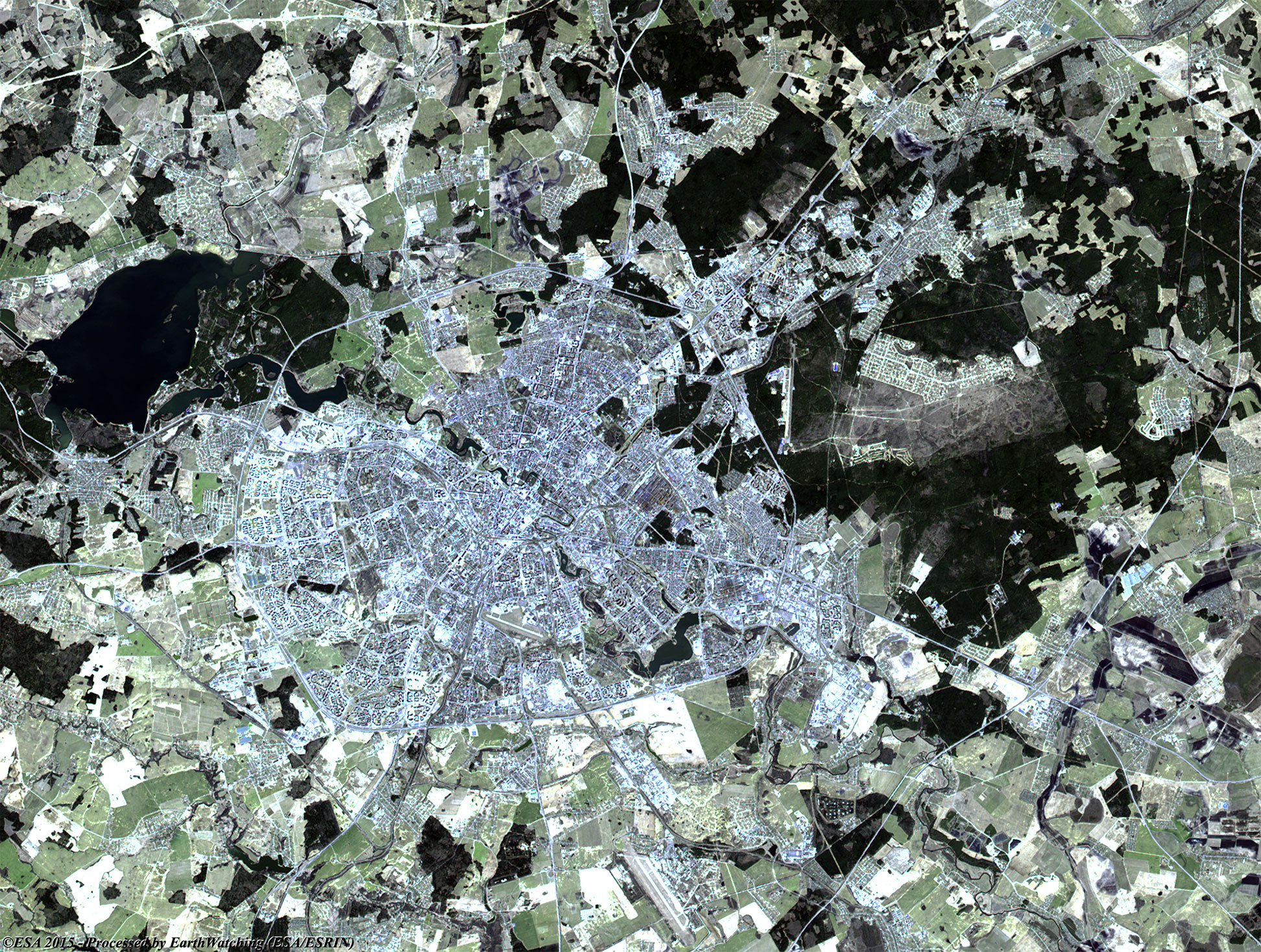
Today our tour stops over the city of Minsk. Located on the southeastern slope of the Minsk Hills, a region of rolling hills running from the southwest (upper reaches of the river Nioman) to the northeast to Lukomskaye Lake in northwestern Belarus. The average altitude above sea level is 220 metres. The physical geography of Minsk was shaped over the two most recent ice ages. The Svislach River, which flows across the city from the northwest to the southeast, is in the urstromtal, an ancient river valley formed by water flowing from melting ice sheets at the end of the last Ice Age. There are six smaller rivers within the city limits, all part of the Black Sea basin. Minsk is in the area of mixed forests typical of most of Belarus. Pinewood and mixed forests border the edge of the city, especially in the north and east. Some of the forests were preserved as parks (for instance, the Chelyuskinites Park) as the city grew. The city was initially built on the hills, which allowed for defensive fortifications, and the western parts of the city are the most hilly. In relation to that, these images, acquired by the Landsat 5 and 8 satellites with an acquisition time window (before / after) of thirty years, aim to show the urban development in and around the city during this time window. As we see in the overlay of the images, the city experienced a great urban increase especially in the south west and south east areas, with new large roads around the city. Another aim of these images is to promote the opportunity to download Landsat data through the ESA portals, where images captured every day are made available in near real time to the users and the scientific community. Landsat full resolution data products are freely available for immediate download at: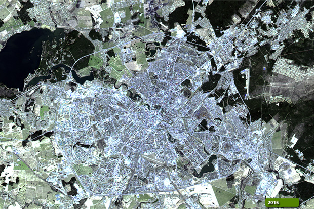 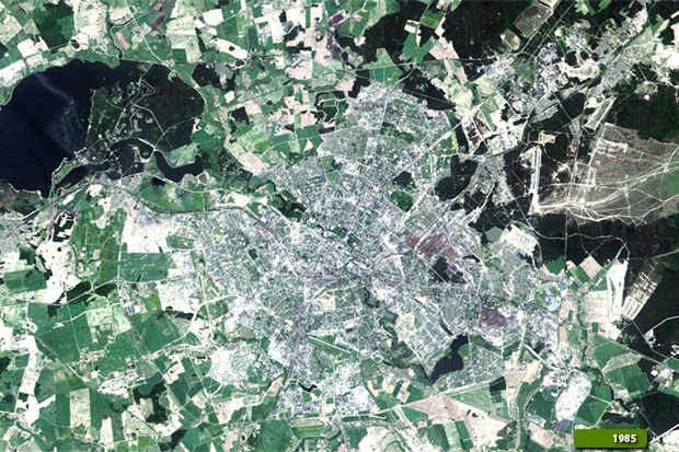 View Landsat 5 TM high resolution image (JPG 1 MB) View Landsat 8 OLI high resolution image (JPG 1.3 MB)
|
|||||||||||||||||||||