 Glasgow, United Kingdom
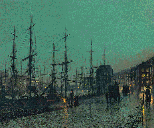
Glasgow is the largest city in Scotland, and third largest in the United Kingdom. Historically part of Lanarkshire, it is now one of the 32 Council Areas of Scotland. It is situated on the River Clyde in the country's West Central Lowlands. Inhabitants of the city are often referred to as Glaswegians or Weegies. Glasgow grew from a small rural settlement on the River Clyde to become the largest seaport in Britain. Expanding from the medieval bishopric and royal burgh, and the later establishment of the University of Glasgow in the 15th century, it became a major centre of the Scottish Enlightenment in the 18th century. From the 18th century the city also grew as one of Great Britain's main hubs of transatlantic trade with North America and the West Indies. With the onset of the Industrial Revolution, the population and economy of Glasgow and the surrounding region expanded rapidly to become one of the world's pre-eminent centres of chemicals, textiles and engineering; most notably in the shipbuilding and marine engineering industry, which produced many innovative and famous vessels. Glasgow was the "Second City of the British Empire" for much of the Victorian era and Edwardian period, although many cities argue the title was theirs. In the late 19th and early 20th centuries Glasgow grew in population, reaching a peak of 1,128,473 in 1939. Comprehensive urban renewal projects in the 1960s, resulting in large-scale relocation of people to new towns and peripheral suburbs, followed by successive boundary changes, reduced the population of the City of Glasgow council area to 599,650 with 1,209,143 people living in the Greater Glasgow urban area. The entire region surrounding the conurbation covers about 2.3 million people, 41% of Scotland's population. At the 2011 census, Glasgow had a population density of 3,390/km2, the highest of any Scottish city. Glasgow hosted the 2014 Commonwealth Games. Glasgow is also well known in the sporting world for the football rivalry of the Old Firm between Celtic and Rangers. Glasgow is also known for Glasgow patter, a distinct dialect that is noted for being difficult to understand by those from outside the city. More information is available on Wikipedia
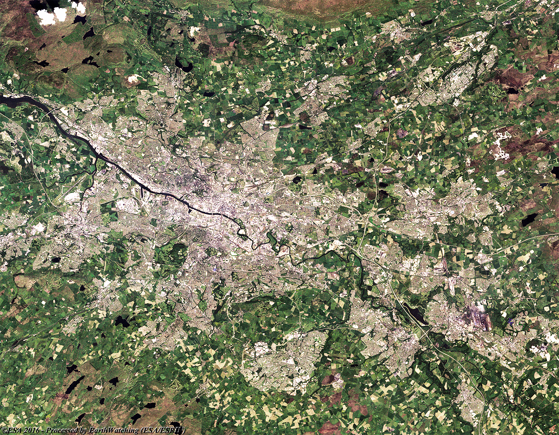
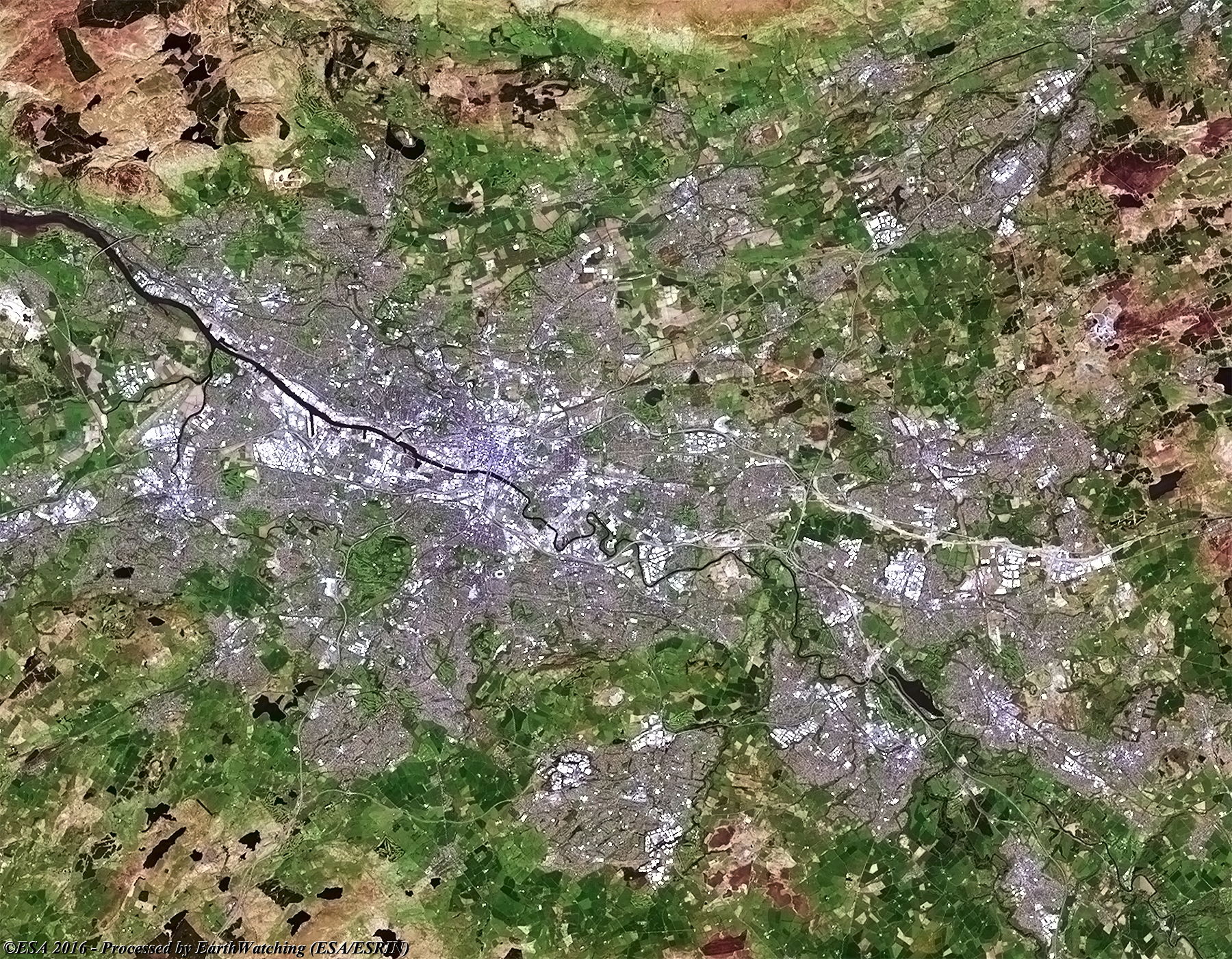
Today our tour of major cities stops over Glasgow. The administrative centre of Glasgow City unitary authority, it is located in south-west central Scotland on the River Clyde. Although not the capital, it is the most populous city, and principal commercial and industrial centre of Scotland. It is also a major tourist destination, possessing some of the finest architecture in Britain and hosting a variety of cultural events and attractions. The city occupies both banks of the Clyde about 32 km east of the river's mouth on the Firth of Clyde. It covers an area of some 180 sq km, at the centre of the historical region of Strathclyde. As with our previous views of major cities; the aim with this article is to show the differences Glasgow has experienced with the Landsat 5 and 8 images acquired in 1988 and 2016 used as reference. In the comparison, it is possible to see the development of the city, particularly in the suburbs and along the banks of the River Clyde. Another aim of these images is to promote the opportunity to download Landsat data through the ESA portals, where images captured every day are made available in near real time to the users and the scientific community. Landsat full resolution data products are freely available for immediate download at: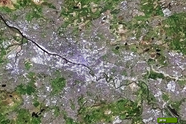 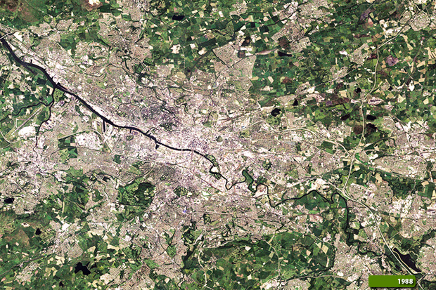 View Landsat 5 TM high resolution image (JPG 4.4 MB) View Landsat 8 OLI high resolution image (JPG 2.6 MB)
|
|||||||||||||||||||||