 Casablanca, Morocco
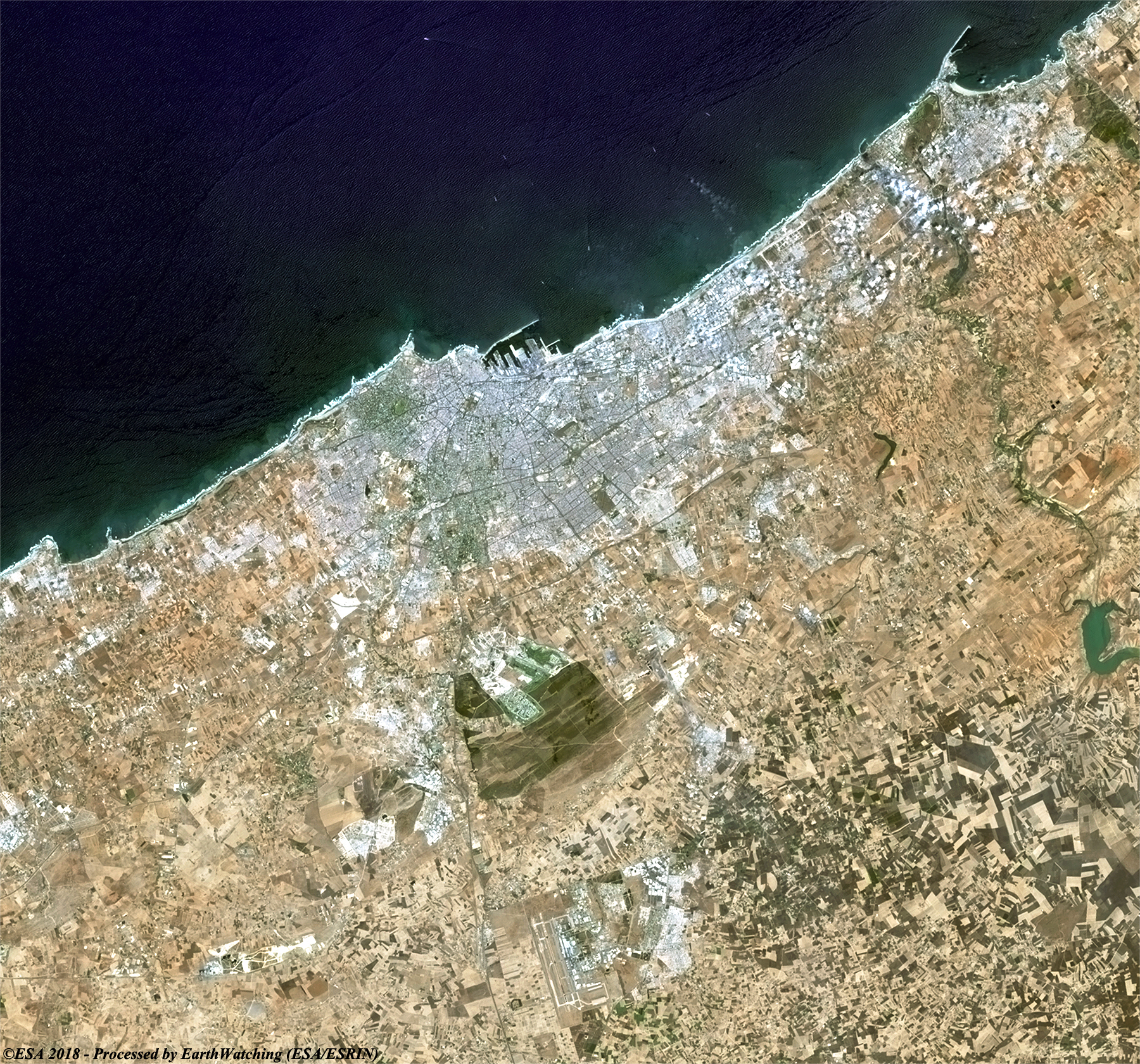
Casablanca, located in the central-western part of Morocco bordering the Atlantic Ocean, is the largest city in Morocco. It is also the largest city in the Maghreb, as well as one of the largest and most important cities in Africa, both economically and demographically. Casablanca is Morocco's chief port and one of the largest financial centers on the continent. According to the 2014 population estimate, the city has a population of about 3.35 million in the urban area and over 6.8 million in the Casablanca-Settat region. Casablanca is considered the economic and business center of Morocco, although the national political capital is Rabat. The leading Moroccan companies and international corporations doing business in the country have their headquarters and main industrial facilities in Casablanca. Recent industrial statistics show Casablanca retains its historical position as the main industrial zone of the country. The Port of Casablanca is one of the largest artificial ports in the world, and the second largest port of North Africa, after Tanger-Med 40 km east of Tangier. Casablanca also hosts the primary naval base for the Royal Moroccan Navy. More information is available on Wikipedia.
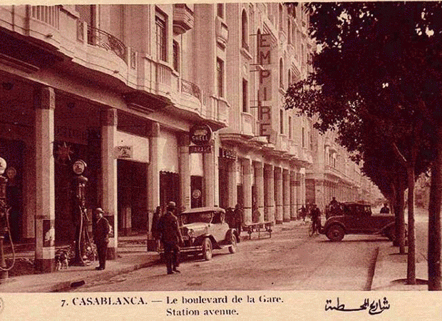
Today our tour focuses on the city of Casablanca in Morocco. Casablanca, is the chief seaport of the country, on the Atlantic Ocean near Rabat. Casablanca is one of the leading commercial cities of North Africa. It is home to the largest artificial harbour in the world: most of the foreign trade of Morocco passes through the city. Casablanca also is the country's chief industrial centre, where the leading industries are fishing, fish canning, and sawmilling.
During World War II Casablanca was one of the three key landing places for the invasion of North Africa by Allied forces. The city was the site of the Casablanca Conference (January 1943) between United States President Franklin D. Roosevelt and British Prime Minister Winston Churchill, at which both leaders pledged that their countries would fight until the Axis powers surrendered unconditionally. The withdrawal of the French in 1956 after Morocco became independent caused Casablanca severe economic hardship. A thriving tourist trade and increased industry subsequently restored its prosperity. Landsat full resolution data products are freely available for immediate download at: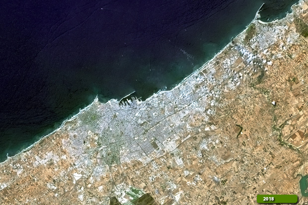 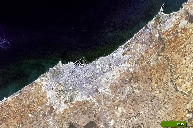 View Landsat 8 OLI high resolution image (JPG 3.8 MB) View Landsat 5 TM high resolution image (JPG 3.2 MB)
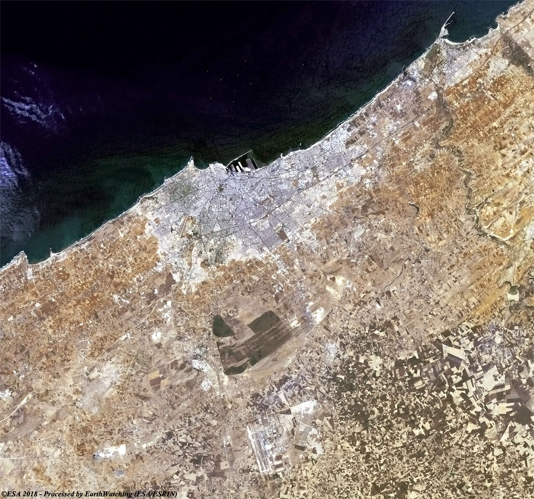
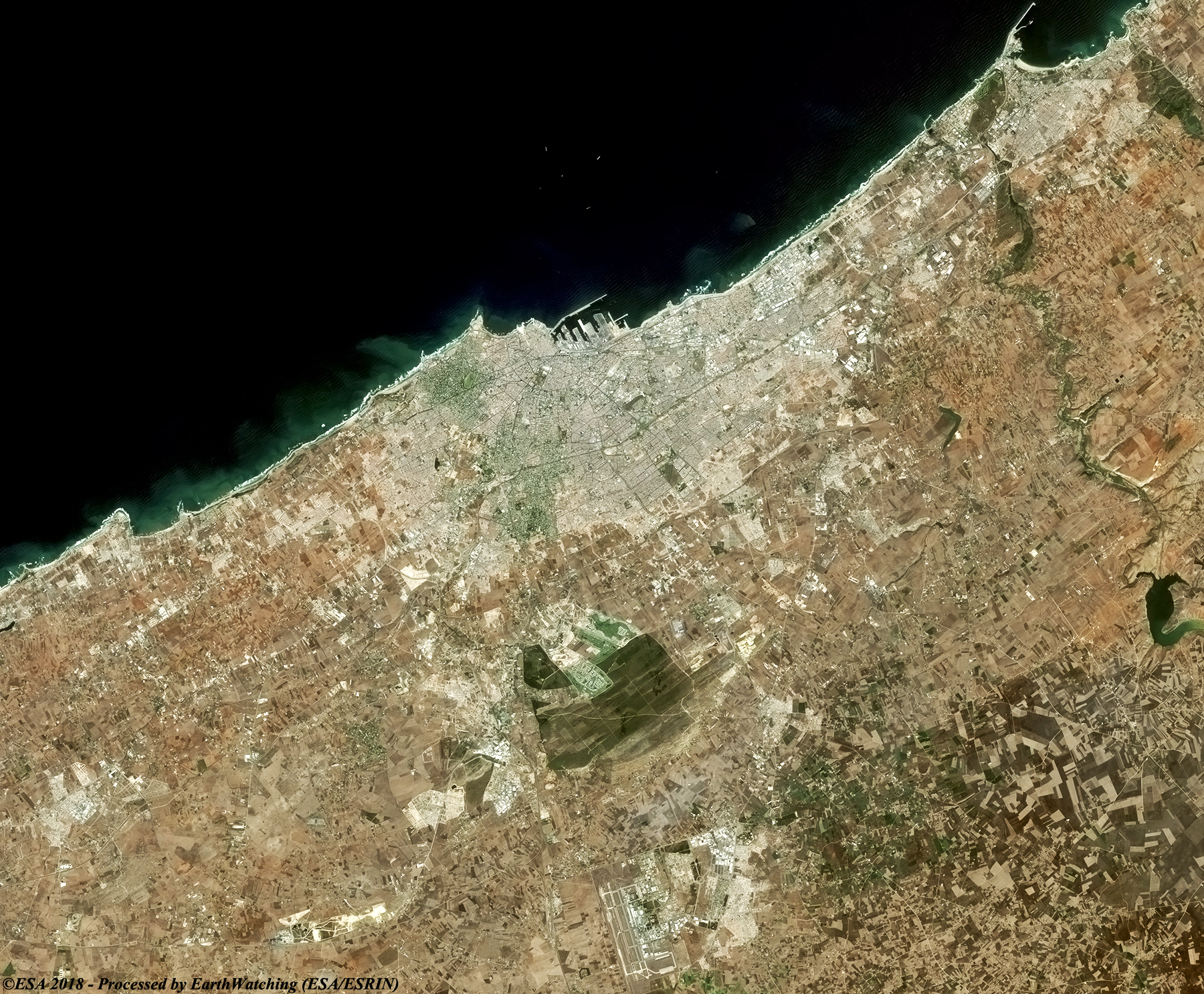
This image below, acquired by the optical sensor on the Copernicus Sentinel-2, aims to show the same area with the same bands combination of Landsat 8, but with different pixel resolution compared to the Landsat 8 imagery. 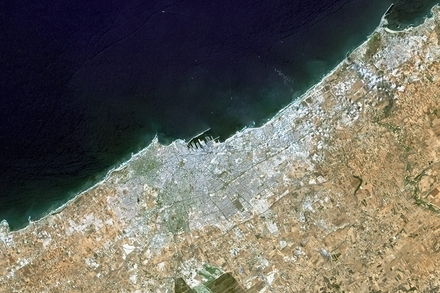
View Sentinel-2 high resolution image (JPG 2.5 MB)
|
||||||||||||||||||||||||||||||||||