 Budapest, Hungary
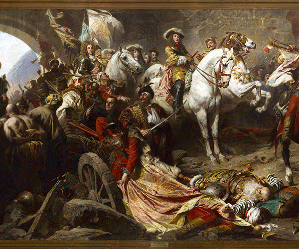
The history of Budapest began with Aquincum, originally a Celtic settlement that became the Roman capital of Lower Pannonia. Hungarians arrived in the territory in the 9th century. Their first settlement was pillaged by the Mongols in 1241-42. The re-established town became one of the centres of Renaissance humanist culture by the 15th century. Following the Battle of Mohács and nearly 150 years of Ottoman rule, the region entered a new age of prosperity in the 18th and 19th centuries, and Budapest became a global city after its unification in 1873. It also became the second capital of the Austro-Hungarian Empire, a great power that dissolved in 1918, following World War I. Budapest was the focal point of the Hungarian Revolution of 1848, the Hungarian Republic of Councils in 1919, the Battle of Budapest in 1945, and the Revolution of 1956. Cited as one of the most beautiful cities in Europe, Budapest's extensive World Heritage Site includes the banks of the Danube, the Buda Castle Quarter, Andrássy Avenue, Heroes' Square and the Millennium Underground Railway, the second-oldest metro line in the world. It has around 80 geothermal springs, the world's largest thermal water cave system, second largest synagogue, and third largest Parliament building. The city attracts about 4.4 million tourists a year, making it the 25th most popular city in the world, and the 6th in Europe, according to Euromonitor. Considered a financial hub in Central Europe, the city ranked third on Mastercard's Emerging Markets Index, and ranked as the most liveable Central or Eastern European city on EIU's quality of life index. It is also ranked as "the world's second best city" by Condé Nast Traveler, and "Europe's 7th most idyllic place to live" by Forbes. It is the highest ranked Central/Eastern European city on Innovation Cities' Top 100 index. Budapest is home to the headquarters of the European Institute of Innovation and Technology (EIT), the European Police College and the first foreign office of the China Investment Promotion Agency (CIPA). Eighteen universities are situated in Budapest, including the Central European University, Eötvös Loránd University and the Budapest University of Technology and Economics. More information is available on Wikipedia
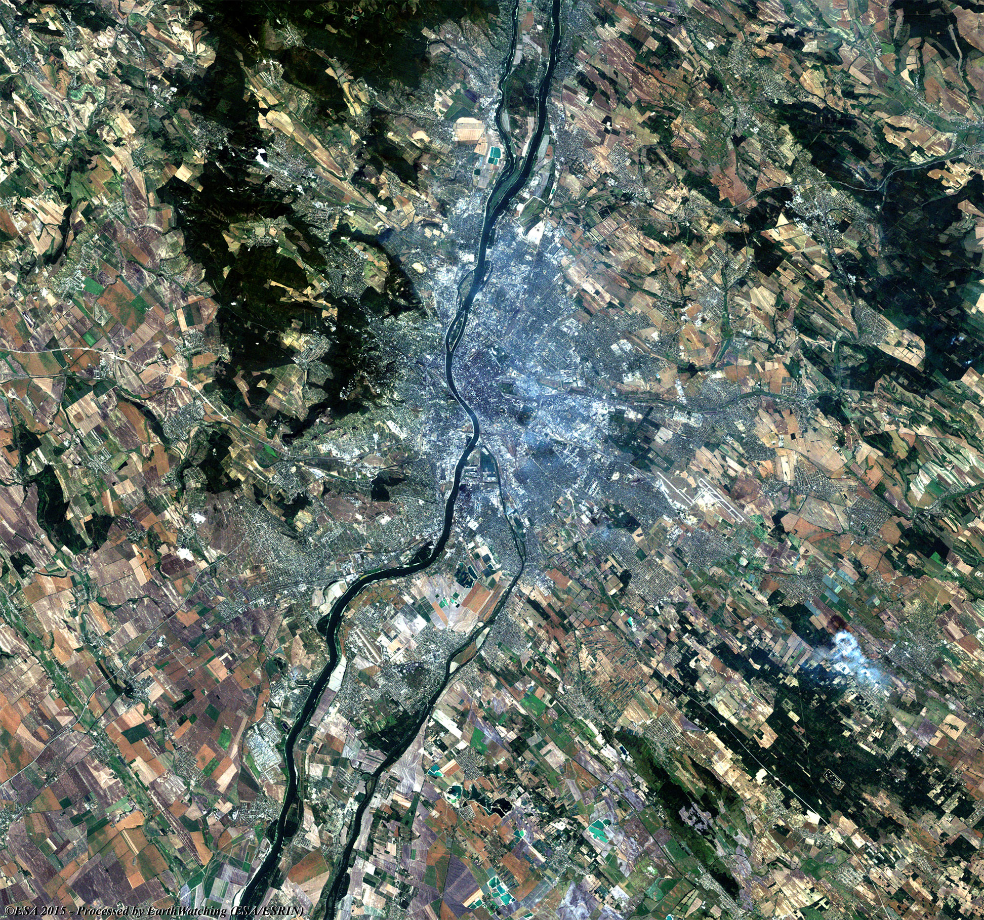
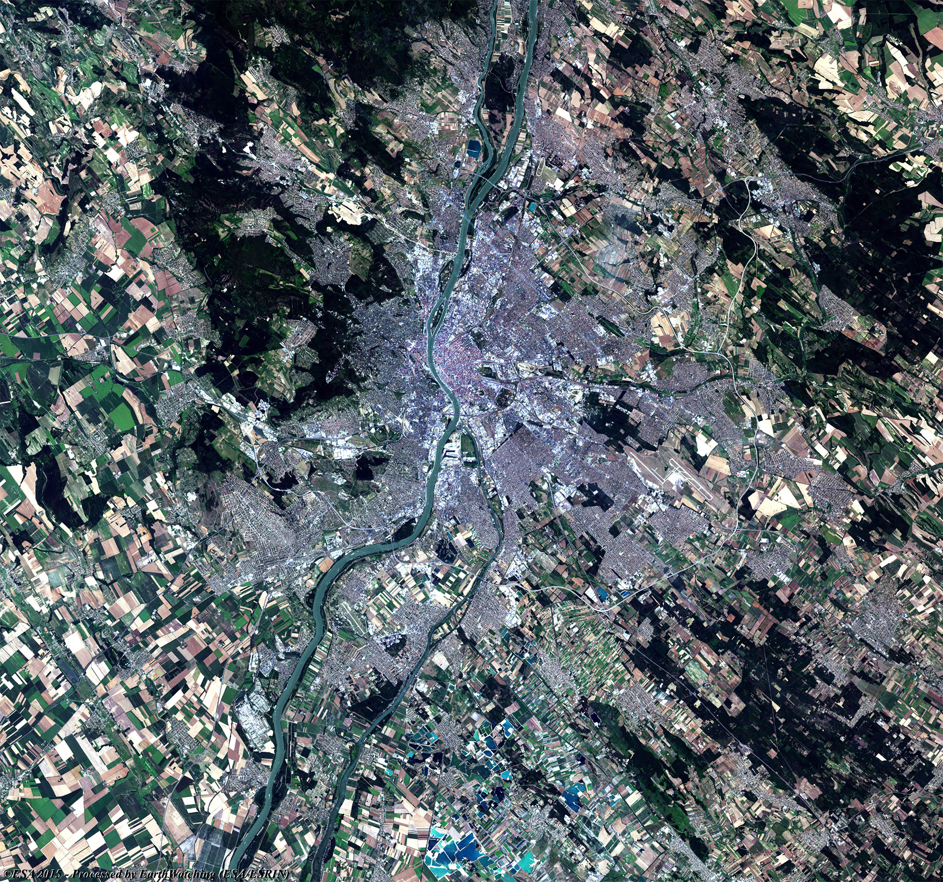
These images, acquired by the Landsat 5 and 8 satellites with an acquisition time window (before / after) of thirty years, aim to show the urban development (see the overlay image) from 1985 until today, along the banks of the River Danube in Budapest. The capital of Hungary, Budapest is located in the north central part of the country, on the Danube River. The present city was formed in 1873 by uniting Buda and Obuda on the right bank with Pest on the left bank of the river. The area has been settled since the third millennium B.C., and two Roman towns were established in the vicinity. These towns were destroyed by the Mongols in 1241, but later in the century King Bela IV of Hungary (1235–70), built a fortress here, and in the 14th century King Sigismund erected a palace. Buda became Hungary's capital in 1361. Under King Matthias Corvinus (1458–90) it became a center of learning. The Ottoman Empire captured Pest in 1526 and Buda in 1541. Both were mostly ruins by the time Charles V of Lorraine recaptured them for the Hapsburg dynasty in 1686. They were rebuilt and resettled and gradually became important cities again. The Empress Maria Theresa of Austria aided them by transferring a university to Buda in 1777 and building a palace. The united city in the late 19th century was, with Vienna, one of the two capitals of Austria-Hungary. By the time of World War I it was also a busy commercial and industrial center. Tourists came for its many theatrical, musical, and other attractions. Another aim of these images is to promote the opportunity to download Landsat data through the ESA portals, where images captured every day are made available in near real time to the users and the scientific community. Landsat full resolution data products are freely available for immediate download at: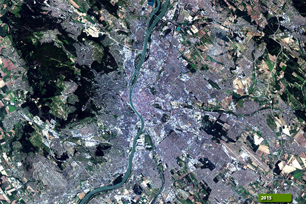 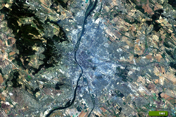 View Landsat 5 TM high resolution image (JPG 1.7 MB) View Landsat 8 OLI high resolution image (JPG 1.7 MB)
|
|||||||||||||||||||||