 Beirut, Lebanon
Beirut is the capital and largest city of Lebanon. No recent population census has been done but in 2007 estimates ranged from slightly more than 1 million to slightly less than 2 million as part of Greater Beirut. Located on a peninsula at the midpoint of Lebanon's Mediterranean coast, Beirut is the country's largest and main seaport. It is one of the oldest cities in the world, inhabited more than 5,000 years ago. The first historical mention of Beirut is found in the ancient Egyptian Tell el Amarna letters dating from the 15th century BC. The Beirut River runs south to north on the eastern edge of the city. Beirut is Lebanon's seat of government and plays a central role in the Lebanese economy, with many banks and corporations based in its Central District, Badaro, Rue Verdun, Hamra and Ashrafieh. Following the destructive Lebanese Civil War, Beirut's cultural landscape underwent major reconstruction. Identified and graded for accountancy, advertising, banking/finance and law, Beirut is ranked as a Beta World City by the Globalization and World Cities Research Network. In May 2015, Beirut was officially recognised as one of the New7Wonders Cities together with Vigan, Doha, Durban, Havana, Kuala Lumpur, and La Paz. More information is available on Wikipedia

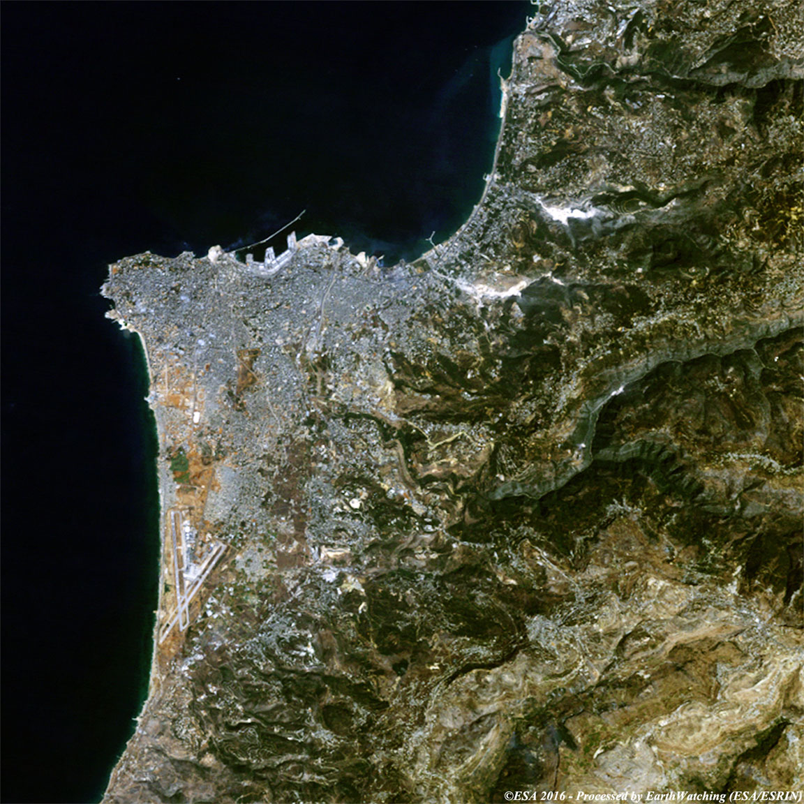
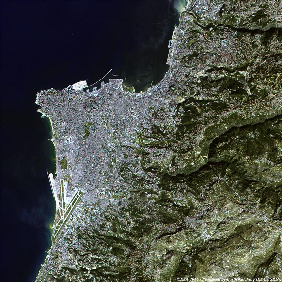
Today our Landsat comparison is focused over the city of Beirut. Beirut is a coastal city located in the eastern basin of the Mediterranean Sea, at the foot of the mountain chain that runs through Lebanon. The city was founded on a small peninsula extending westward into the sea, then with the growth of the population over time it has expanded to the southeast urbanising part of the hills. The peninsula on which the city is located is not flat but slightly hilly and two hills especially characterise it; located in the east and in the west and crossed by a river which the same name as the city. After the last war of 2006, thanks to the initiative and commercial economy ability, Beirut has become strong and open to the international development market, especially in the financial sector. Today the city is in continuous metamorphosis, is very rich and the town, almost completely rebuilt from the ashes of war, has reared its head and boasts a very respectable skyline, skyscrapers and modern buildings of merit. It is undeniably a hyper modern city, multi-ethnic and multi-religious, where diversity constitutes the daily life, the very essence of a place where they overlap countless characters settlement, social, political and religious. The changes of the city are visible in these two Landsat images taken as comparison (before and after) with a time window of thirty-two years. In effect as shown in the image acquired in 2016, the city has had a large development along the south west coast and the surrounding city. A notable change is the area around the airport, which has completely changed during these years. Landsat full resolution data products are freely available for immediate download at: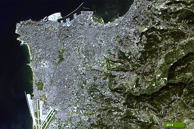 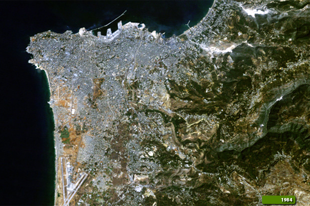 View Landsat 5 TM high resolution image (JPG 333 KB) View Landsat 8 OLI high resolution image (JPG 558 KB)
|
|||||||||||||||||||||