 Astana, Kazakhstan
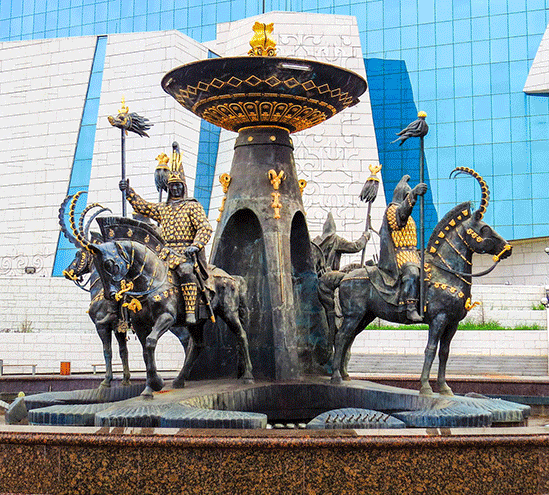
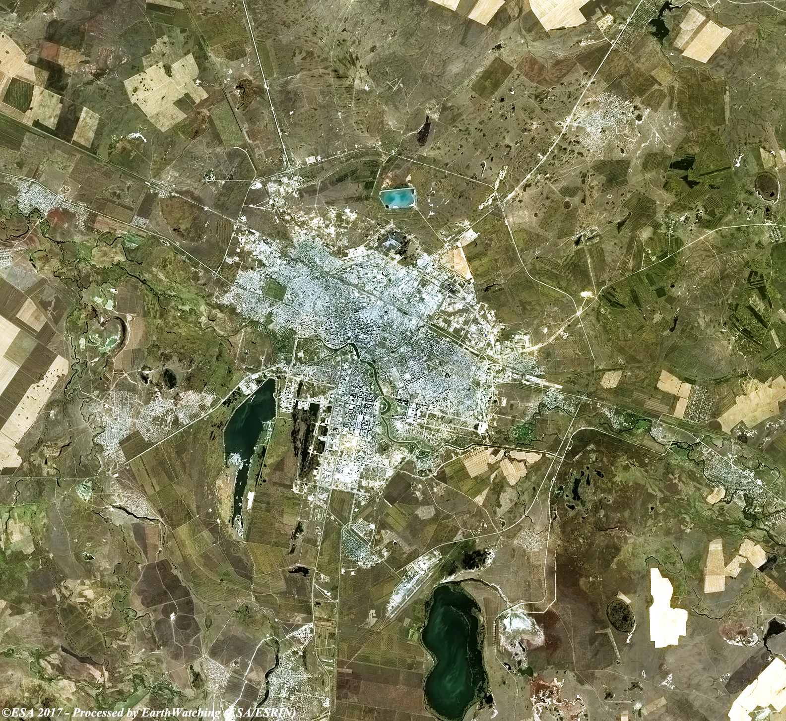
Astana is the capital city of Kazakhstan. It is located on the banks of Ishim River in the north portion of Kazakhstan, within the Akmola Region, though administrated separately from the region as a city with special status. The 2014 census reported a population of 835,153 within the city limits, making it the second-largest city in Kazakhstan, behind Almaty. Founded in 1830 as a settlement of Akmoly or Akmolinsky prikaz, it served as a defensive fortification for the Siberian Cossacks. In 1832 the settlement was granted a town status and renamed Akmolinsk. On 20 March 1961 the city was renamed Tselinograd to mark the city's evolution as a cultural and administrative center of the Virgin Lands Campaign. In 1992 it was renamed Akmola, the modified original name meaning "a white grave". On 10 December 1997 Akmola replaced Almaty as the capital of Kazakhstan. On 6 May 1998 it was renamed Astana, which means "the capital city" in Kazakh. Modern Astana is a planned city, like Brasília in Brazil, Canberra in Australia, Huambo in Angola, Milton Keynes, UK and Washington, D.C. in the United States. After Astana became the capital of Kazakhstan, the city cardinally changed its shape. The master plan of Astana was designed by Japanese architect Kisho Kurokawa. As the seat of the Government of Kazakhstan, Astana is the site of the Parliament House, the Supreme Court, the Ak Orda Presidential Palace and numerous government departments and agencies. It is home to many futuristic buildings, hotels and skyscrapers. Astana also has extensive healthcare, sports and education systems. More information is available on Wikipedia
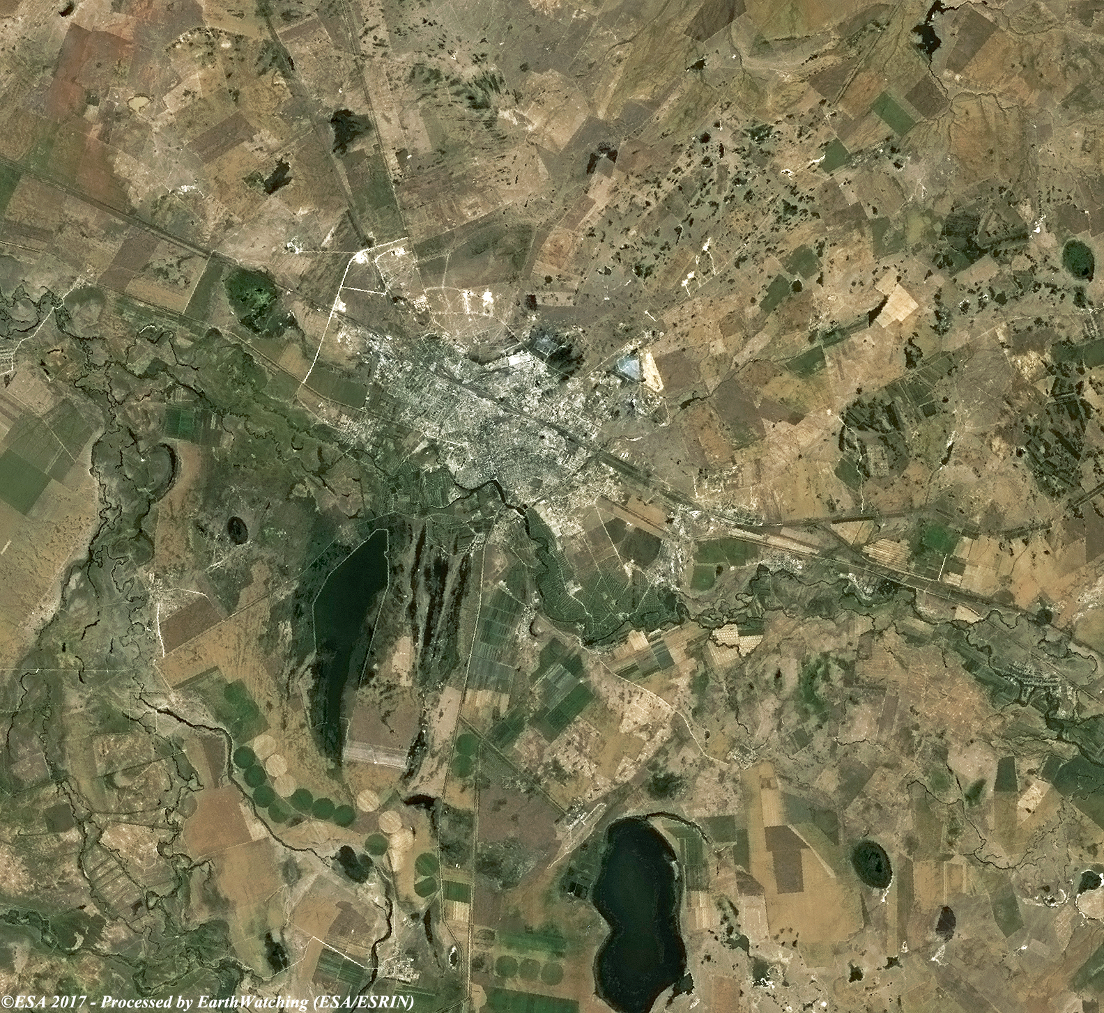
Today we focus our tour over the city of Astana. This city lies on the bank of the Ishim River near its source, in the centre of a mineral-rich steppe region and is a substantial commercial and economic centre for the area. An important rail junction, the main industries in Astana are meat-packing and the production of agricultural machinery and chemicals. The surrounding area is an important grain-growing region. Astana is currently hosting Expo 2017, the international exhibition on "Future Energy", which takes place from 10 June until 10 September. There are about 115 countries participating, including Italy, and 18 organisations, including the UN, UNESCO and the OSCE. This Expo will be a bridge between the Expo in Milano 2015 and the future Expo, Dubai 2020. Astana wants to become the economic crossroads between China, Russia and Europe, taking on the trade flows that will travel along the new Silk Road. Astana wants to be the unexplored capital of mineral resources of uranium, zinc, tungsten, barium, silver, fluorite and molybdenum, and the rich oil fields, including the maxi field of Kashagan on the Caspian Sea, costing 16 years of work and $50 billion to a consortium led by Eni, Kazakhstan is relying on its natural wealth to cover the costs of development and the accounts of the ongoing maxi-projects. The aim of these images acquired by the Landsat family, with a time window (before/after) of 18 years, is to show how Astana has changed since 1989. The skyline of the city has developed with new areas constructed, particularly in the south of the city where pavillions for the exhibition are located, and new infrastructure is now visible in this image comparison. Another aim of these images is to promote the opportunity to download Landsat data through the ESA portals (or third party mission free catalogue), where images captured every day are made available in near real time to the users and the scientific community. Landsat full resolution data products are freely available for immediate download at: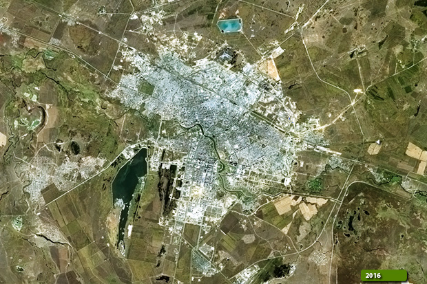 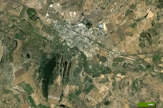 View Landsat 4 TM high resolution image (JPG 3.0 MB) View Landsat 8 OLI high resolution image (JPG 3.2 MB)
|
|||||||||||||||||||||