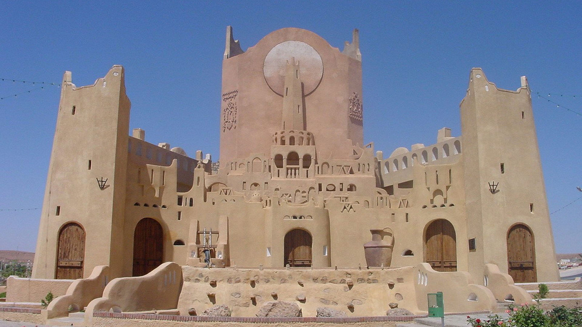
 Algiers, Algeria
Algeria, officially People's Democratic Republic of Algeria, is a country in the Maghreb region of North Africa on the Mediterranean coast. Its capital and most populous city is Algiers. With a total area of 2,381,741 square kilometres, 90% of which is desert, Algeria is the tenth-largest country in the world, and the largest in Africa and in the Mediterranean. The territory of today's Algeria was the home of many prehistoric cultures, including Aterian and Capsian and the "Proto-Imazi en" cultures. Its area has known many empires and dynasties, including ancient Amazi Numidians, Phoenecians, Lybio-Punic Carthaginians, Romans, Vandals, Byzantines, Arab Umayyads, Arab Abbasids, Multi-Ethnic Fatimids, Amazi Almoravids, Amazi Almohads, Turkish Ottomans and the French colonial empire. In recent decades Algeria along with the other nations of the "Desert Belt" has experienced an identity crisis, in response Algeria, along with Morocco, has nationalised Tamazi, the language of its 13,000 year old people. Algeria is a semi-presidential republic, it consists of 48 provinces and 1541 communes. With a population of 37.9 million, it is the 35th most populated country on Earth. Algeria's economy is largely based on hydrocarbons, due to which manufacturing has suffered from Dutch disease. The country supplies large amounts of natural gas to Europe and energy exports are the backbone of the economy. According to OPEC Algeria has 17th largest reserves of oil in the world, and second largest in Africa, while it has the 9th largest reserves of natural gas. Sonatrach, the national oil company, is the largest company in Africa. Algeria has the second largest military in North Africa with the largest defense budget in Africa. Algeria has had a peaceful nuclear program since the 1990s. Algeria is a member of the African Union, the Arab League, OPEC and the United Nations, and is a founding member of the Arab Maghreb Union.
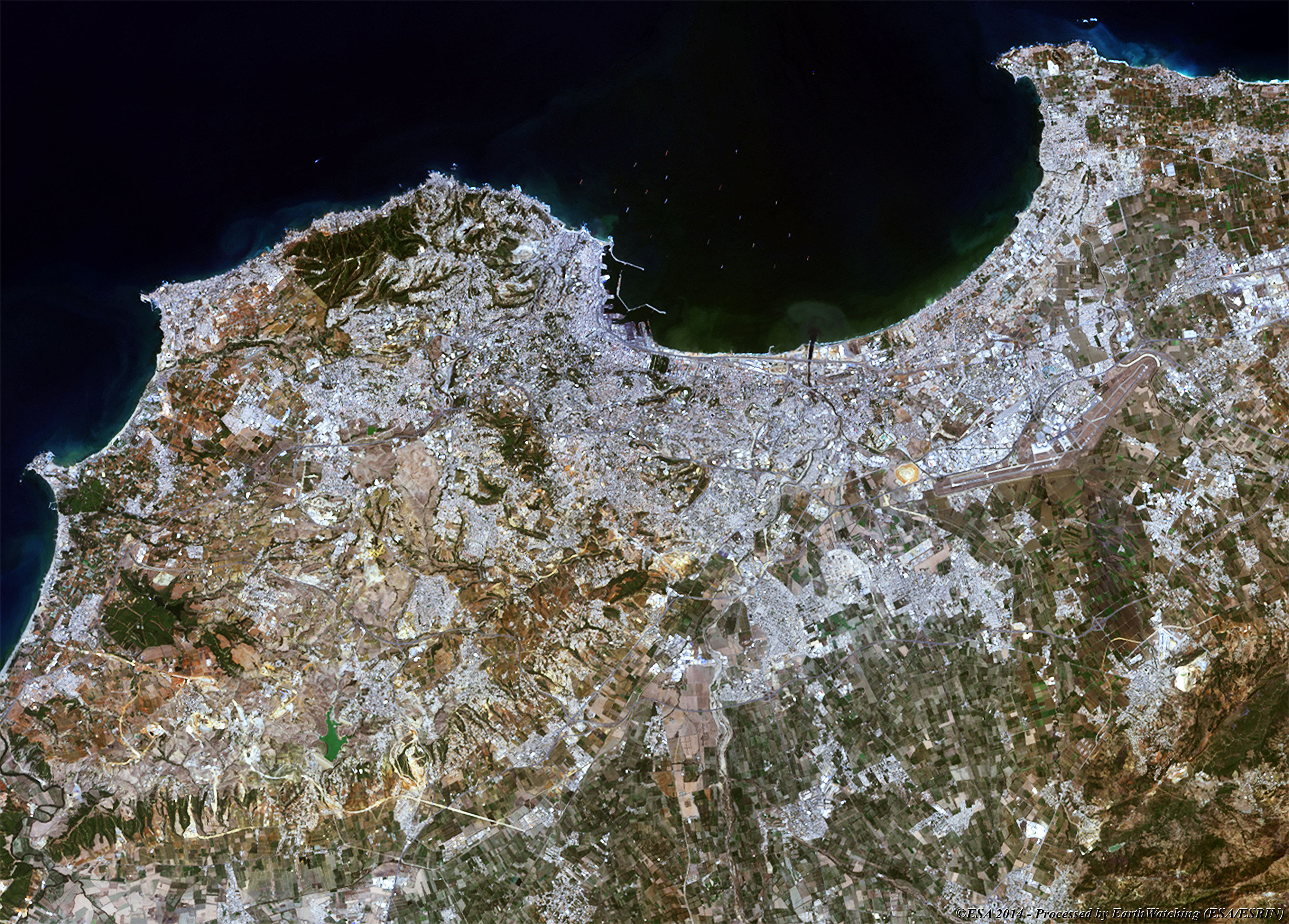
These images acquired over Algiers, in a time window of 29 years by the Landsat 5 and 8 satellites, aim to show the significant development of the city during this period of time. In fact, large urban areas have been built along the gulf coast and also in the hinterlands of the city. Using this type of comparison it is possible to see these changes side by side. Another aim of these images is to promote the opportunity to download Landsat data through the ESA portals, where images captured every day are made available in near real time to the users and the scientific community. Landsat full resolution data products are freely available for immediate download at: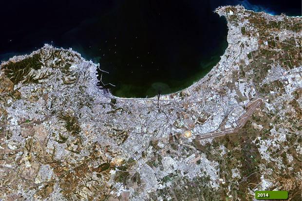 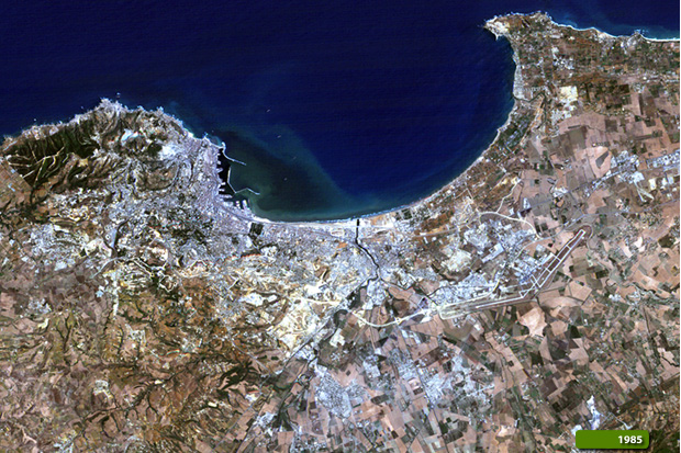 View Landsat 5 TM high resolution image (JPG 1.4 MB) View Landsat 8 OLI high resolution image (JPG 1.5 MB)
|
|||||||||||||||||||||