Minimize Envisat MERIS Full Resolution Full Swath Gallery 2007

MERIS FRS Gallery 2007 - The generation of the Full Resolution Full Swath product was introduced in the processor IPF version 4.10, installed in January 2005.

This series features MERIS FRS products acquired by the instrument aboard Envisat from around the world in 2007.

Cook Strait

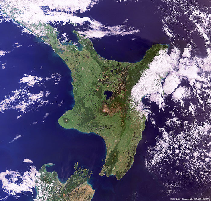
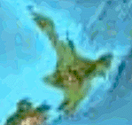
The Cook Strait separates the north and south islands of New Zealand and is considered one the most dangerous passages in the world for its strong winds and sudden currents.

View large image [JPG 176 KB] and corresponding swath [GIF]
Technical Information
Satellite: Envisat
Instrument: Medium Resolution Imaging Spectrometer (MERIS)
Product: MER_FRS_1P
Date of acquisition 31 Dec 2007
Orbit number: 30515
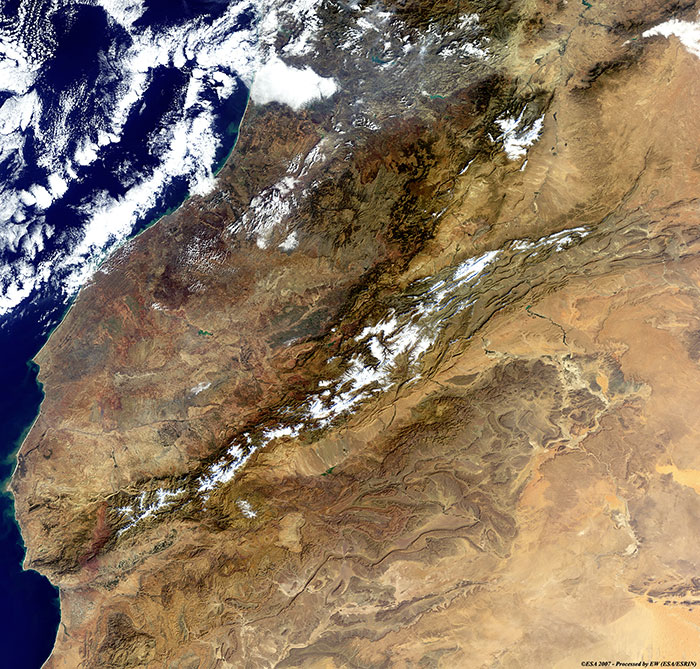
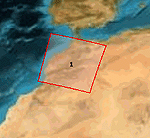
Snow on the Atlas Mountains (Morocco)
View large image [JPG 205 KB] and corresponding swath [GIF]
Technical Information
Satellite: Envisat
Instrument: Medium Resolution Imaging Spectrometer (MERIS)
Product: MER_FRS_1P
Date of acquisition 03 Dec 2007
Orbit number: 30108
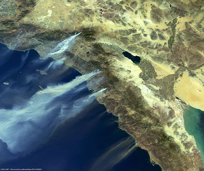
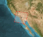
Fires in Los Angeles and San Diego
View large image [JPG 124 KB] and corresponding swath [GIF]
Technical Information
Satellite: Envisat
Instrument: Medium Resolution Imaging Spectrometer (MERIS)
Product: MER_FRS_1P
Date of acquisition 22 Oct 2007
Orbit number: 29511
Peloponnese Peninsula

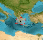
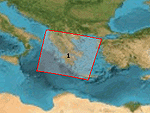
This image shows the Peloponnese Peninsula one month after fires struck the region in August.

View large image [JPG 186 KB] and corresponding swath [GIF]
Technical Information
Satellite: Envisat
Instrument: Medium Resolution Imaging Spectrometer (MERIS)
Product: MER_FRS_1P
Date of acquisition 06 Sep 2007
Orbit number: 28847
Band combination: 15, 13, 11

This view of the Peloponnese Peninsila shows fires in progress.

View large image [JPG 107 KB] and corresponding swath [GIF]
Technical Information
Satellite: Envisat
Instrument: Medium Resolution Imaging Spectrometer (MERIS)
Product: MER_FRS_1P
Date of acquisition 24 Aug 2007
Orbit number: 28661
Band combination: 7, 5, 2
The Canary Islands

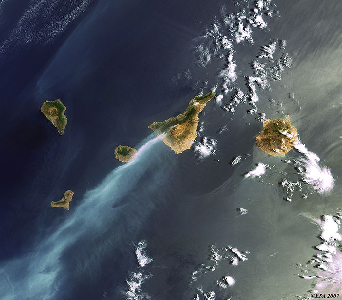
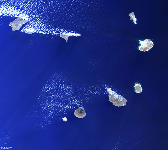
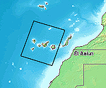
Fires are visible in this image along the south west coast of Tenerife Island and over El Pico del Teide (The Peak of Teide).

View large image [JPG 85 KB] and corresponding swath [GIF]
Technical Information
Satellite: Envisat
Instrument: Medium Resolution Imaging Spectrometer (MERIS)
Product: MER_FRS_1P
Date of acquisition 31 Jul 2007
Orbit number: 28319
Mesopotamia (Iraq)
View large image [JPG 147 KB] and corresponding swath [GIF]
Technical Information
Satellite: Envisat
Instrument: Medium Resolution Imaging Spectrometer (MERIS)
Product: MER_FRS_1P
Date of acquisition 14 Jun 2007
Orbit number: 27644
Ireland
View large image [JPG 125 KB] and corresponding swath [GIF]
Technical Information
Satellite: Envisat
Instrument: Medium Resolution Imaging Spectrometer (MERIS)
Product: MER_FRS_1P
Date of acquisition 03 May 2007
Orbit number: 27045
The English Channel
View large image [JPG 129 KB] and corresponding swath [GIF]
Technical Information
Satellite: Envisat
Instrument: Medium Resolution Imaging Spectrometer (MERIS)
Product: MER_FRS_1P
Date of acquisition 27 Mar 2007
Orbit number: 26515
Cape Verde Islands

Located in the Atlantic Ocean, this archipelago consists of ten islands and five small islets.

View large image [JPG 79 KB] and corresponding swath [GIF]
Technical Information
Satellite: Envisat
Instrument: Medium Resolution Imaging Spectrometer (MERIS)
Product: MER_FRS_1P
Date of acquisition 25 Feb 2007
Orbit number: 26086

Back to top