 Stromboli Volcano
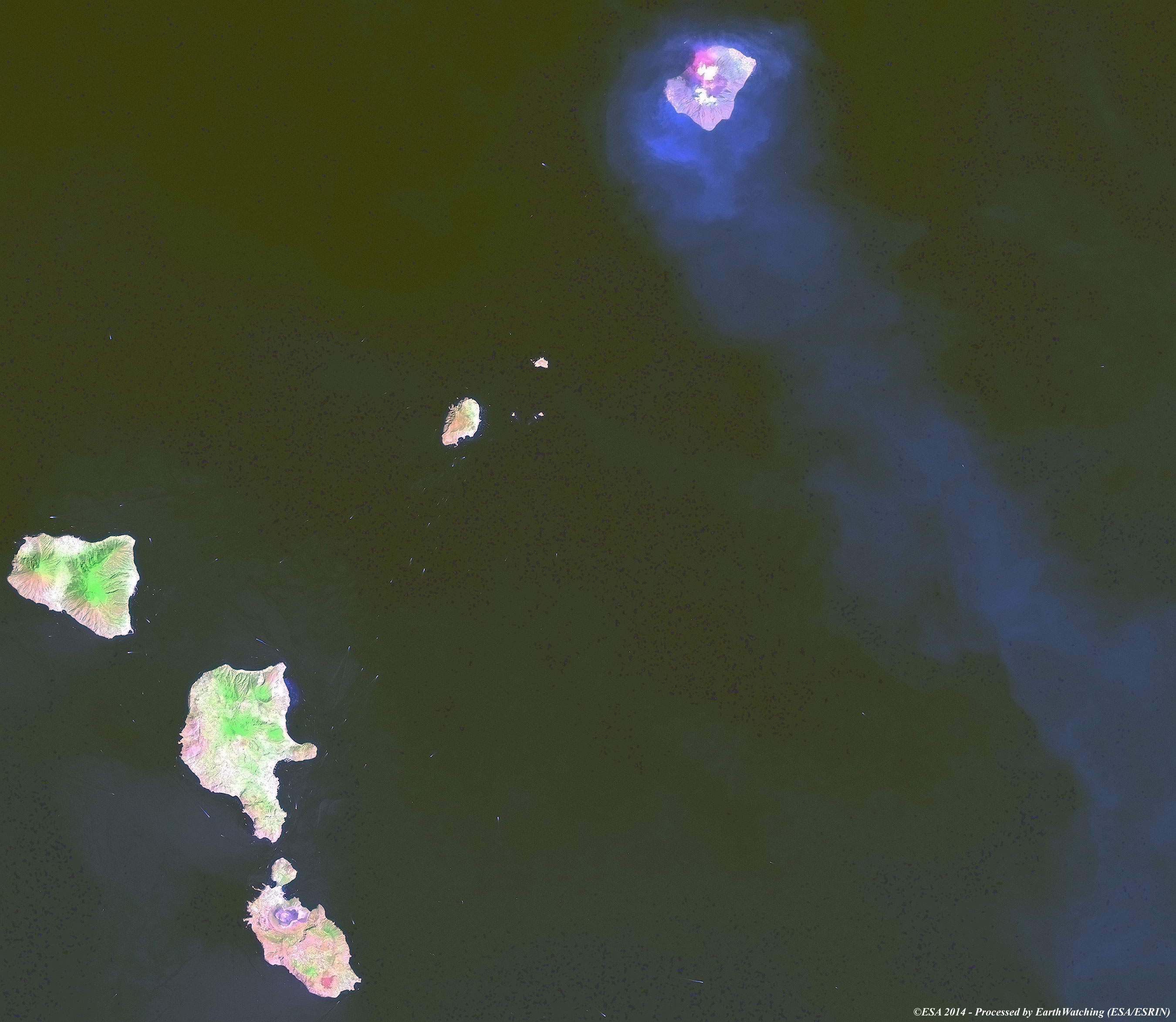
Stromboli is a small island in the Tyrrhenian Sea, off the north coast of Sicily, containing one of the three active volcanoes in Italy. It is one of the eight Aeolian Islands, a volcanic arc north of Sicily. This name is derived from the Ancient Greek name Strongule which was given to it because of its round swelling form. The island's population is between 400 and 850 persons. The volcano has erupted many times and is constantly active with minor eruptions, often visible from many points on the island and from the surrounding sea, giving rise to the island's nickname (Lighthouse of the Mediterranean). The most recent major eruption was on 13 April 2009. Stromboli stands 926 m above sea level, and over 2,700 m on average above the sea floor. There are three active craters at the peak. A significant geological feature of the volcano is the Sciara del Fuoco (Stream of fire), a big horseshoe shaped depression generated in the last 13,000 years by several collapses on the northwestern side of the cone. Two kilometres to the northeast lies Strombolicchio, the volcanic plug remnant of the original volcano. Mt. Stromboli has been in almost continuous eruption for the past 2,000 years. A pattern of eruption is maintained in which explosions occur at the summit craters, with mild to moderate eruptions of incandescent volcanic bombs, at intervals ranging from minutes to hours. This Strombolian eruption, as it is known, is also observed at other volcanoes worldwide. Eruptions from the summit craters typically result in a few short, mild, but energetic bursts, ranging up to a few hundred metres in height, containing ash, incandescent lava fragments and stone blocks. Mt. Stromboli's activity is almost exclusively explosive, but lava flows do occur at times when volcanic activity is high, an effusive eruption occurred in 2002, the first in 17 years, and again in 2003, 2007, 2013, and 2014.

Stromboli volcano has been particularly active in recent weeks, and spectacular eruptions have been captured in numerous videos that show the incredible phenomenon. In these images below, captured by Landsat 8 during both night and day, we can also see this phenomenon from a different perspective; from space. Another aim of these images is to promote the opportunity to download Landsat data through the ESA portals, where images captured every day are made available in near real time to the users and the scientific community. Landsat full resolution data products are freely available for immediate download at:
Day
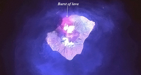 Night 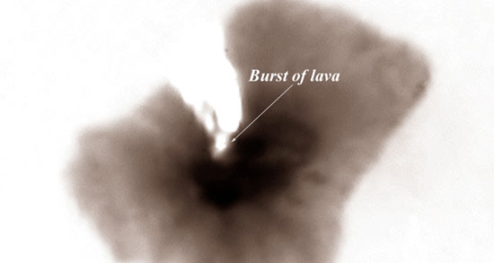 View Landsat 8 OLI high resolution image (JPG 1 MB)
|
|||||||||||||||||||||