 Karachi, Pakistan
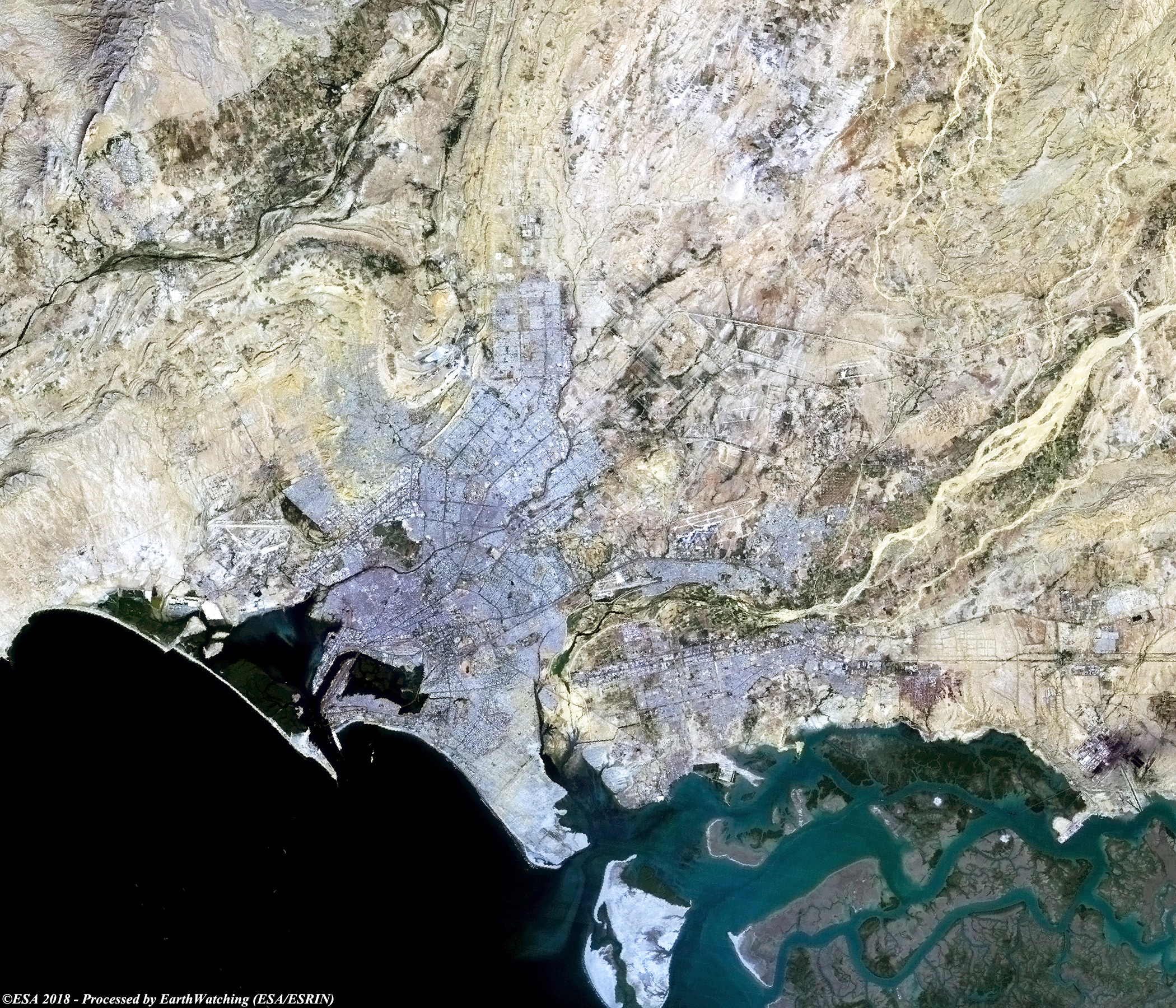
Karachi is the capital of the Pakistani province of Sindh. Situated on the Arabian Sea, Karachi serves as a transport hub, and is home to Pakistan's two largest seaports, the Port of Karachi and Port Bin Qasim, as well as the busiest airport in Pakistan. Though the Karachi region has been inhabited for millennia, the city was founded as the fortified village of Kolachi in 1729. Karachi is one of the world's fastest growing cities, and has communities representing almost every ethnic group in Pakistan. Karachi is built on a coastal plains with scattered rocky outcroppings, hills and coastal marshlands. Coastal mangrove forests grow in the brackish waters around the Karachi Harbour, and farther southeast towards the expansive Indus River Delta. West of Karachi city is the Cape Monze, locally known as Ras Muari, which is an area characterised by sea cliffs, rocky sandstone promontories and undeveloped beaches. Within the city of Karachi are two small ranges: the Khasa Hills and Mulri Hills, which lie in the northwest and act as a barrier between North Nazimabad Town and Orangi Town. Karachi's hills are barren and are part of the larger Kirthar Range, and have a maximum elevation of 528 metres (1,732 feet). More information is available on Wikipedia.
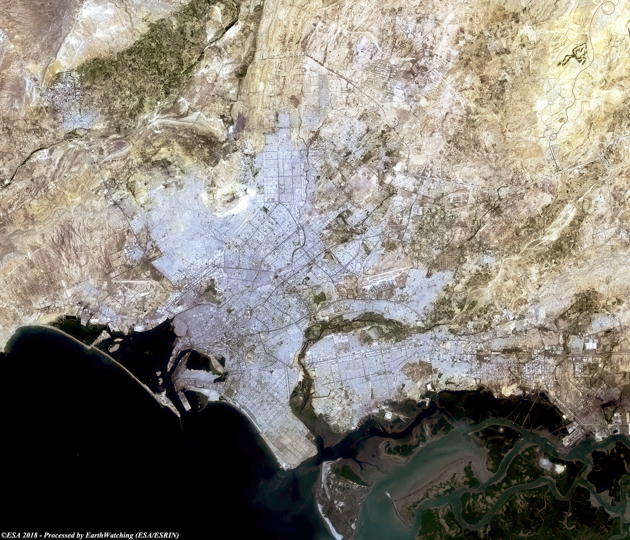
In this comparison we focus our interest over the city of Karachi. It is the heart of the Pakistani economy, crossed by the Indus River and has experienced enormous expansion over the last few decades. Karachi has quickly become the second most populous city in the world after Shanghai. This comparison of Landsat 5 and Landsat 8 images, shows the urban development of the city during the last 29 years, and highlights the large increase of urbanisation in the north west and south east of the original city area. Another aim of these images is to promote the opportunity to download Landsat data through the ESA portals (or third party mission free catalogue), where images captured every day are made available in near real time to the users and the scientific community. Landsat full resolution data products are freely available for immediate download at: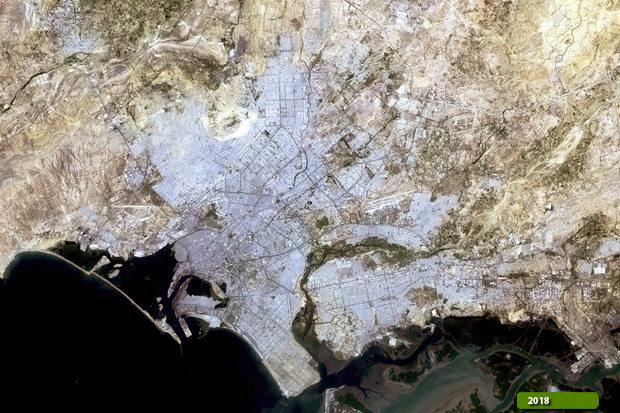 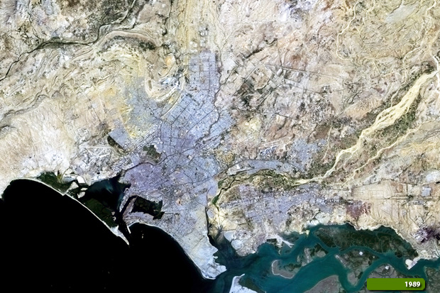 View Landsat 8 OLI high resolution image (JPG 4.4 MB) View Landsat 5 TM high resolution image (JPG 4.1 MB)
|
|||||||||||||||||||||