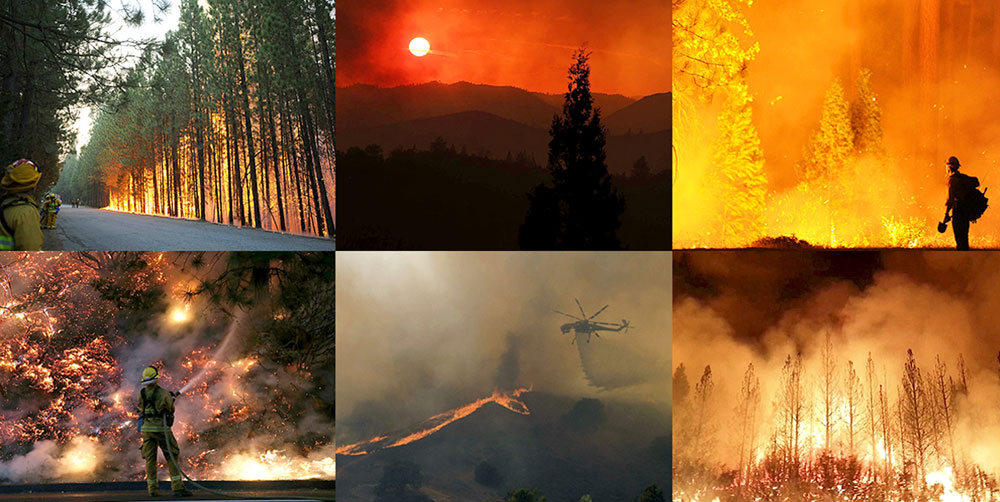
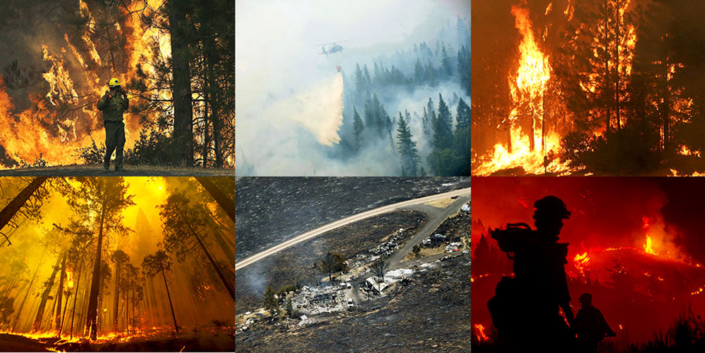
YOSEMITE NATIONAL PARK, 30 Aug 2013 (From: AFP) – The wildfire threatening Yosemite National Park is spreading further into the US tourist landmark, officials said Thursday as they battled to stop it clouding a holiday weekend. Efforts to contain the so-called Rim Fire, which has grown to become California's sixth biggest wildfire ever, were also being boosted by the deployment of a military drone approved by the Pentagon. The fire, which now covers more than 192,000 acres, or 300 square miles, and is 30 percent contained, has also threatened San Francisco's water supply, due to ash falling on a key reservoir. The blaze, about a quarter of which is now inside the park's boundaries, "is expected to continue its eastward spread farther into the west side of Yosemite National Park," said the latest firefighters' online update.
The fire, which started west of the park on August 17, is threatening some 4,500 structures and on Wednesday forced the closure of a second main road into the major US tourist attraction ahead of the Labor Day weekend. A surge of visitors is typically expected over this weekend's Labor Day holiday at Yosemite, which draws millions of tourists every year, most in July and August. Labor Day traditionally marks the end of the summer season. "On a normal holiday weekend we see anywhere between 15,000-21,000 people ... I still expect that it will increase but just not quite as much as it usually does," Yosemite spokeswoman Kari Cobb told AFP.
Last week officials closed Highway 120, the main road used by visitors from San Fransisco into the west of the park. There are three other main roads in. On Wednesday authorities closed a key section of the Tioga Road, which runs horizontally across the park, effectively blocking access from the east into Yosemite Valley, the spectacular area at its heart. Cobb said the reason for closing the Tioga Road was to use it "as a barrier so the fire doesn't go any further." By Thursday the fire was about two miles short of the road. By Thursday the fire had burned through some 45,000 acres inside the park, she said. But there was no risk that it will reach Yosemite Valley, the park's main tourist area which is still 15 miles away. "It would have to travel a very far distance to get here. And the other thing is that Yosemite Valley is surrounded by granite cliffs, and granite is a very good fire stopper. "So at this point there is absolutely no talk of the fire reaching Yosemite Valley." The inferno has however reached the Hetch Hetchy Reservoir, the main source of water for 2.6 million people living in the San Francisco Bay Area, some 200 miles (320 kilometers) to the west. Ash has fallen on the reservoir, but water quality has not been affected so far, authorities say.
No injuries or deaths have been reported due to the blaze, but it has destroyed at least 111 structures -- 31 homes as well as buildings on campgrounds that were hastily evacuated last week when the fire erupted. The California National Guard on Wednesday began using a Predator military drone, of the kind which have been used in Afghanistan over the last decade, to monitor the blaze from the air, a Pentagon spokesman told AFP. Full containment of the fire is not expected for several weeks, the latest estimate by the California Department of Forestry and Fire Protection (Cal Fire) is that they will not have it totally under control until September 20.
|
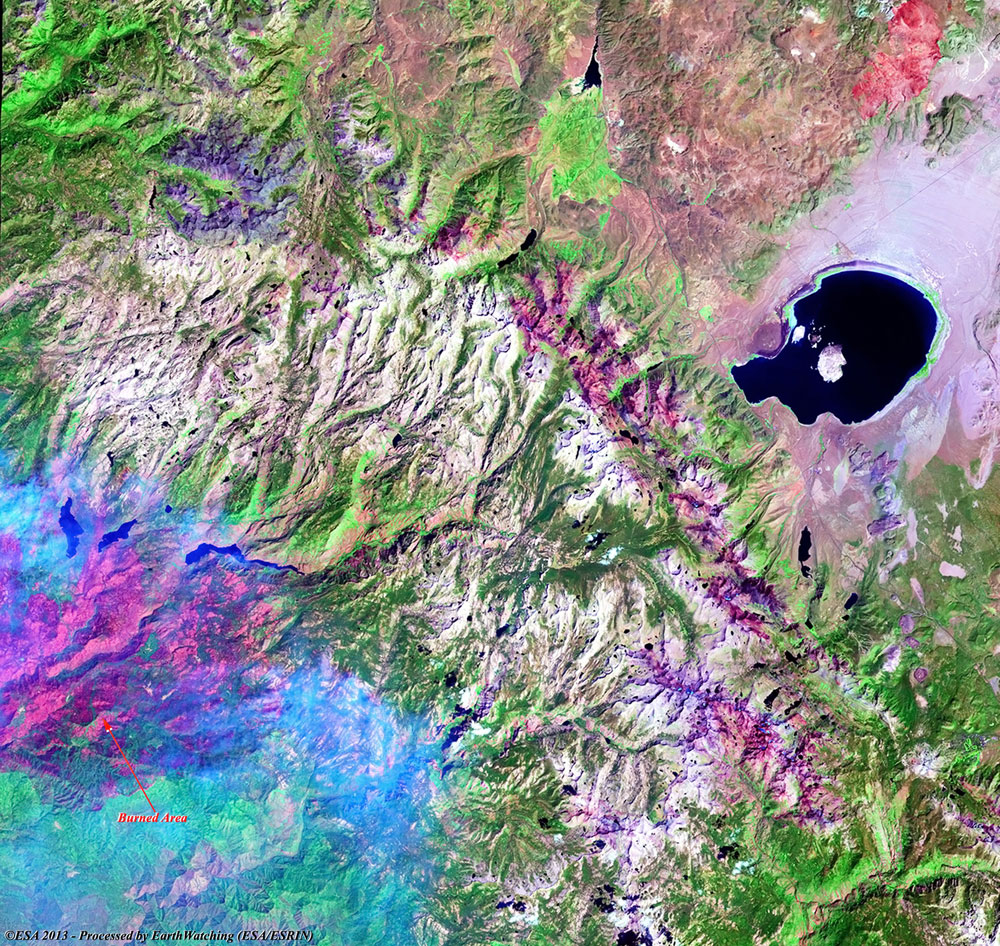
Landsat 8 multispectral bands (Full area) - 09 September 2013 |
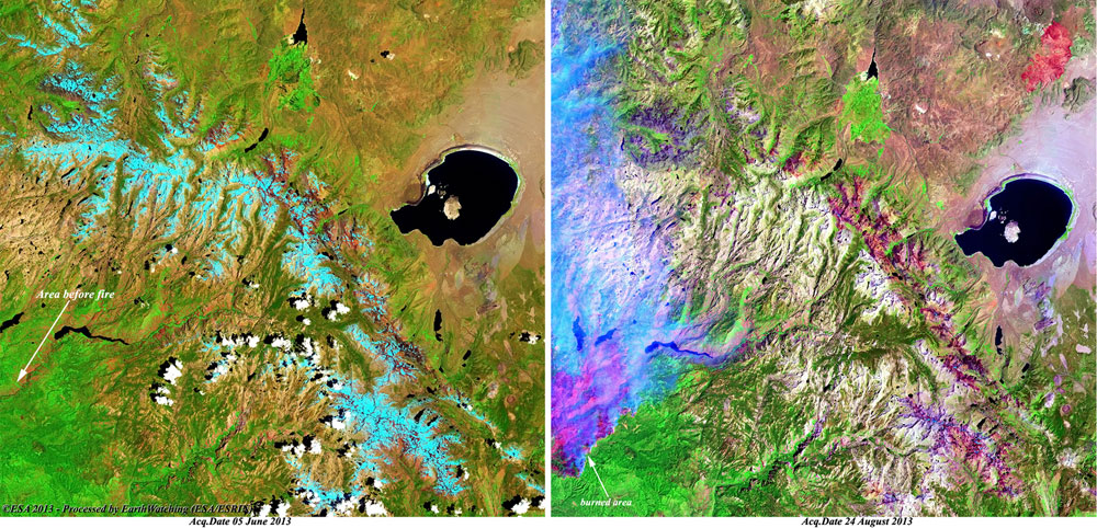
This latest multispectral image acquired by the Landsat 8 satellite over the Yosemite National Park (California), shows the large area burned during the fire that broke out in the park on 20 August 2013, in the US tourist landmark. In the below image, the forest area that has been burnt is recognisable in dark violet (see the reference point on the image).
|
Technical Information |
|
Product: |
Geo Tiff format |
|
Satellite: |
Landsat 8 |
|
Instrument: |
Operational Land Imager (OLI) - Multispectral bands 1-7 and 9 (30 metres) |
|
Coverage: |
About 180 x 180 KM2 |
|
Acquisition date: |
09 September 2013 |
|
Band combination: |
7, 5, 2 (R-G-B) |
|
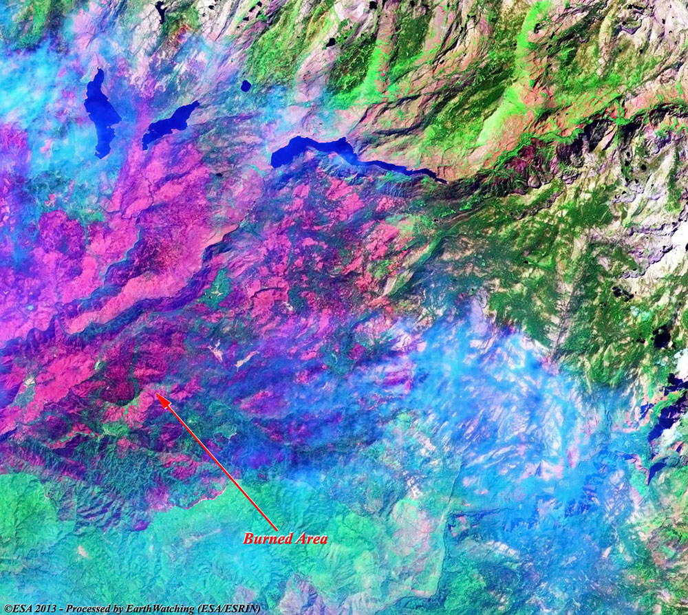
Landsat 8 multispectral bands (Full area) - 31 August 2013 |
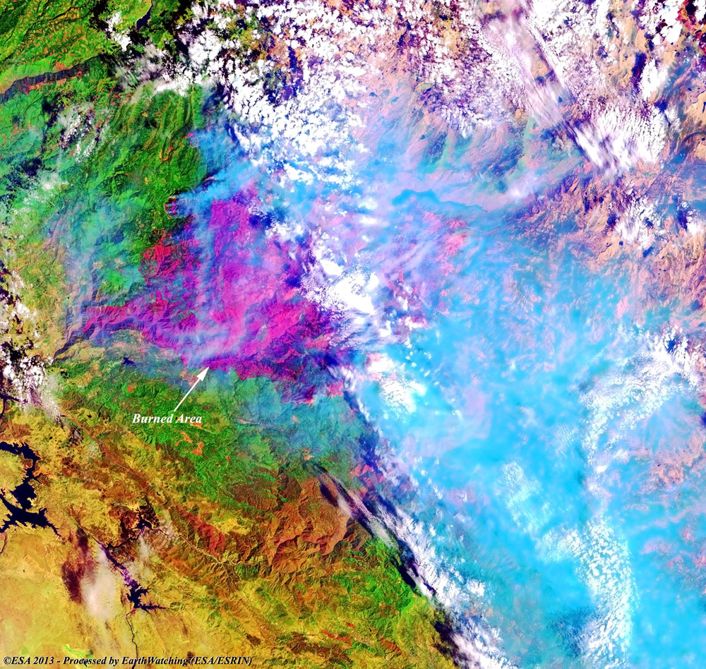
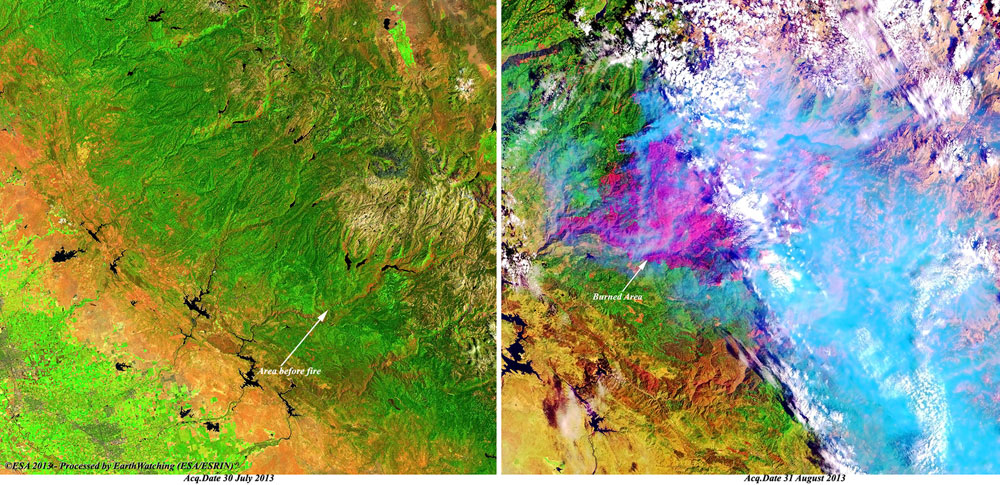
These multispectral images acquired by the Landsat 8 satellite over the Yosemite National Park in California, show the large fire that broke out in the park on 20 August 2013, in the US tourist landmark. The burnt area is recognisable in violet with high columns of smoke that rise to the sky.
|
Technical Information |
|
Product: |
Geo Tiff format |
|
Satellite: |
Landsat 8 |
|
Instrument: |
Operational Land Imager (OLI) - Multispectral bands 1-7 and 9 (30 metres) |
|
Coverage: |
About 180 x 180 KM2 |
|
Acquisition date: |
31 August 2013 |
|
Band combination: |
7, 5, 2 (R-G-B) |
|
Comparison images before and during the fire |
|
Magnified view of area - 24 August 2013 |
|
Technical Information |
|
Product: |
Geo Tiff format |
|
Satellite: |
Landsat 8 |
|
Instrument: |
Operational Land Imager (OLI) - Multispectral bands 1-7 and 9 (30 metres) |
|
Coverage: |
About 180 x 180 KM2 |
|
Acquisition date: |
31 August 2013 |
|
Band combination: |
7, 5, 2 (R-G-B) |
|
Comparison images before and during the fire |
Back to top
 Yosemite National Park (California, USA) - Fire, September 2013