 Oroville Dam crisis
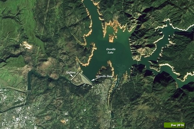
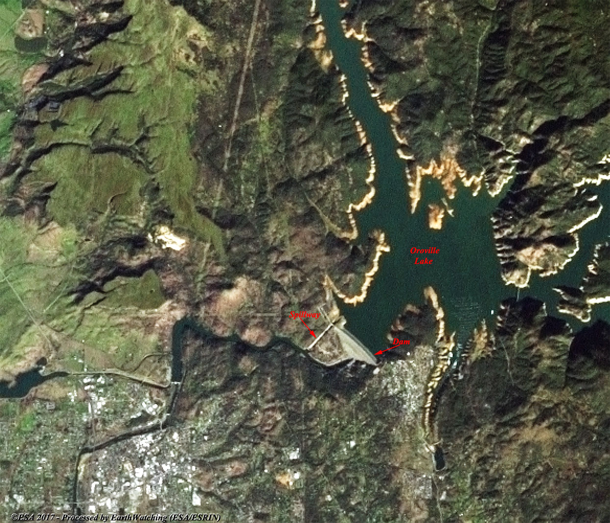
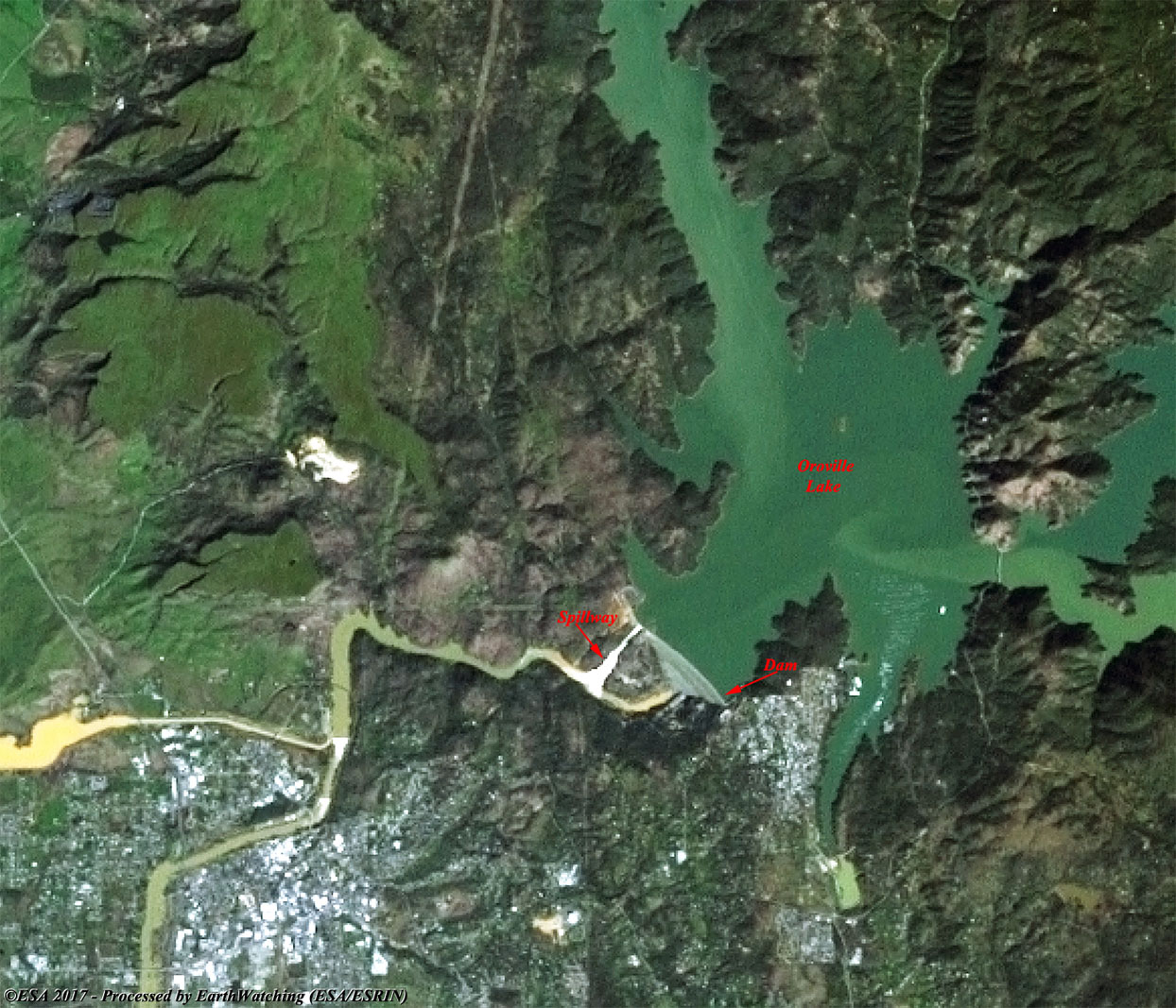
The 2017 Oroville Dam crisis is a major and ongoing threat to lives and property in Northern California. At 235 m, Oroville Dam is the tallest dam in the United States. Located in Butte County about 110 km north of Sacramento, the dam impounds Lake Oroville, and controls the flow of the Feather River. Storms in early February 2017 caused heavy damage to the dam's spillways, hindering the safe release of floodwater. The prospect of uncontrolled release of water from the lake forced the evacuation of more than 180,000 people living downstream along the Feather River. More information is available on Wikipedia
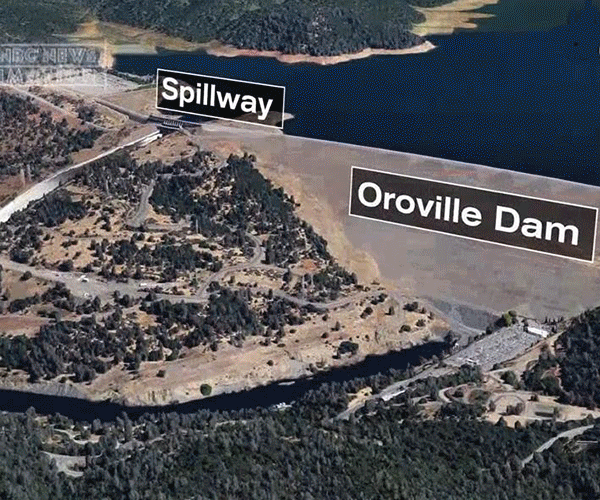
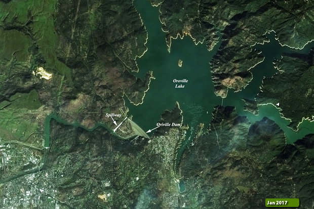
Oroville Dam is an earthfill embankment dam on the Feather River east of the city of Oroville, California, in the United States. At 235 m high, it is the tallest dam in the U.S. and serves mainly for water supply, hydroelectricity generation and flood control. The dam impounds Lake Oroville, the second largest man-made lake in the state of California, capable of storing more than 4.4 km3. It is located in the Sierra Nevada foothills east of the Sacramento Valley. Built by the California Department of Water Resources (DWR), Oroville Dam is one of the key features of the California State Water Project (SWP), one of two major projects passed that set up California's statewide water system. Construction was initiated in 1961, and despite numerous difficulties encountered during its construction, including multiple floods and a major train wreck on the rail line used to transport materials to the dam site, the embankment was topped out in 1967 and the entire project was ready for use in 1968. The dam began to generate electricity after completion of the Edward Hyatt Pump-Generating Plant, then the country's largest underground power station. Since its completion in 1968, the Oroville Dam has allocated the flow of the Feather River from the Sacramento-San Joaquin Delta into the State Water Project's California Aqueduct, which provides a major supply of water for irrigation in the San Joaquin Valley as well as municipal and industrial water supplies to coastal Southern California, and has prevented large amounts of flood damage to the area - more than $1.3 billion between the years of 1987 and 1999. The dam has confined fish migration up the Feather River and the controlled flow of the river as a result of the Oroville Dam has affected riparian habitat. Multiple aims at trying to counter the dam's impacts on anadromous fish have included the construction of a salmon/steelhead fish incubator on the river, which began shortly after the dam was completed. More information is available on Wikipedia These images acquired through a combination of optical satellites, in this case Landsat 7 and Sentinel-2, show the state of the dam during the event (before/During). The users, using the cursor on the image, have the possibility to see the difference of the Lake Oroville in a time window of the few days. The images (see the little captions) acquired during the event, show the high rise in water level of the Lake and the spillway. In the image acquired during the alert, the area damaged is more evident. Another aim of these images is to promote the opportunity to download Landsat data through the ESA portals, where images captured every day are made available in near real time to the users and the scientific community. Landsat full resolution data products are freely available for immediate download at: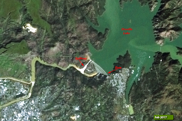 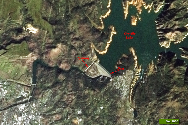 View Landsat 7 ETM (Before) high resolution image (JPG 380 KB) View Landsat 7 ETM (During) high resolution image (JPG 330 KB)
  View Sentinel-2 (Before) high resolution image (JPG 10 MB) View Sentinel-2 (During) high resolution image (JPG 9.2 MB)
|
||||||||||||||||||||||||||||||||