 Fires at Fort McMurray, Canada
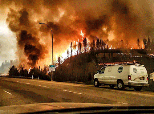
Alberta's fire boss hopes fresh feet at the perimeter of Fort McMurray's massive fire will save some of the province's most valuable assets. More than 1,000 firefighters from across Canada, the U.S., South Africa and other countries will soon join the roughly 1,200-member fire crew already in Fort McMurray. Provincial wildfire manager Chad Morrison said his team made the decision to order them up last week - around the time the fires swept to the edges of oilsands sites, forcing a mandatory evacuation of 19 facilities north of Fort McMurray. Those evacuation orders have since been lifted, but caution continues as flames keep raging and growing. "This fire is not under control by any means," Morrison said in a news conference Tuesday, when asked if the oilsands are in the clear. He said there is no immediate threat, but added it's early yet, both in the life of this fire and the fire season in general. And with no significant rain in two to three months, combined with warm forecast this week, it's going to stay tough. "There always is that potential," that flames could cross the firebreaks around the Suncor and Syncrude facilities, that firefighters patrol, Morrison said. "That's why we're investing thousands of resources," he said. "We continue to secure the sites around there. We expect to hold it as best we can over the next coming days."
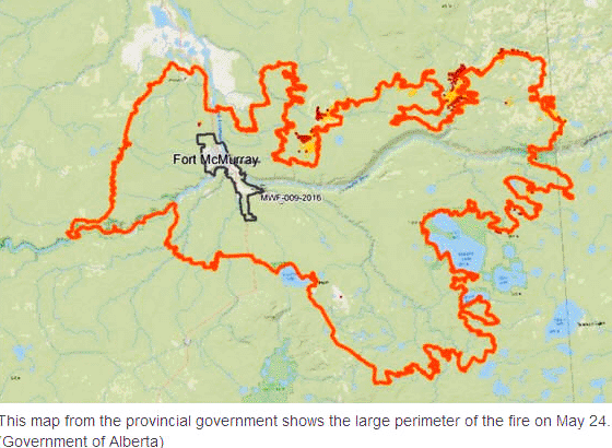
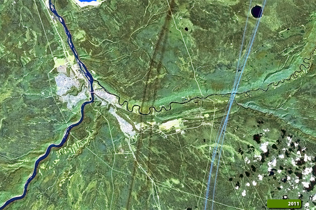
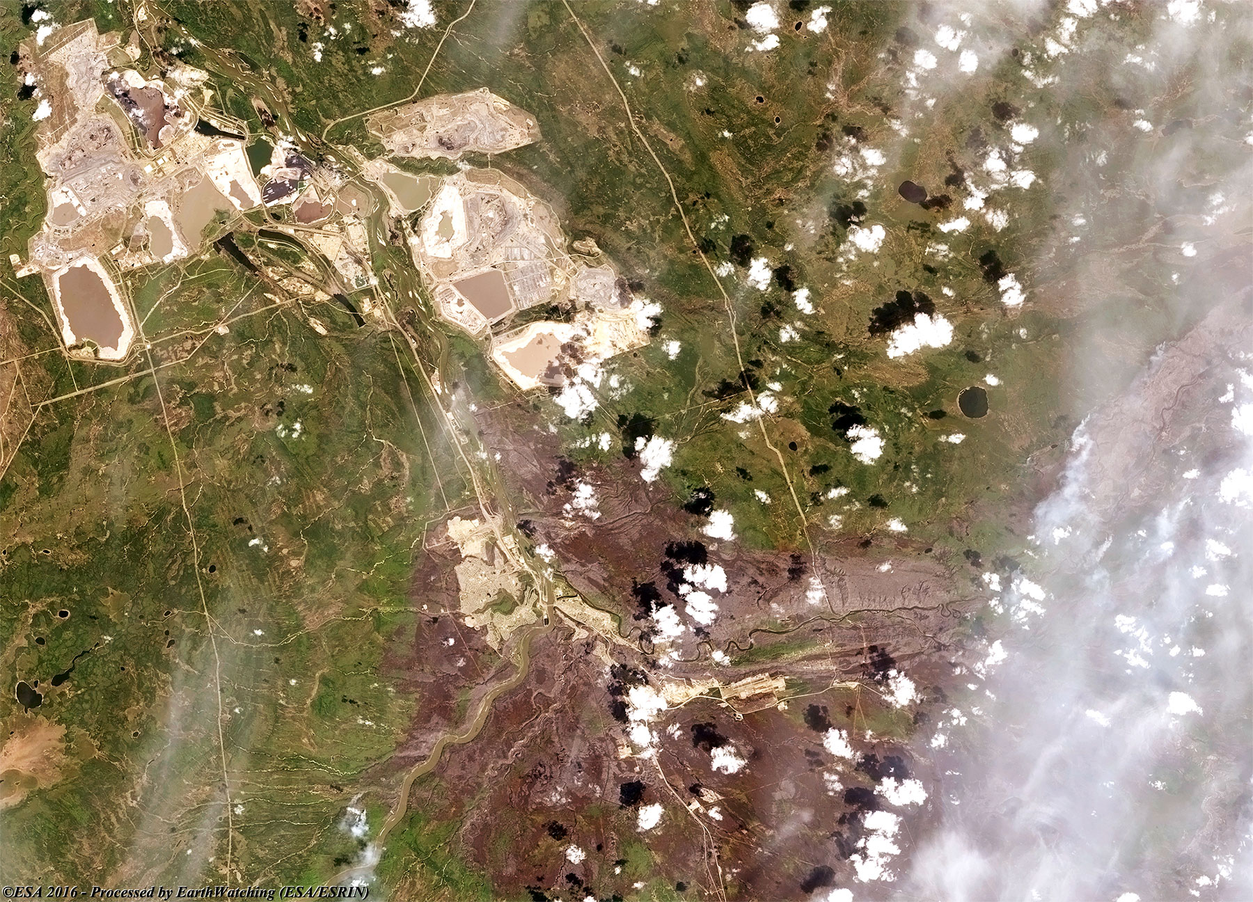
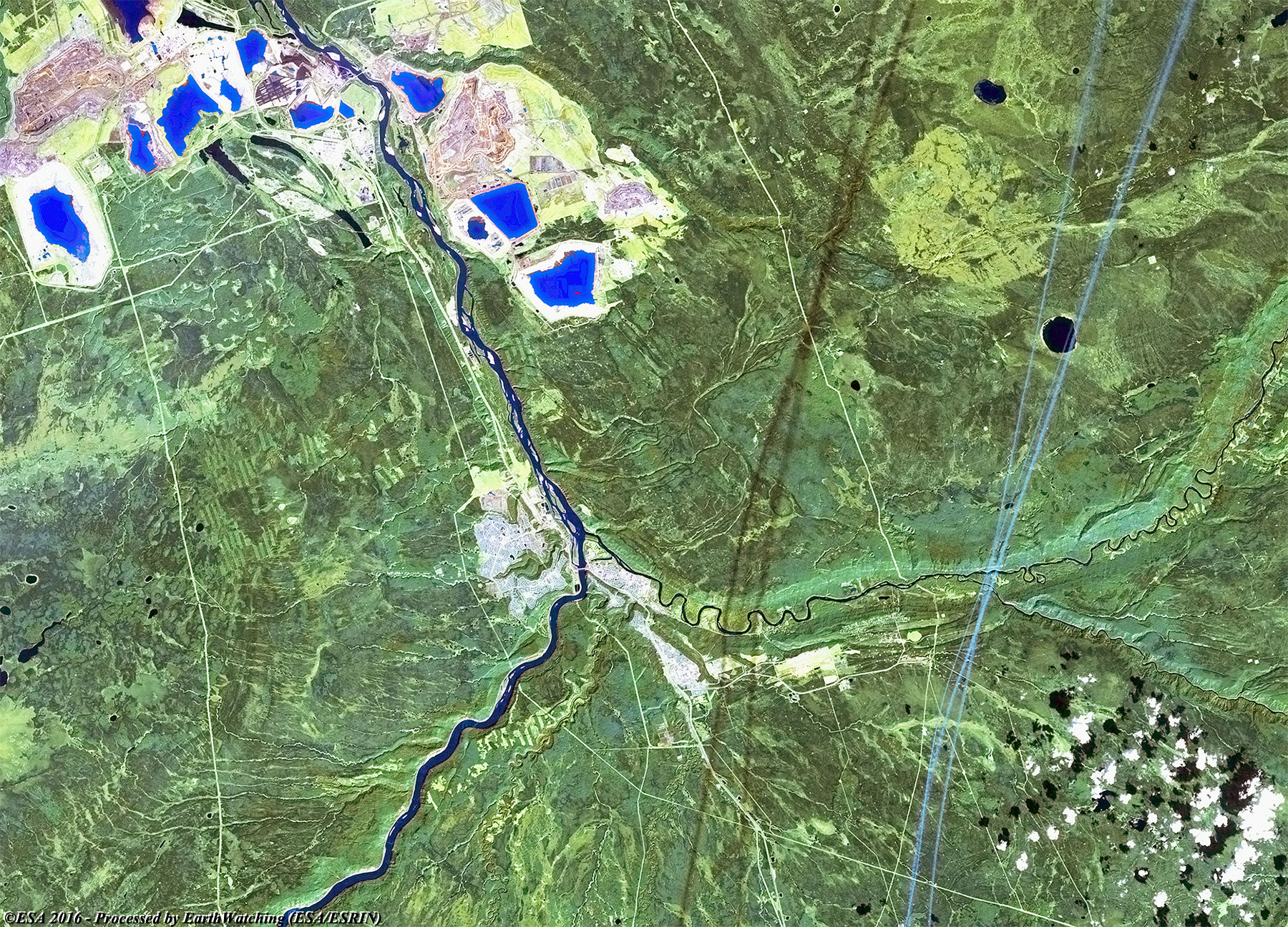
These new comparisons of images created with the use of the Landsat 5 TM and Landsat 8 OLI satellites (from USGS free Archive) with a visible colour and false colour band combination, aim to show the situation of the large fires around the city of Fort McMurray in the Alberta Region (Canada). These comparisons show the large area the fires have affected since the first days of May. The area burned is recognisable especially in the false colour images (with layers combination 7, 5, 2) around the city and along the bank of the Athabasca River. For an earlier view of the fires, also see a Landsat 8 comparison of the situation at Fort McMurray on 3 May 2016. 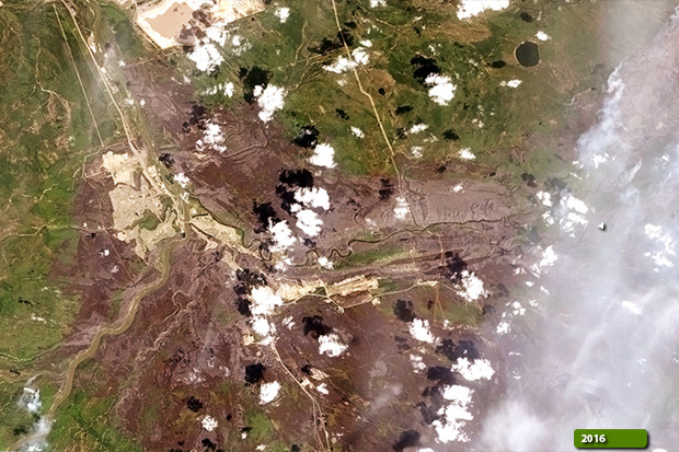 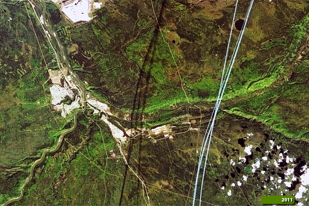 View large format slider of the natural colour comparison
View Landsat 5 TM high resolution image before the fire in natural colour (JPG 1.1 MB)
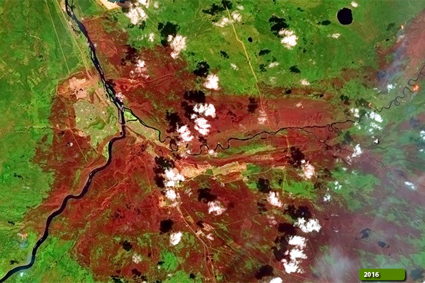  View large format slider of the false colour comparison
View Landsat 5 TM high resolution image before the fire in false colour (JPG 1 MB)
|
||||||||||||||||||||||