 California fires
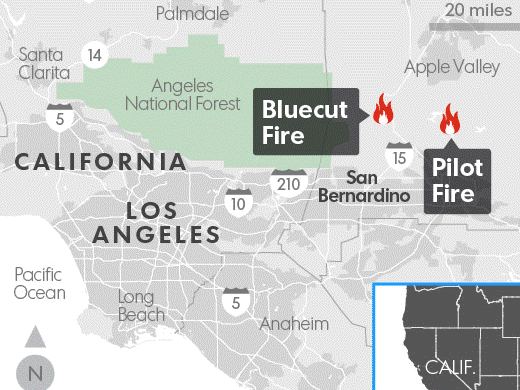
(From: USA Today) - A wildfire raging through drought-parched canyons near Cajon Pass in Southern California has forced the mandatory evacuation of thousands of people. Authorities say the blaze is moving north toward Wrightwood and shows no sign of slowing down. The Blue Cut Fire also prompted the closure of I-15 and Highway 138, Cal Fire said. I-15 links Las Vegas with Los Angeles, threading through the narrow pass that funnels winds through the sparsely populated area known for its small communities and equestrian properties. Local media reported that firefighters had to abandon two engines as the fire overcame their positions. Authorities said two firefighters suffered minor injuries, and 700 personnel were deployed. The entire mountain town of Wrightwood, with about 4,500 people, was ordered to evacuate as the blaze grew more fierce. The Blue Cut Fire is the latest in a string of destructive wildfires across drought-stricken California. Tuesday afternoon, firefighters said the Clayton Fire has burned at least 175 structures, many of them homes, in the town of Lower Lake, a community of about 1,300 people 100 miles north of San Francisco. It was 35% contained Tuesday night, Cal Fire said. Wildfires have burned more than 112,950 acres across California this year, and the worst of the fire season is yet to come. More information is available in the full news from USA Today
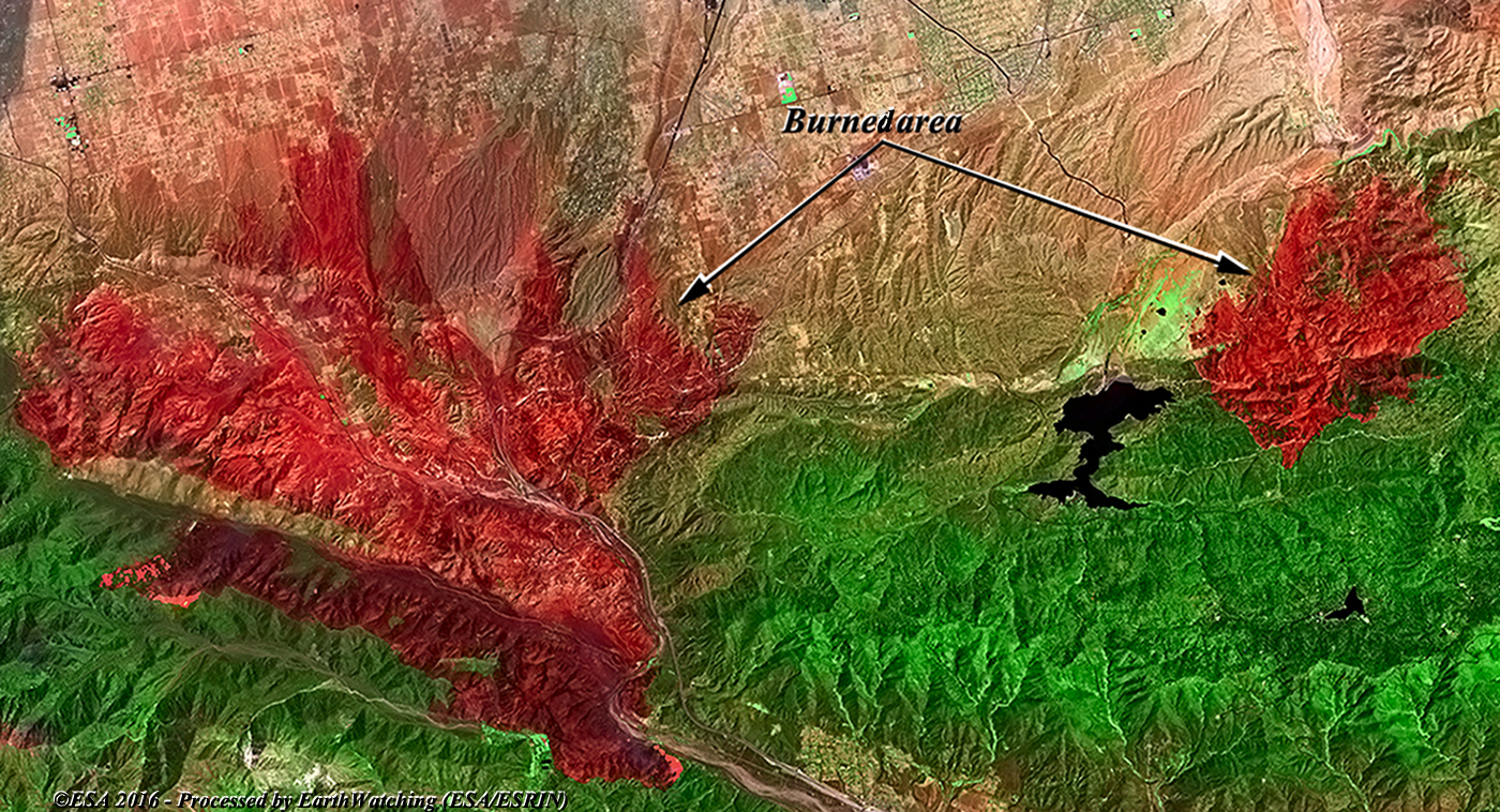
This comparison created with the use of the Landsat 8 satellite (from the USGS free Archive) using infrared bands combination, aims to show the large fires to the north of San Bernardino in the state of California (USA). This combination of bands shows (also visible in the magnified images), the area where the fires are still active (in red) and the two burnt areas, recognisable in dark red to the north of the city. 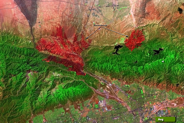 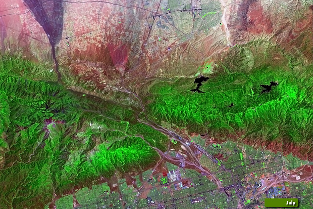 View large format slider before and during the event View high resolution image in August (JPG 7.0 MB) View high resolution image in July (JPG 7.0 MB) View magnified image of the burnt area (JPG 1.3 MB)
|
|||||||||||||||||||||