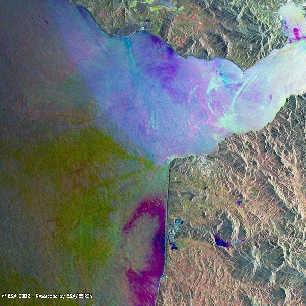
This SAR multi-temporal image of the Strait of Gibraltar was generated from three separate acquisitions using the European Space Agency's environmental radar satellite ERS-2. Through the Strait, a continuous current enters the Mediterranean Sea from the Atlantic Ocean, as highlighted by the different colours of the sea which relate to the different wind conditions during the acquisitions. Red 22 November 1999, Green 04 February 1992, Blue 19 June 2000.
In the upper right corner of the image, Algeciras, a port and industrial centre in the Bay of Gibraltar can seen. And to the right, La Linea de la Concepción, in the neutral zone that separates Spain from the British dependency of Gibraltar; below it, the free port of Gibraltar itself. In the ocean intense ship traffic and oil slicks can be seen. In the bottom part of the image northwestern Morocco is visible, with the town of Tangier (Cap Spartel headland) facing the Strait, and on bottom left the airport.
|
Technical Information |
|
Satellite: |
ERS-2 |
|
Instrument: |
Synthetic Aperture Radar (SAR) |
|
Date of acquisition |
22 Nov 1999, 04 Feb 2002, 19 Jun 2000 |
|
Orbit number: |
23996, 35119, 27002 |
|
Frame: |
2885 |
|
Band combination: |
Multi-temporal image (RGB) |
Back to top
 Browse SAR Events by Year