Holland, February 1995 - Heavy rain combined with the snow melt in the Alps, caused extensive flooding along the Maas (or Meuse) river.
On 25 January, the water level of the Maas River started rising dangerously in southern Holland, near the town of Maastricht. The Government of The Netherlands evacuated 75,000 people living along the Maas and Waal areas.
|
Event Timeline |
|
SAR Multi-temporal image |
|
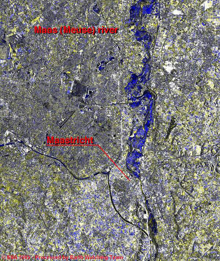
This image represents the region of Maastricht, Netherlands. The Maas (Meuse) River is visible via the boundary line between Belgium and the Netherlands.
|
|
The various colour bands were achieved by merging two datasets together. The Red, Green and Blue represent the changes between the two acquisition dates; September 1994 - January 1995.
|
|
Normal situation |
|
Technical Information |
|
Satellite: |
ERS-1 |
|
Instrument: |
Synthetic Aperture Radar (SAR) |
|
Image area coverage: |
100 X 150 km |
|
Date of acquisition: |
Red - 30 January 1995
Green - 30 January 1995
Blue - 21 September 1994 |
|
Orbits: |
18531, 16651 |
|
Frame: |
2583 |
|
Acquired by: |
Fucino (Italy) |
 Browse SAR Events by Year