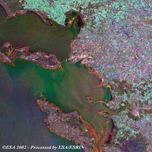
La Rochelle, the capital of the department of Charente-Maritime, lies on an inlet of the Bay of Biscay, opposite the Ile de Ré. It is an important base for Atlantic fishing boats and is served by the major commercial port of La Pallice. This SAR multi-temporal image is generated from three separate acquisitions using the European Space Agency's environmental radar satellite ERS-2. This image was generated in occasion of the ESA exhibition in France: the city is shown as a cluster of bright points in the middle of the image along the coast. In the south of La Rochelle the Oléron Island is visible in dark brown. Opposite La Rochelle Town is visible the Ile de Ré Island; there is a bridge that joins the two coasts.
Along the coast and around the Island, the dark orange area depends on the difference between high and low tides. The different colours of the fields can be explained by the change in vegetation during the different acquisitions. The different colours of the sea can be explained by different wind conditions during the acquisitions. The colours highlight the separate acquisitions: Red 22 July 2001, Green 24 December 2000 and Blue 04 March 2001.
|
Technical Information |
|
Satellite: |
ERS-2 |
|
Instrument: |
Synthetic Aperture Radar (SAR) |
|
Date of acquisition: |
22 Jul 2001, 24 Dec 2000, 04 Mar 2001 |
|
Orbit: |
32699, 29693, 30695 |
|
Frame: |
2676 |
Back to top
 Browse SAR Events by Year