The Netherlands, February 1995 - The heavy rain that hit France (in the area of Charleville) and Germany at the end of January 1995 enlarged the Mass (Meuse), Waal and Rhine rivers, threatening to overwhelm the Netherlands' flood protection walls and inundate the heart of the country.
The Earth Watching team, observing the flood's critical high point move down the Maas River, processed image after image, including this multi-temporal image of the Nijmegen area.
|
Event Timeline |
|
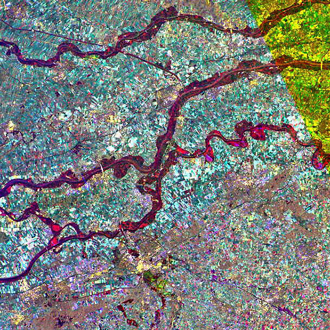
Multi-temporal image |
|
This image shows the three rivers; Lower Rhine, Waals and Maas (Meuse), which covers an area of 45 km by 60 km.
|
|
The image has been composed using various colours, each representing the date of acquisition;
-
Green – 30 January 1995
-
Red – 05 February 1995
-
Blue – 21 September 1994
|
|
Technical Information |
|
Satellite: |
ERS-1 |
|
Instrument: |
Synthetic Aperture Radar (SAR) |
|
Image area coverage: |
50 X 60 km |
|
Date of acquisition: |
Red - 05 February 1995
Green - 30 January 1995
Blue - 21 September 1994 |
|
Orbits: |
18624, 16651 |
|
Frame: |
2565 |
|
Acquired by: |
Fucino (Italy) |
 Browse SAR Events by Year