Honduras, November 1998 - Torrential rains, flooding and mudslides over a five day period devastated Honduras, Central America – one of the poorest countries in that region.
On 22 October 1998, a category 5 Hurricane Mitch formed in the southwest Caribbean Sea from a tropical wave which slowly moved westward and intensified into a tropical storm.
Reportedly 75 inches (1,900 mm) of rain fell over Honduras, Guatemala and Nicaragua. Nearly 7,000 people have been killed, and another 11,000 are missing and up to 1 million more are left homeless. The damages caused by the flooding will cost over $1 billion (half of the nation's annual economic output), to rebuild what was destroyed.
The storm impacts key exports including coffee, bananas, sugar and peanuts and threatens to set the region's economy back by several decades - a hardship that will spread to consumers around the world. It has been estimated that 70 percent of the nation's economic output has been lost.
|
Event Timeline |
|
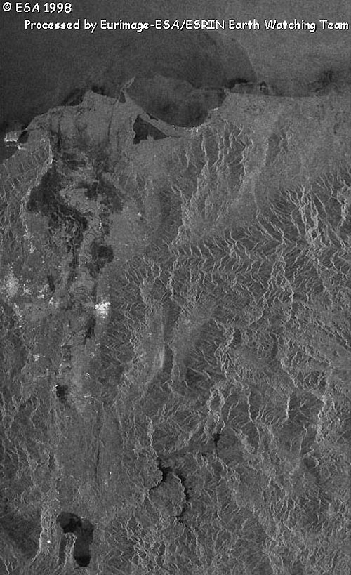
ERS-2 SAR Satellite images |
|
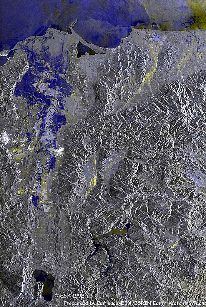
These images were acquired on 05 November 1998 over the Ulúa River delta. The flooded areas between San Pedro Sula and Ulúa River are visible from these images.
|
|
ERS-2 SAR image – San Pedro Sula
|
|
Multi-temporal image – Ulúa River
|
|
Technical Information |
|
Satellite: |
ERS-2 |
|
Instrument: |
Synthetic Aperture Radar (SAR) |
|
Date of Acquisition: |
05 November 1998 and 16 October 1997 |
|
Orbits: |
(ERS-2) 18531, 13020 |
|
Frames: |
3285, 3303 |
Area Map
 Browse SAR Events by Year