November 1998 - A collection of ERS-2 SAR satellite images over the floods in Germany and the Netherlands.
|
Event Timeline |
|
ERS-2 SAR Satellite images |
|
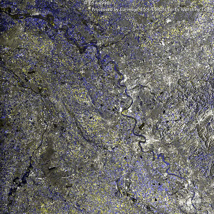
This image was acquired on 03 November 1998 which covers the area from Rhein River from Koln (Germany) to Nijmegen (The Netherlands). The floods pass through the German towns of Dusseldorf and Duisburg. The flooded areas are shown in blue.
|
|
Multi-temporal image
|
|
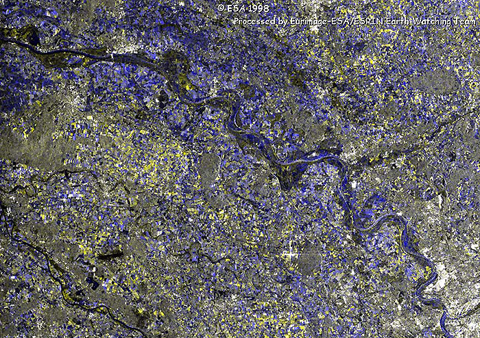
This image was acquired on 25 August 1998. This is a more detailed image, covering the area from Duisburg to Nijmegen, highlighting the flooded areas along the Rheine River. The high levels of soil moisture in the fields are also visible in this image.
|
|
Zoom image
|
|
Technical Information |
|
Satellite: |
ERS-2 |
|
Instrument: |
Synthetic Aperture Radar (SAR) |
|
Area covered: |
100 X 100 km |
|
Date of Acquisition: |
(Red) 03 November 1998
(Green) 03 November 1998
(Blue) 25 August 1998 |
|
Orbits: |
17497, 18499 |
|
Frames: |
2570 |
|
Acquired by: |
Fucino (Italy) |
 Browse SAR Events by Year