Italy, October 1996 - Strong rains hit the Italian peninsula, killing two people and causing serious economic damages all over the country.
On 14 October, the ERS-2 Radar Satellite passed over the Emilia Romagna region, making it possible to understand the affects of the rainfall between Modena and Valli di Comacchio.
|
Event Timeline |
|
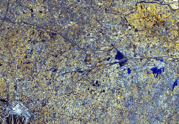
ERS-2 SAR multi-temporal image |
|
An ERS-2 SAR multi-temporal image was acquired on 14 October 1996 which was superimposed onto a reference image acquired on 09 September 1996.
|
|
An artificial channel (First Principal Component) was used to extract data from the two acquisitions. The changes between the two acquisitions can be identified from this image.
|
|
Multi-temporal image – Normal situation |
|
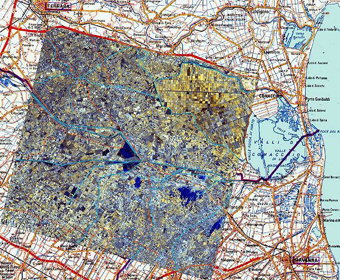
A part of the multi-temporal image has been superimposed onto a topographic map.
(Map) Key:
-
Red lines represent Roads
-
Blue lines represent Rivers/Channels
|
|
Superimposed image |
|
Technical Information |
|
Satellite: |
ERS-2 |
|
Instrument: |
Synthetic Aperture Radar (SAR) |
|
Image area coverage: |
30 X 28 km |
|
Date of acquisition: |
Red - 14 October 1996
Green - First Principal Component
Blue - 09 September 1996 |
|
Orbits: |
7262, 7763 |
|
Frame: |
2709 |
|
Acquired by: |
Fucino (Italy) |
 Browse SAR Events by Year