France, January 1996 - On 29 January, the small town of Béziers was hit by a large flood. Torrential rains caused the nearby Orb River to overflow. During the floods, four people died and more than 600 people were evacuated.
The floods came a year after the disastrous floods in Ardennes (Northern France), which left 2,700 towns and villages in a state of devastation.
The ERS-1/ERS-2 SAR Satellites passed over the area during heavy rainfall (200mm over 24 hours), from 28 – 29 January 1996.
This event is in collaboration with Laboratoire Commun de Teledetection (CEMAGREF).
|
Event Timeline |
|
ERS-1/ERS-2 SAR Satellite images |
|
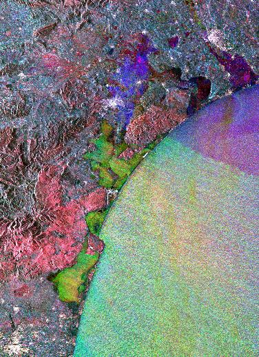
This image has been merged using ERS-1/ERS-2 SAR data.
|
|
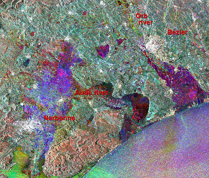
Multi-temporal image - Bézier wide area |
|
After the event, the Laboratoire Commun de Teledetection (CEMAGREF) extracted the multi-temporal SAR image onto a SPOT panchromatic image.
|
|
These types of images can be used to estimate the extent of the flooding impact using various mechanisms.
|
|
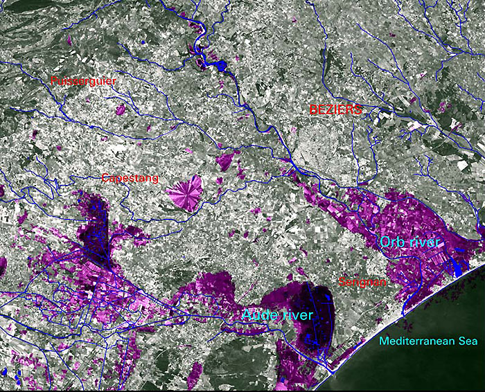
Superimposed image |
|
Technical Information |
|
Satellite: |
ERS-1/ERS-2 |
|
Instrument: |
Synthetic Aperture Radar (SAR) |
|
Image area coverage: |
30 X 28 km |
|
Date of acquisition: |
(ERS-2) Red - 07 August 1995
(ERS-2) Green - 29 January 1996
(ERS-1) Blue - Blue – 28 January 1996 |
|
Orbits: |
(ERS-2) 1558
(ERS-2) 4063
(ERS-1) 23736 |
|
Frame: |
855 |
|
Acquired by: |
Fucino (Italy) |
 Browse SAR Events by Year