 Browse SAR Events by Year
20 Years of SAR
Browse SAR Events by Year
20 Years of SAR
This SAR multi-temporal image of the Dublin area is generated from three separate acquisitions using the European Space Agency's environmental radar satellite ERS-2. The city of Dublin is shown as a cluster of bright points in the centre of the image along the coast. To the south, the Dublin and Wicklow hills are clearly visible in green-bluish colour. Slightly north of the city the runway of Dublin airport can be seen and immediately to the right the peninsula of Howth is shown. The plume of the river Liffey is also clearly imaged. The different colours of the fields can be explained by the changes in vegetation during the different acquisitions. The tidal planes, clearly visible along the coast line, are shown in magenta or in light green-blue. 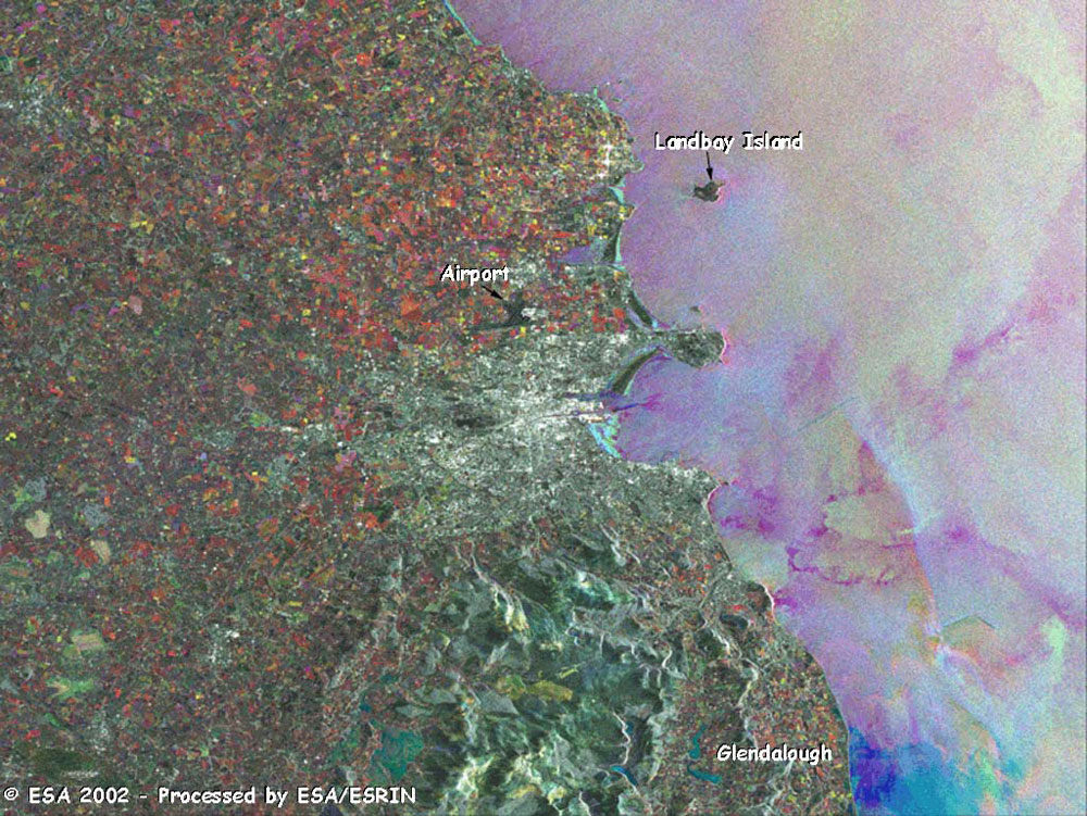
|
|||||||||||||||||||