 Browse SAR Events by Year
20 Years of SAR
Browse SAR Events by Year
20 Years of SAR
Cartagena, the capital of Bolívar, is on an island formed by a shallow extension of the harbour, one of the best in northern South America. This SAR multi-temporal image is generated from three separate acquisitions using the European Space Agency's environmental radar satellite ERS-2. This image was generated in occasion of the ESA exhibition in Cartagena: the city is shown as a cluster of bright points in the northern part of the image along the coast. To the south of Cartagena the island Playa de Punta Arena is visible in grey. The different colours of the sea can be explained by different wind conditions during the acquisitions. The different colours highlight the separate acquisitions: Red 08 September 2000, Green 26 May 2000, Blue 28 September 2001. 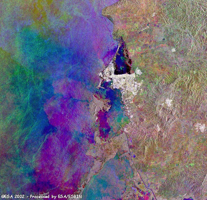
|
|||||||||||||||||