Camargue, France, January 1994 - During the first weeks of January, while the water was receding from another big flood in Germany, the heavy rainfall and the snow melt in the Alps caused a dangerous rise in water level of the Rhône River in the South-East of France.
The river forks near the town of Arles, and it was the western "Petit Rhône" branch that broke its banks, flooding fields and towns. It took several days to rebuild the banks.
|
Event Timeline |
|
ERS-1 SAR Images |
|
The ERS-1 Satellite acquired data over a three day cycle, capturing imagery before, during and after the event.
|
|
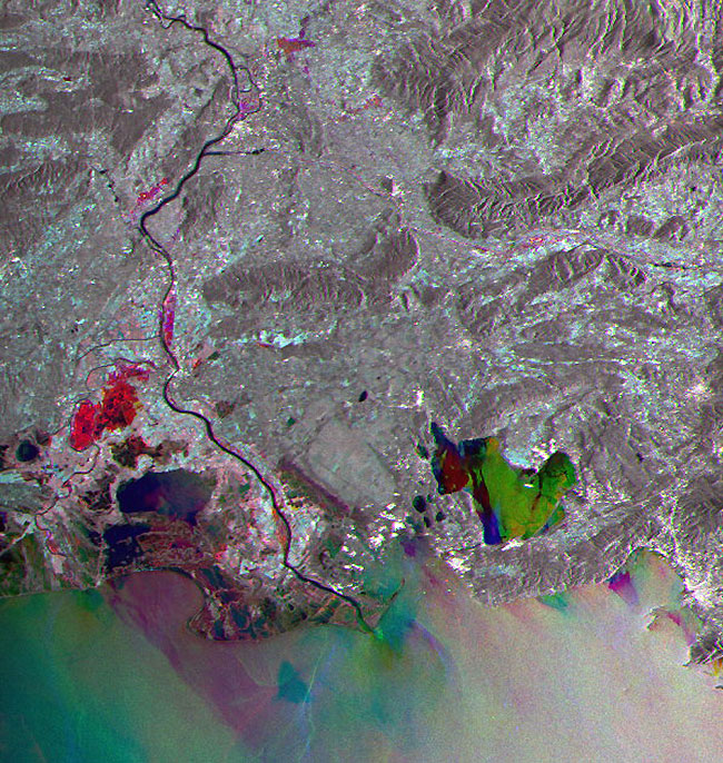
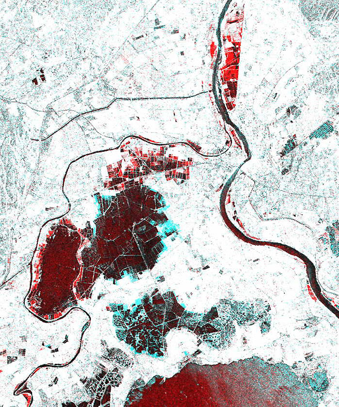
This image shows was acquired over the Rhône River. The flooded areas are highlighted in red.
|
|
Fast Delivery SAR Multi-temporal image |
|
Technical Information |
|
Satellite: |
ERS |
|
Instrument: |
Synthetic Aperture Radar (SAR) |
|
Image area coverage: |
100 X 100 km |
|
Date of acquisition: |
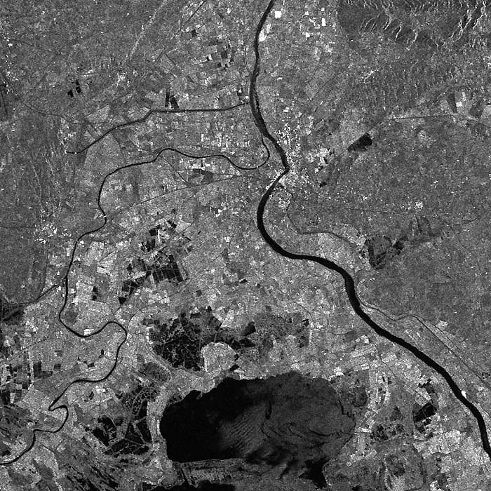
Red - 03 January 1994
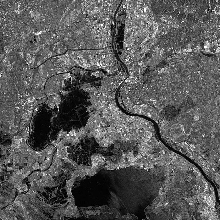
Blue - 12 January 1994
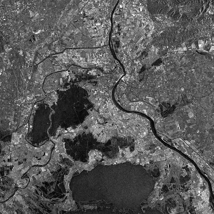
Green - 15 January 1994 |
|
This image shows the town of Arles marked by several tiny white spots.
|
|
SAR Image – Before the flood (Normal situation) |
|
This image shows the three different flooded areas;
-
North of Arles
-
Petit Rhône and the Highway
-
The largest flooded area between the highway and Etang des Vaccares
|
|
During the flood |
|
This image shows the area where the banks have been rebuilt after the flood.
|
|
After the flood |
|
This image is a composition of the above datasets which are colour coded (Red, Green, Blue) to emphasise the changes between the acquisition dates (12 – 15 January 1994).
|
|
Zoom Image |
|
This is the same image as above.
|
|
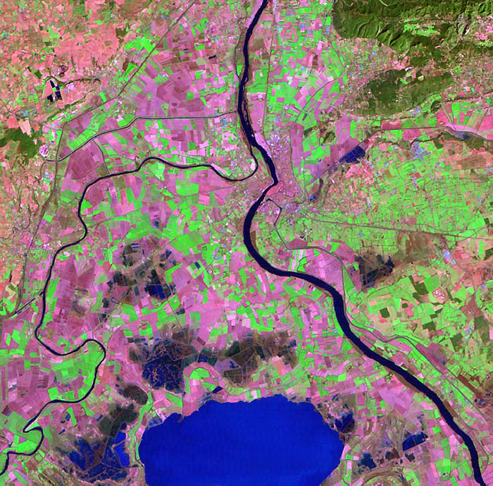
Landsat-TM Image |
|
This image was acquired in March 1998 which shows the different crops in the area.
|
|
Technical Information |
|
Satellite: |
Landsat TM/ETM |
|
Image area coverage: |
30 X 28 km |
|
Band composition: |
Red, Green, Blue |
|
Date of acquisition: |
March 1998 |
 Browse SAR Events by Year