- All Categories (29)
- Data (1)
- Missions (2)
- Events (5)
- Tools (1)
- Activities (3)
- Documents (17)
Document - Conference Presentation - Poster
1_Iannini_PolInSAR2013.pdf
Assimilation of Distributed Targets and PS Information for the Monitoring of Polarimetric SAR Systems L. Iannini [Politecnico di Milano - Italy]
Document - Conference Presentation - Poster
2-ITCG_integrated_maritime_surveillance.pdf
Italian Coast Guard integrated maritime surveillance in the framework of security, anti-pollution and fisheries control activities Luigia Caiazzo(Italian Coast Guard, Italy)
Document - Conference Presentation - Poster
2_Charbonneau_compact_pol.pdf
RCM Compact Polarimetry Applied to Watershed Study F. J. Charbonneau [Natural Resources Canada]
Document - Conference Presentation - Poster
2_ppt_POLINSAR2013_dmonells_std.pdf
Performance Comparison between Dual Polarimetric and Fully Polarimetric data for DInSAR Subsidence monitoring D. Monells [Universitat Politecnica de Catalunya, UPC - Spain]
Document - Conference Presentation - Poster
3_towards_automated_classification.pdf
Toward automated classification of brightness fronts in RADARSAT-2 images of the ocean surface Christopher Jones (Dalhousie University Halifax, Canada)
Document - Conference Presentation - Poster
7-Clean_Sea_Net.pdf
The "New Generation" of CleanSeaNet: the EU Remote Sensing Based Monitoring System for Oil Spill and Vessel Detection Sonia Pellizzari (European Maritime Safety Agency)
Document - Conference Presentation - Poster
8_PolinSAR2013_soil_moisture_wetland_session_summary_Fina.pdf
Applications of SAR Polarimetry on Land: Soil Moisture and Wetlands
Data - Announcement of Opportunity (Restrained)
Closed ESA announcement of opportunities
See currently open announcements of opportunity.
Activity - Quality
EDAP
The following missions are currently being considered as part of the Automatic Identification System (AIS) and Radio Frequency
Event - Workshop
Fringe 2007 Workshop
Is it possible to uniquely identify a spatially correlated interferometric phase error due to ionosphere using current sensors
Event - Workshop
Fringe 2011 Workshop
The Fringe series of workshops started in 1992 and they are currently organised by ESA every two years.
Document - Proceedings
Fringe-2011-workshop-recommendations.pdf
This document contains the recommendations from the session summaries of the Fringe 2011 Workshop.
Document - Proceedings
Fringe-2011-workshop-session-summaries.pdf
This document contains the session summaries from the session summaries of the Fringe 2011 workshop.
Activity - General activities
GSCB and LTDP
Envisat data are used in many fields of Earth science, including atmospheric pollution, fire extent, sea ice motion, ocean currents
Document - General Reference
Heritage Missions brochure
This brochure describes ESA's Heritage Space Programme and includes infographics describing some of the missions in the programme.
Document - Product Document
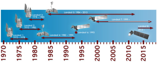
LANDSAT_Products_Description_Document.pdf
This document acts as a User Guide to the Landsat MSS, TM and ETM+ archives, focussing more specifically on the Landsat TM and ETM+ products from the Kiruna, Maspalomas and Matera archives (including from the Matera, Fucino, Neustralitz, O’Higgins, Malindi, Libreville and Bishkek ground stations) that have been generated as part of the ESA archive bulk-reprocessing project.
Mission - Third Party Missions
Multi Spectral Scanner (MSS) Processor Releases
GCP displacement B TM radiometric calibration Update to radiometric calibration strategy for TM reflective bands (Dark Current
Event - Workshop
POLinSAR 2013
Snow, Land Ice and Sea Ice Monitoring Hazards: Fire Monitoring, Volcanoes, Flooding, Earthquake Other applications Past, current


