- All Categories (367)
- Data (1)
- News (12)
- Missions (15)
- Events (8)
- Activities (1)
- Documents (330)
Document - General Reference
The Nine Candidate Earth Explorer Missions - Topography Mission
This report for assessment addresses the Topography mission when it was selected with other nine Earth Explorer missions as a potential candidate for Phase A study.
Document - General Reference
The-Changing-Earth-New-Scientific-Challenges-for-ESAs-Living-Planet-Programme.pdf
This article is extracted from ESA Bulletin Nr. 129.
Document - General Reference
CoReH2O-Report-for-Mission-Selection-An-Earth-Explorer-to-observe-snow-and-ice.pdf
This report describes the CoReH2O (Cold Regions Hydrology high-resolution Observatory) mission, which was selected for feasibility study in the third cycle of Earth Explorers.
Event - Training
Advanced Training Course in Ocean Remote Sensing 2011
Background and access to current and future Chinese, ESA and TPM satellite missions in ocean remote sensing were presented
Mission - Earth Explorers
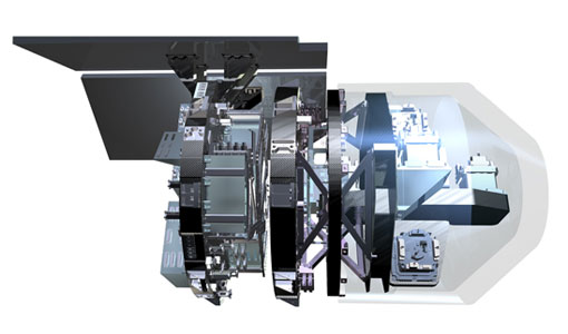
ALADIN
Aeolus Quality Control Reports on L1B/Instrument, L2A and L2B products are currently available to Aeolus Cal/Val teams and
Mission - Earth Explorers
EGG
This opened a window into Earth's interior structure, as well as the currents circulating within the depths of its oceans
Event - Workshop
IDEAS+ Cal/Val Workshop 7
Regular workshops are held every nine months with the whole IDEAS+ Task 3-Cal/Val team in order to review the status of current
Activity - Quality
SnowPEx
to bring together scientists and institutions working in seasonal snow pack monitoring in order to assess the quality of current
Mission - Earth Explorers
GOCE
Explorer (GOCE) mission mapped Earth's geoid very accurately, opening a window into Earth's interior structure as well as the currents
Mission - Earth Explorers
Aeolus
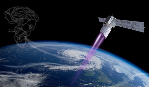
This is currently the only technology that can provide direct wind profile observations in clear air, inside thin clouds
News - Data Release news
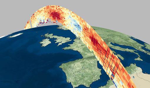
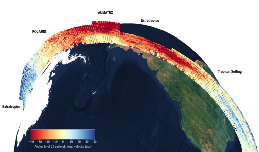
Aeolus data now publicly available
Following the introduction in June 2019 of a correction of biases related to spectrometer pixels showing elevated dark current
Data - Announcement of Opportunity (Restrained)
Announcement of Opportunity for Aeolus Cal/Val
The objective of the current reopening is to invite scientists, new groups and individuals, to participate in Aeolus calibration
News - Operational News
A Guide to Aeolus Range Bin Settings
Current Range Bin Settings Multiple Aeolus Range Bin Settings are active at the same time.
Mission - Earth Explorers
Aeolus Overview
Currently, the global distribution of conventional wind profile measurements is not homogenous and mainly located over land
Mission - Earth Explorers
GOCE Overview
height mapped by altimeters and the knowledge of the precise ocean geoid that has improved our understanding of surface currents
Mission - Earth Explorers
SMOS Overview
Mission Background The SMOS mission is a direct response to the current lack of global observations of soil moisture and
Mission - Earth Explorers
SMOS Objectives
SMOS Science The SMOS mission is a direct response to the current lack of global observations of soil moisture and ocean
Mission - Earth Explorers
GOCE Objectives
Thanks to this current, the coastal waters of Europe are 4°C warmer than waters at equivalent latitudes in the north Pacific
Mission - Earth Explorers
SSTI ANTEX Data
data were generated from 154 days in 2009 GOCE SSTI-B PCVs data were generated from the available data in 2010-2012 The current
Mission - Heritage Missions
GOCE re-entry dataset
with further dynamical and environmental information such as on-board magnetometer measurements of Earth's magnetic field, currents
