- All Categories (33)
- News (10)
- Missions (1)
- Events (4)
- Tools (1)
- Activities (3)
- Documents (14)
Document - Conference Presentation - Poster
2-ITCG_integrated_maritime_surveillance.pdf
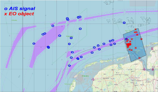
Italian Coast Guard integrated maritime surveillance in the framework of security, anti-pollution and fisheries control activities Luigia Caiazzo(Italian Coast Guard, Italy)
Document - Conference Presentation - Poster
2_ppt_POLINSAR2013_dmonells_std.pdf
Performance Comparison between Dual Polarimetric and Fully Polarimetric data for DInSAR Subsidence monitoring D. Monells [Universitat Politecnica de Catalunya, UPC - Spain]
Document - Conference Presentation - Poster
7-Clean_Sea_Net.pdf
The "New Generation" of CleanSeaNet: the EU Remote Sensing Based Monitoring System for Oil Spill and Vessel Detection Sonia Pellizzari (European Maritime Safety Agency)
News - Success Stories
Commercial and international data for fire monitoring
The Finnish ICEYE constellation, added to the TPM programme in 2021, currently consists of 27 synthetic aperture radar (SAR
Document - Product Handbook
Cosmo-SkyMed-Product-Handbook.pdf
Scope of the Document is to provide COSMO-SkyMed System Users with a SAR Product Handbook giving a quite detailed description of the COSMO SAR Products.
Document - Product Specifications
COSMO-SkyMed-Second-Generation-Mission-Products-Description.pdf
This document provides an overview of the COSMO-SkyMed Second Generation mission and describes its data products.
News - Success Stories
Earth Observation data to improve navigation risk modelling and shipping routes
improve the detection of unreported features in the maritime AIS system and the statistical evaluation of the accuracy of current
Activity - Quality
EDAP
The following missions are currently being considered as part of the Automatic Identification System (AIS) and Radio Frequency
News - Infographics
Explore sample data products from Third Party Missions
This new infographic summarises the missions that currently have sample data: Download the Infographic A link to each sample
Event - Workshop
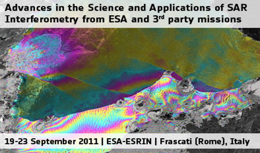
Fringe 2011 Workshop
The Fringe series of workshops started in 1992 and they are currently organised by ESA every two years.
Document - Proceedings
Fringe-2011-workshop-recommendations.pdf
This document contains the recommendations from the session summaries of the Fringe 2011 Workshop.
Document - Proceedings
Fringe-2011-workshop-session-summaries.pdf
This document contains the session summaries from the session summaries of the Fringe 2011 workshop.
Activity - General activities
GSCB and LTDP
Envisat data are used in many fields of Earth science, including atmospheric pollution, fire extent, sea ice motion, ocean currents
Document - General Reference
Heritage Missions brochure
This brochure describes ESA's Heritage Space Programme and includes infographics describing some of the missions in the programme.
News - Thematic area articles
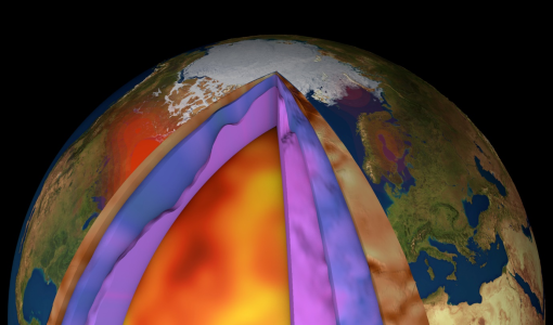
How ESA uses space data to explore deep Earth
Swarm maps core dynamics The swirling, conducting iron in Earth’s liquid outer core create powerful electric currents, which
News - Thematic area articles
How scientists use space data to help advance the energy transition
To build on the current project, the research team plans to use data from ESA’s Third Party Missions programme, which are
News - General News
How SNAP facilitates access to ESA Third Party Missions data
SNAP is currently developed by a consortium that includes Brockmann Consult GmbH, CS France, CS Romania, SenSar and SkyWatch
Document - Product Document
LANDSAT_Products_Description_Document.pdf
This document acts as a User Guide to the Landsat MSS, TM and ETM+ archives, focussing more specifically on the Landsat TM and ETM+ products from the Kiruna, Maspalomas and Matera archives (including from the Matera, Fucino, Neustralitz, O’Higgins, Malindi, Libreville and Bishkek ground stations) that have been generated as part of the ESA archive bulk-reprocessing project.
