- All Categories (152)
- Data (19)
- News (49)
- Missions (5)
- Events (15)
- Tools (2)
- Activities (1)
- Campaigns (9)
- Documents (52)
News - Events and Proceedings
Featuring the power of Earth observation data at EGU
The European Geosciences Union General Assembly 2024 brings together geoscientists from all over the world, aiming to provide a forum where scientists and early career researchers can present their work and discuss their ideas with experts, in all fields of geoscience.
News - Announcement of Opportunity updates
Announcement of Opportunity for SAOCOM – deadline extended
The submission deadline for the ESA/CONAE Announcement of Opportunity for SAOCOM mission data has been extended until 31 December 2024.
News - Operational News
Transition from FTP to FTPS for SMOS, Aeolus and Campaign data dissemination systems
As of 15 April 2024 access to the SMOS, Aeolus and Campaign data will be changed from simple FTP to FTPS.
Document - Newsletter
Earth Online Newsletter - 23 February 2024
This issue of the Earth Online Newsletter covers a selection of the latest news and events from ESA.
News - Data Release news
New reanalysis dataset impacts SMOS Level 3 and 4 sea ice thickness
On 24 January 2024 the JRA55 reanalysis dataset was terminated and updated with the Japanese Reanalysis for Three Quarters of a Century.
News - Maintenance News
SMOS Data Dissemination - Maintenance on 30 January 2024
A planned software maintenance activity will affect ESA's SMOS data dissemination service on 30 January 2024, from 08:30 to 09:30 UTC.
News - Events and Proceedings
Highlighting the value of SMOS data in space weather applications
Data from ESA’s SMOS mission are driving many space weather applications, ranging from air navigation, characterisation of solar flares, space weather modelling and ionospheric electron content mapping.
Document - Campaign Report
FLEXSense 2019 Final Report
This report summarises the FLEXSense 2019 campaign.
Campaign
FLEXSense 2019
The FLEXSense 2019 campaign activities were undertaken in Germany and Italy with the goal of providing a complete set of high-resolution experimental data, including all relevant elements required for the preparation of the FLEX satellite mission.
News - General News
Ensuring soil moisture data quality with reference measurements
ESA is taking steps to verify the accuracy of soil moisture estimation with the Fiducial Reference Measurements for Soil Moisture (FRM4SM) project and a new version of the Quality Assurance for Soil Moisture (QA4SM) service.
Mission - Third Party Missions
NovaSAR-1
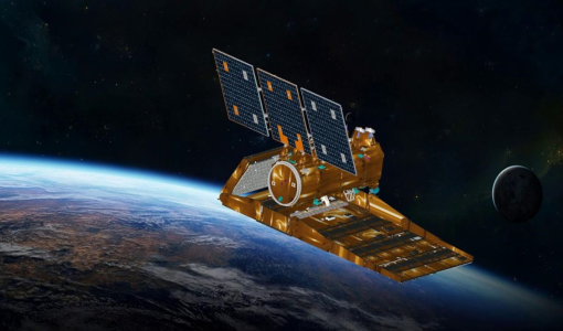
Launched on 16 September 2018, NovaSAR-1 features an S-band synthetic aperture radar (SAR) instrument offering a variety of modes with different resolutions and swath widths.
Data - Announcement of Opportunity (Restrained)
Announcement of Opportunity for NovaSAR-1
ESA is launching an Announcement of Opportunity for the international scientific community to access data from the NovaSAR-1 mission for science and EO-based applications development.
Data - Project Proposal (Restrained)
NovaSAR-1 new tasking
NovaSAR-1 new acquisition data are available in two baseline acquisition modes: Stripmap – provides the highest resolution of 6 metres with up to 20 km swath selected from a 150 km field of regard, available in single polarisation. ScanSAR – has a 20 - 30 metre resolution and up to 150 km swath. Available in single polarisation. Within each of the baseline modes there are a variety of mode options that vary according to ground range resolution, incidence angles, swath width and the number of looks: Acquisition Mode Polarisation Resolution (m) Swath Width (km) Incidence Angles Number of Looks Stripmap Single: HH 6 20 16.0 – 25.38° 3 (1 range, 3 azimuth) 13 – 20 21.29 – 31.2° Single: VV 6 20 16.0 – 25.38° 3 (1 range, 3 azimuth) 13 – 20 21.29 – 31.2° ScanSAR Single: HH 20 100 15.0 - 24.66° 4 (2 range, 2 azimuth) 50 24.51 - 28.94° Single: VV 20 100 15.0 – 24.66° 4 (2 range, 2 azimuth) 50 24.51 - 28.94° Single: HH 30 150 11.29 – 25.93° 4 (2 range, 2 azimuth) 55 27.35 - 32.01° Single: VV 30 150 11.29 – 25.93° 4 (2 range, 2 azimuth) 55 27.35 - 32.01° NovaSAR-1 data are provided as a Level 2 (ARD) product as standard, but the accompanying Level 1 data may also be requested. Level 1 – delivered as reconstructed, unprocessed instrument data at full resolution. Level 2 (ARD) – delivered as a processed product with applied radiometric and geometric corrections i.e. orthorectification and spatial registration: Geocoded Ellipsoid Corrected (GEC) – Maritime and ocean applications Geocoded Terrain Corrected (GTC) – Land applications and change detection Where available, associated automatic identification system (AIS) data may be requested alongside the NovaSAR-1 data products.
News - Operational News
Update for the SMOS Near Real Time Sea Surface Wind Speed Processor configuration
An updated configuration of the SMOS Near Real Time Sea Surface Wind Speed Processor was deployed at the IFREMER and ESA operational ground segment on 4th December 2023.
News - Data Release news
New version v206 of the SMOS-CryoSat level 4 sea ice thickness product is now available
The new version 206 of the merged SMOS-CryoSat level 4 sea ice thickness product is now available on the SMOS data dissemination service.
News - Data Release news
Experimental version of SMOS Antarctic Sea ice thickness product is now available
The experimental version of SMOS Antarctic Sea ice thickness product was produced using a method to derive the sea-ice thickness from 1.4 GHz brightness temperatures previously developed for the Arctic, with only modified auxiliary data. The product is available in the cold season during the freezing period, typically March to October for the Southern Hemisphere.
News - Data Release news
14 years of reprocessed SMOS Freeze/Thaw soil status products are now available
14 years of reprocessed SMOS Freeze/Thaw soil status products are now available from the SMOS dissemination service
News - Operational News
SMOS Winds product configuration updates
Since 5 November 2023, several level 1 products used as input to the SMOS winds processor were flagged as warning due to antenna temperature exceeding 29° C for some of the units located in arm-A.
News - Data Release news
New version of SMOS L3 Soil Freeze and Thaw product soon available
Seasonal freezing and thawing of soil play a fundamental role in shaping ecosystems and influencing a range of ecological processes.
Event - Workshop
2nd SMOS for Space Weather Workshop
The Second Workshop on SMOS for Space Weather will take place on 27 October 2023, hosted by the Space Weather Group of the University of Alcala, Alcalá de Henares (Madrid, Spain).


