- All Categories (4515)
- Data (8)
- News (25)
- Missions (4)
- Events (18)
- Tools (7)
- Activities (6)
- Campaigns (1)
- Documents (4446)
NEWS
Discover the latest news on the European Space Agency's Earth Observation activities. Learn all about new data availability and how ESA's missions are performing.
News - Data Release news
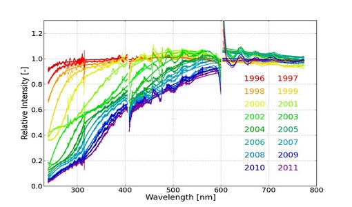
New ERS-2 GOME Level 1 v5.1 dataset available online
A new GOME Level 1b dataset has been generated for the 16-year mission period bringing relevant quality improvements for the revised calibration approach, compensating aging and instrument degradation, and provide enhanced accessibility.
News - Success Stories
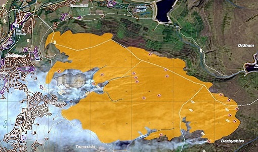
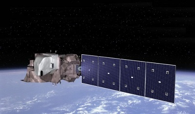
Satellite data allows real-time detection of potential fires
A pilot Fire Detection Service, based on real-time processing of Landsat-8 data being assessed within the framework of ESA's Earthnet Programme.
News - Data Release news
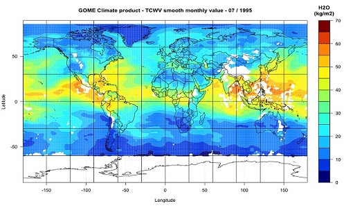
GOME TCWV Climate product available online
GOME Total Column Water Vapour (TCWV) Climate product developed within the ESA GOME-Evolution project is now accessible from the ESA data archives together with the ERS-2 GOME data.
News - Operational News
Landsat-8 web portal now available on new environment
The Landsat-8 Portal service has been migrated to a new server and is accessible on the previous web address.
News - General News
Release of CHRIS PROBA-1 toolbox for SNAP
PROBA -1 continues to provide valuable hyperspectral data to the scientific community, and so the tools to handle this data have been incorporated into ESA’s SNAP multi-mission toolbox.
News - Data Release news
New reprocessed Landsat data on a new dissemination server
The full ESA Landsat archive has been reprocessed with the latest version of the processor to provide a homogenous dataset covering MSS, TM and ETM+ data.
News - Infographics
ERS - ESA’s first Earth observation satellites
To mark the 30th anniversary of ERS, we've released a new infographic summarising the mission.
News - Success Stories
ERS Heritage Data allow for 30 years of science
At their time of launch thirty years ago, the two ERS satellites were the most sophisticated Earth observation spacecraft ever developed and launched by Europe.
News - Data Release news
New reprocessing of datasets celebrates 30 years of ERS
The ERS programme celebrated its 30th anniversary on 17 July. Today, we are still exploiting ERS data and experts continue to work on improving the altimeter, radiometer and SAR data the programme acquired.
News - Spotlight on EO community
Introducing Mirko Albani
In this short introduction, ESA's Heritage Missions Programme Manager describes what he likes most about ESA's long term archive of satellite mission data and his role in the programme.
News - Spotlight on EO community
Interviewing Mirko Albani
ESA’s Heritage Space Programme Manager describes the goals of the programme, some of the challenges involved in preserving and improving 40 years of historical Earth observation data, and his passion for curating this long-term archive.
News - Events and Proceedings
National missions in the spotlight at the Living Planet Symposium
In the framework of ESA’s Third Party Missions (TPM) programme, the agency offers access to the full data archives of almost 50 satellite missions, which are owned by organisations around the world.
News - Infographics
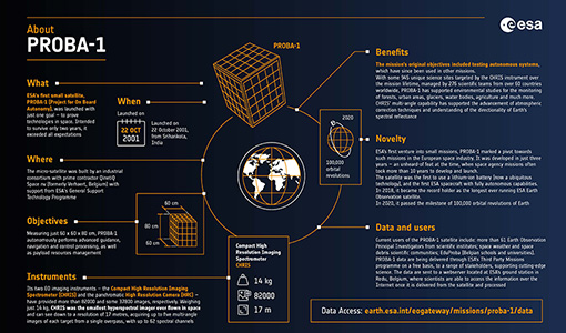
PROBA-1 - From technology demonstration to long-term Earth observation
Learn about ESA's PROBA-1 (Project for On-Board Autonomy) mission in our new infographic.
News - Thematic area articles
Transforming space data into climate action
ESA’s Earth observation activities are playing a key role in the revitalised global drive to combat climate change.
News - Infographics
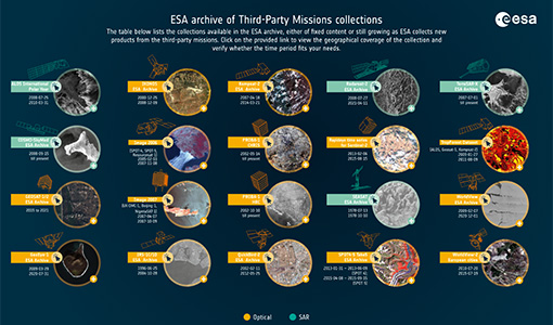
A summary of ESA Third Party Mission collections
A new summary is available, showcasing the ESA archives for Third Party Mission collections.
News - Success Stories
Satellites track the health of the ozone layer
ESA’s Earth observation activities are contributing to international efforts to monitor and preserve the layer of stratospheric ozone that blankets the planet.
News - Data Release news
Full European Landsat data collection now available under the same catalogue
The Full European Landsat data collection, from Landsat-1 to Landsat-8, is now available under the same catalogue
News - Success Stories
New cross-calibration readies PROBA-1 data for climate research
While PROBA-1 has already exceeded expectations by suppling over 21 years of Earth observation hyperspectral data, recent cross-calibration activities are aiming to ensure the data will robustly serve long time-series research, even when the satellite ends operations.
News - Success Stories
Commercial and international data for fire monitoring
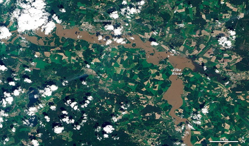
As climate change sparks a surge in the frequency and intensity of wildfires, satellite data disseminated through ESA’s Third Party Missions (TPM) programme are helping scientists to track and investigate these potentially damaging natural events.
News - Thematic area articles
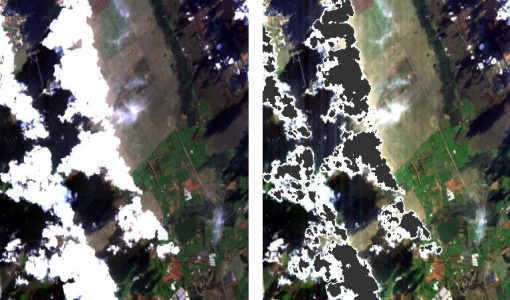
Cloud-free collections key for land monitoring
Satellite imagery is a crucially important tool for monitoring the land, but cloud cover can often block parts of Earth’s surface from view, limiting subsequent analyses.
