- All Categories (122)
- Data (1)
- News (7)
- Missions (1)
- Events (12)
- Tools (2)
- Activities (1)
- Documents (98)
Document - Newsletter
Earth Online Newsletter - 23 February 2024
This issue of the Earth Online Newsletter covers a selection of the latest news and events from ESA.
News - Infographics
Learn more about Envisat MERIS Full Resolution Level-1 data
Learn more about the Envisat MERIS Level 1 products in our latest infographic.
Event - Workshop
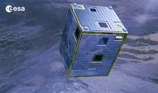
PROBA-1 CHRIS End of Mission Workshop
The PROBA-1 CHRIS End of Mission Workshop will take place from 18-19 January 2024 in Ghent, Belgium.
News - Thematic area articles
Global understanding of Earth's land surfaces greatly boosted by satellite data
ESA perform land surface monitoring with a range of instruments onboard satellites acquiring optical and radar data. Collections of data from these missions are freely available for research purposes.
Event - Training
EO Summer School 5
ESA's series of summer schools, on Monitoring of the Earth System, aims to promote the exploitation of Earth observation data.
News - Thematic area articles
Space helps monitor Earth’s changing biosphere
Earth’s biosphere is continually changing. Through its pioneering Earth observation missions, ESA is making critical contributions to monitor these changes and their impacts on Earth’s water and carbon cycles.
News - Events and Proceedings
Data preservation takes centre stage at Living Planet Symposium
Against the backdrop of the famed Rhine River, world-class scientists and Earth observation data-users are gathered this week in the historical city of Bonn, at the Living Planet Symposium (LPS).
News - Spotlight on EO community
Introducing Mirko Albani
In this short introduction, ESA's Heritage Missions Programme Manager describes what he likes most about ESA's long term archive of satellite mission data and his role in the programme.
News - Success Stories
How Envisat helped to shape global understanding of Earth’s systems
Twenty years have passed since a ground-breaking European spacecraft designed to deliver unprecedented insight into the planet’s changing environment was lofted into orbit.
Activity - Projects
Dragon 2 Cooperation Programme
The Dragon 2 Programme focussed on the exploitation of ESA, ESA's Third Party Missions and Chinese Earth observation data for science and applications development in land, ocean and atmospheric applications.
Event - Workshop
ESA/MERIS Workshop 2008
The ESA/MERIS Workshop 2008 covered the use of Envisat/MERIS data and the wider ESA-NASA-NOAA plans and collaboration.
Tools - Apps
Heritage Missions app for iOS
Download the Heritage Missions application to discover what the missions were about, how it worked and what the elements of the space and ground segment that make these missions unique.
Tools - Apps
Heritage Missions app for Android
Download the Heritage Missions application to discover what the missions were about, how it worked and what the elements of the space and ground segment that make these missions unique.
News - Infographics
Envisat - ESA's versatile Earth observation satellite
Learn more about ESA's Envisat mission - the largest Earth observation satellite ever built - in a new infographic.
Event - Training
3rd Advanced Training Course on Ocean Remote Sensing 2013
The 3rd Advanced Training Course on Ocean Remote Sensing was held from 23 to 27 September 2013 in Cork, at the National Maritime College of Ireland.
Data - EO Sign In Authentication (Open)
PROBA-1 CHRIS Level 1A
CHRIS acquired a set of up to five images of each target during each acquisition sequence, these images were acquired when PROBA-1 was pointing at distinct angles with respect to the target. CHRIS Level 1A products (supplied in HDF data files, version 4.1r3) include five formal CHRIS imaging modes, classified as modes 1 to 5: Mode Name Swath Spectral Bands/Ground Resolution Mode 1 Aerosols 13 km 62 at 34 m (773 nm / 1036 nm) Mode 2 Water bands 13 km 18 at 18 m Mode 3 Land channels 13 km 18 at 18 m Mode 4 Chlorophyll band set 13 km 18 at 18 m Mode 5 Land channels 6.5 km 37 at 18 m Spatial coverage: Check the spatial coverage of the collection on a map available on the Third Party Missions Dissemination Service.
Mission - Heritage Missions
Envisat
Envisat was ESA's successor to ERS. Envisat carried ten instruments aboard for a wide range of Earth observing fields. The mission was operational from 2002 to 2012.
Document - Proceedings
2004 Envisat and ERS Symposium
The 2004 Envisat and ERS Symposium was held in Salzburg - Austria from 6 to 10 September 2004. The 2004 Envisat and ERS Symposium provided a forum for investigators to present results of ongoing research project activities and assess the development of applications and services.
Event - Workshop
IDEAS+ Cal/Val Workshop 7
The 7th IDEAS+ Cal/Val Workshop took place on 4 and 5 June 2019 and it was hosted at the Wageningen University and Research (WUR) in The Netherlands.


