- All Categories (21)
- Data (5)
- News (8)
- Missions (1)
- Events (3)
- Tools (1)
- Activities (2)
- Documents (1)
News - Events and Proceedings
Featuring the power of Earth observation data at EGU
The European Geosciences Union General Assembly 2024 brings together geoscientists from all over the world, aiming to provide a forum where scientists and early career researchers can present their work and discuss their ideas with experts, in all fields of geoscience.
News - Operational News
Transition from FTP to FTPS for SMOS, Aeolus and Campaign data dissemination systems
As of 15 April 2024 access to the SMOS, Aeolus and Campaign data will be changed from simple FTP to FTPS.
News - Thematic area articles
Remote sensing data map impacts of natural hazards
As climate change increases the frequency and severity of natural disasters, remote sensing data can warn about extreme events and help tackle emergency situations.
News - Events and Proceedings
Scientists to showcase value of Earth observation data at EGU
Remote sensing scientists are getting ready to present innovative and exciting applications of satellite data at the European Geosciences Union general assembly which will take place from 24 to 28 April in Vienna, Austria.
News - Thematic area articles
Remote sensing data underpin research on soil
Environmental data disseminated by ESA’s Earth observation programmes provide knowledge about the stresses on Earth’s soils – aiding many applications such as crop management, drought and flood forecasting, and ecosystem protection.
News - Thematic area articles

How satellite data help to shape society
Data from ESA’s Earth observation archives are improving understanding of the interactions between human activities and the environment, helping to power green economic development and boosting prosperity in Europe and beyond.
Event - Conference

Living Planet Symposium 2022
Learn about the 2022 edition of ESA's Living Planet Symposium.
News - Thematic area articles

Space helps monitor Earth’s changing biosphere
Earth’s biosphere is continually changing. Through its pioneering Earth observation missions, ESA is making critical contributions to monitor these changes and their impacts on Earth’s water and carbon cycles.
Activity - Projects
Dragon 2 Cooperation Programme
The Dragon 2 Programme focussed on the exploitation of ESA, ESA's Third Party Missions and Chinese Earth observation data for science and applications development in land, ocean and atmospheric applications.
Event - Workshop

Space and the Arctic 2009 Workshop
Temperatures in the Arctic are rising at an unprecedented rate. This workshop looked at the needs and challenges of working and living in the rapidly changing Arctic and explore how space-based services might help to meet those needs.
News - Infographics

An overview of ESA's Third Party Missions programme
ESA’s Third Party Missions programme consists of almost 50 satellite missions, which are owned by organisations around the world. ESA has agreements with these organisations to acquire, process, and distribute data from their missions
Data - Project Proposal (Restrained)
RapidEye Full archive
The RapidEye Level 3A Ortho Tile, both Visual (in natural colour) and Analytic (multispectral), full archive products are available as part of Planet imagery offer. The RapidEye Ortho Tile product (L3A) is radiometric, sensor and geometrically corrected (by using DEMs with a post spacing of between 30 and 90 metres) and aligned to a cartographic map projection. Ground Control Points (GCPs) are used in the creation of every image and the accuracy of the product will vary from region to region based on available GCPs. Product Components Image File – GeoTIFF file that contains image data and geolocation information Metadata File – XML format metadata file Unusable Data Mask (UDM) file – GeoTIFF format Bands 3-band natural color (blue, green, red) or 5-band multispectral image (blue, green, red, red edge, near-infrared) Ground Sampling Distance 6.5 m at nadir (average at reference altitude 475 km) Projection UTM WGS84 Accuracy Depends on the quality of the reference data used (GCPs and DEMs) The products are available as part of the Planet provision from RapidEye, Skysat and PlanetScope constellations. RapidEye collection has worldwide coverage: the Planet Explorer Catalogue can be accessed (Planet registration requested) to discover and check the data readiness. All details about the data provision, data access conditions and quota assignment procedure are described in the Terms of Applicability. As per ESA policy, very high-resolution imagery of conflict areas cannot be provided.
Activity - General activities

EO Science for Society
ESA's Earth Observation Science for Society programme aims to promote scientific exploitation of satellite data, forges new scientific discoveries and pioneers new services, stimulating downstream industrial and economic growth.
Tools - Other

Forestry TEP
The Forestry Thematic Exploitation Platform (TEP) enables users in the forestry sector to access satellite data based processing services and tools for generating value-added forest information products.
Data - Announcement of Opportunity (Restrained)

Announcement of Opportunity for Aeolus Cal/Val
An Announcement of Opportunity call is open for the Aeolus mission. Scientists, new groups and individuals are invited to participate in Aeolus Cal/Val throughout the mission lifetime.
Data - EO Sign In Authentication (Open)
RapidEye time series for Sentinel-2
The European Space Agency, in collaboration with BlackBridge collected two time series datasets with a five day revisit at high resolution: February to June 2013 over 14 selected sites around the world April to September 2015 over 10 selected sites around the world. The RapidEye Earth Imaging System provides data at 5 m spatial resolution (multispectral L3A orthorectified). The products are radiometrically and sensor corrected similar to the 1B Basic product, but have geometric corrections applied to the data during orthorectification using DEMs and GCPs. The product accuracy depends on the quality of the ground control and DEMs used. The imagery is delivered in GeoTIFF format with a pixel spacing of 5 metres. The dataset is composed of data over: 14 selected sites in 2013: Argentina, Belgium, Chesapeake Bay, China, Congo, Egypt, Ethiopia, Gabon, Jordan, Korea, Morocco, Paraguay, South Africa and Ukraine. 10 selected sites in 2015: Limburgerhof, Railroad Valley, Libya4, Algeria4, Figueres, Libya1, Mauritania1, Barrax, Esrin, Uyuni Salt Lake. Spatial coverage: Check the spatial coverage of the collection on a map available on the Third Party Missions Dissemination Service.
Data - EO Sign In Authentication (Open)
RapidEye South America
ESA, in collaboration with BlackBridge, has collected this RapidEye dataset of level 3A tiles covering more than 6 million km2 of South American countries: Paraguay, Ecuador, Chile, Bolivia, Peru, Uruguay and Argentina. The area is fully covered with low cloud coverage. Spatial coverage: Check the spatial coverage of the collection on a map available on the Third Party Missions Dissemination Service.
Data - Fast Registration with approval (Restrained)
RapidEye ESA archive
The RapidEye ESA archive is a subset of the RapidEye Full archive that ESA collected over the years. The dataset regularly grows as ESA collects new RapidEye products. Spatial coverage: Check the spatial coverage of the collection on a map available on the Third Party Missions Dissemination Service.
Event - Conference

Living Planet Symposium 2019
ESA's Living Planet Symposia are amongst the biggest Earth observation conferences in the world. Scientists present their latest findings on Earth's environment and climate.
Mission - Heritage Missions
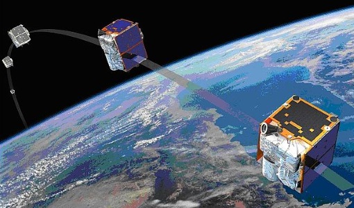
RapidEye
Together, the five RapidEye satellites were capable of collecting over 4 million square kilometres of 5 m resolution, 5-band colour imagery every day.