- All Categories (44)
- Data (6)
- News (9)
- Missions (2)
- Events (7)
- Tools (7)
- Activities (3)
- Campaigns (2)
- Documents (8)
Document - Proceedings

EO-Summer-School-5-ESA-Satellite-Missions-for-Climate-Observations.pdf
This presentation from ESA's EO Summer School 5 describes ESA Satellite Missions for Climate Observations
Document - Conference Presentation - Poster

04_OCT2013_ESA-EO_programmes.pdf
ESA EO missions and their exploitation for science and applications ESA
Document - User Guide

ResourceSat-1-Data-User-Handbook.pdf
The IRS-P6 Data User’s Handbook is published to provide essential information to the users about the mission - the sensors, orbit and coverage, referencing scheme, data acquisition, products, services and potential applications of the data.
Campaign

AROMAT-II
This campaign covers the fields of atmospheric composition: NO2, SO2, aerosols, over Romania (Bucharest and Turceni) and Germany (Berlin).
Event - Conference

Living Planet Symposium 2019
ESA's Living Planet Symposia are amongst the biggest Earth observation conferences in the world. Scientists present their latest findings on Earth's environment and climate.
Event - Workshop

Copernicus Sentinel-5 Precursor Validation Team Workshop
The purpose of the workshop was to gather feedback from the Sentinel-5P Validation Team (S5PVT) about the uncertainty characterisation of all Copernicus Sentinel-5P products.
Event - Training

Advanced Ocean Synergy Training Course
This ESA course was devoted to training the next generation of Earth Observation scientists to exploit data from ESA and Third Party Mission instruments for ocean science and application development.
Event - Meeting

20th GHRSST Science Team Meeting
The 20th GHRSST International Science Team meeting in 2019 brought together sea surface temperature experts to look at future innovations.
Tools - Visualisation
ESOV Software Tools (ESOV NG)
ESOV tool provides the means to visualise instrument swaths of all ESA EO Satellites, assist in understanding where and when satellite measurements are made and ground contact is possible.
Tools - Processing

EO CFI Software
Earth Observation CFI Software is a collection of multiplatform precompiled C libraries for timing, coordinate conversions, orbit propagation, satellite pointing calculations, and target visibility calculations.
Tools - Visualisation

S2G Data Viewer
S2G Data Viewer is an extensible application that allows you to inspect the contents of CCSDS-compliant telemetry data exchanged between a satellite and its ground segments on the space-to-ground link.
Tools - Processing
Atmospheric Toolbox
The Atmospheric Toolbox (previously known as BEAT) is a collection of executable tools and API, developed to facilitate the utilisation, viewing and processing of e.g. GOMOS, MIPAS, SCIAMACHY and GOME data.
Event - Training
4th ESA EARSEL CNR School - Remote Sensing for Forest Fires
This course was to disseminate and discuss research methods and technologies of active and passive Earth Observation for applications related to forest fires.
Activity - Fiducial Reference Measurements
FRM4GHG: Reference Measurements for Ground-Based FTIR Greenhouse Gas Observation
Fiducial Reference Measurements for Ground-Based Infrared Greenhouse Gas Observations (FRM4GHG) is a European Space Agency (ESA) funded project.
Mission - Heritage Missions
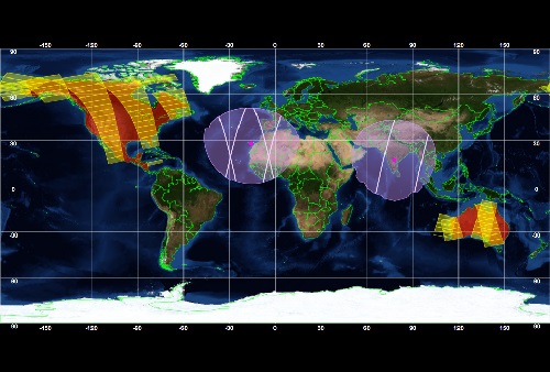
IRS-P6 (ResourceSat-1)
IRS-P6 (also known as ResourceSat-1) launched on 17 October 2003 from Satish Dhawan Space Centre by the Indian PSLV-C5, and came to an end on 30 September 2013.
Campaign

AROMAT-I
The main objective of this AROMAT-I campaign was to test newly developed airborne sensors and to evaluate their capabilities as validation tools for future air quality space borne sensors, in particular TROPOMI.
Data - Campaigns (Open)
AROMAT-I
The main objective of this AROMAT-I campaign was to test newly developed airborne sensors and to evaluate their capabilities as validation tools for future air quality space borne sensors, in particular TROPOMI.
Data - Campaigns (Open)
AROMAT-II
This campaign covers the fields of atmospheric composition: NO2, SO2, aerosols, over Romania (Bucharest and Turceni) and Germany (Berlin).
Data - Fast Registration with approval (Restrained)
Image 2006 European coverage
The Image 2006 collection is a SPOT-4, SPOT-5 and ResourceSat-1 (also known as IRS-P6) cloud free coverage over 38 European countries in 2006 (from February 2005 to November 2007). The Level 1 data provided in this collection originate from the SPOT-4 HRVIR instrument (with 20 m spatial resolution), from SPOT-5 HRG (with 10 m spatial resolution resampled to 20 m) and IRS-P6 LISS III (with 23 m spatial resolution), each with four spectral bands. The swath is of about 60 km for the SPOT satellites and 140 km for the IRS-P6 satellite. In addition to the Level 1, the collection provides the same data geometrically corrected towards a European Map Projection with 25 m resolution. Spatial coverage: Check the spatial coverage of the collection on a map available on the Third Party Missions Dissemination Service.