- All Categories (291)
- Data (9)
- News (17)
- Missions (2)
- Events (17)
- Tools (8)
- Activities (4)
- Campaigns (2)
- Documents (232)
Document - Product Cal/Val Plan/Report

Validation Report following the 3rd MERIS data reprocessing
This document prepared by the MERIS Quality Working Group (QWG) corresponds to the Validation Report following the 3rd MERIS data reprocessing. It aims at qualifying and quantifying the accuracy of the MERIS L2 products generated with the version 8.0 of MERIS Ground Segment prototype (MEGS), delivered to the whole community through the ODESA software (http://earth.eo.esa.int/odesa/). It is equivalent to version 6.0 of the Instrument Processing Facilities (IPF) at ESRIN.
News - Thematic area articles
Tracking the world’s forests from space
As human activities continue to threaten the planet’s forests, data delivered by satellites are boosting global efforts to conserve these crucial natural resources.
Document - Campaign Report

SPARC-2004-data-acquisition-report.pdf
SPARC-2004 campaign objective was to collect a CHRIS/PROBA reference dataset for SPECTRA-related studies.
Campaign

SPARC
ESA's SPectra bARrax Campaign (SPARC) activity was part of the preparatory study for a proposed ESA Earth Explorer mission called SPECTRA. The objective was to collect a CHRIS/PROBA reference dataset for SPECTRA-related studies.
Data - Campaigns (Open)
SPARC
ESA's SPectra bARrax Campaign (SPARC) activity was part of the preparatory study for a proposed ESA Earth Explorer mission called SPECTRA. The objective was to collect a CHRIS/PROBA reference dataset for SPECTRA-related studies.
News - Thematic area articles
Space data support Earth’s ecosystems
ESA’s Earth observation (EO) missions are making a critical contribution to monitoring transformations in our planet’s ecosystems, helping track changes in the vegetation, soil, and ocean that affect these systems.
Tools - Analysis

SNAP
SNAP is a common architecture for all Sentinel Toolboxes. It is ideal for Earth observation processing and analysis.
Activity - Quality
SEOM CAWA
The Advanced Clouds, Aerosols and WAter vapour products for Sentinel-3/OLCI project aims to develop and improve the advanced atmospheric retrieval algorithms developed for MERIS and OLCI instruments.
Tools - Analysis

Sentinel-3 Toolbox
The Toolbox consists of a set of visualisation, analysis and processing tools for the exploitation of OLCI and SLSTR data.
Campaign

SEN3EXP
The main objective of Sen3Exp (Sentinel-3 Experimental Campaign) was to provide a comprehensive dataset that covers all Sentinel-3 OLCI and SLSTR bands that is to be used for the algorithm prototype and ground segment processor development.
Data - Campaigns (Open)
SEN3EXP
The main objective of Sen3Exp (Sentinel-3 Experimental Campaign) was to provide a comprehensive dataset that covers all Sentinel-3 OLCI and SLSTR bands that is to be used for the algorithm prototype and ground segment processor development.
News - Data Release news

Release of Envisat MERIS 4th reprocessing data
The data from the 4th MERIS reprocessing has been released to users and is now freely available from the new ESA Online Dissemination Service for MERIS.
Document - Technical Note

Reference Model for MERIS Level 2 Processing
The specifications provided here define the parameters to be used to generate inherent optical properties for the ocean and atmosphere as a function of geophysical properties and wavelengths, which can be the basis upon which to generate test data and auxiliary parameters needed for operation and end-to-end tests of the MERIS ground segment processor (i.e., mostly to generate water-leaving reflectances or total reflectances at the top of the atmosphere level). Parameters have been selected from various measurements and models in water, surface and atmosphere.
Document - Technical Note
Radiative transfer processes simulated within a coupled 'Atmosphere-Land-Ocean' system
The purpose of this document is to describe the radiative transfer processes simulated within a coupled 'Atmosphere-Land/Ocean' system by two different codes developed by ???? Freie Universit??t Berlin ???? (FUB) in Germany and ???? Laboratoire Interdisciplinaire en Sciences de l'Environnement - Universit?��� du Littoral (LISE/UdL) in France.
Data - Fast Registration with approval (Restrained)
QuickBird-2 ESA archive
The QuickBird-2 archive collection consists of QuickBird-2 products requested by ESA supported projects over their areas of interest around the world. The dataset regularly grows as ESA collects new products over the years. Panchromatic (up to 61 cm resolution) and 4-Bands (up to nominal value of 2.44 m resolution, reduced to 1.63 m when the orbit altitude was lowered to 300 km at the end of the mission) products are available. The 4-Bands includes various options such as Multispectral (separate channel for Blue, Green, Red, NIR1), Pan-sharpened (Blue, Green, Red, NIR1), Bundle (separate bands for PAN, Blue, Green, Red, NIR1), Natural Colour (pan-sharpened Blue, Green, Red), Coloured Infrared (pan-sharpened Green, Red, NIR1), Natural Colour / Coloured Infrared (3-Band pan-sharpened). The processing levels are: STANDARD (2A): normalised for topographic relief View Ready Standard (OR2A): ready for orthorectification View Ready Stereo: collected in-track for stereo viewing and manipulation Map-Ready (Ortho) 1:12,000 Orthorectified: additional processing unnecessary Map-Ready (Ortho) 1:15,000 Orthorectified: additional processing unnecessary Spatial coverage: Check the spatial coverage of the collection on a map available on the Third Party Missions Dissemination Service. The following table summarises the offered product types EO-SIP product type Band Combination Description BGI_PAN_2A Panchromatic (PAN) Panchromatic Standard/Panchromatic Ortho Ready Standard BGI_PAN_MP Panchromatic (PAN) Panchromatic Map Scale Ortho BGI_PAN_OR Panchromatic (PAN) Panchromatic Ortho Ready Stereo BGI_4B__2A 4-Band (4B) 4-Band Standard/4-band Ortho Ready Standard BGI_4B__MP 4-Band (4B) 4-Band Map Scale Ortho BGI_4B__OR 4-Band (4B) 4-Band Ortho Ready Stereo
Mission - Heritage Missions
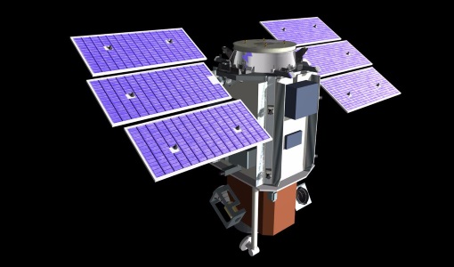
QuickBird-2
QuickBird-2 was an Earth-imaging satellite. When launched in 2001, it was then the highest resolution commercial satellite.
Data - Project Proposal (Restrained)
QuickBird full archive
QuickBird high resolution optical products are available as part of the Maxar Standard Satellite Imagery products from the QuickBird, WorldView-1/-2/-3/-4, and GeoEye-1 satellites. All details about the data provision, data access conditions and quota assignment procedure are described into the Terms of Applicability available in Resources section. In particular, QuickBird offers archive panchromatic products up to 0.60 m GSD resolution and 4-Bands Multispectral products up to 2.4 m GSD resolution. Band Combination Data Processing Level Resolution Panchromatic and 4-bands Standard(2A)/View Ready Standard (OR2A) 15 cm HD, 30 cm HD, 30 cm, 40 cm, 50/60 cm View Ready Stereo 30 cm, 40 cm, 50/60 cm Map-Ready (Ortho) 1:12,000 Orthorectified 15 cm HD, 30 cm HD, 30 cm, 40 cm, 50/60 cm 4-Bands being an option from: 4-Band Multispectral (BLUE, GREEN, RED, NIR1) 4-Band Pan-sharpened (BLUE, GREEN, RED, NIR1) 4-Band Bundle (PAN, BLUE, GREEN, RED, NIR1) 3-Bands Natural Colour (pan-sharpened BLUE, GREEN, RED) 3-Band Colored Infrared (pan-sharpened GREEN, RED, NIR1) Natural Colour / Coloured Infrared (3-Band pan-sharpened) Native 30 cm and 50/60 cm resolution products are processed with MAXAR HD Technology to generate respectively the 15 cm HD and 30 cm HD products: the initial special resolution (GSD) is unchanged but the HD technique intelligently increases the number of pixels and improves the visual clarity achieving aesthetically refined imagery with precise edges and well reconstructed details.
Document - Proceedings

PolInSAR-2007-Proceedings-of-the-3rd-International-Workshop-on-Science-and-Applications-of-SAR-Polarimetry-and-Polarimetric-Interferometry.pdf
Proceedings of PolInSAR 2007 held in Frascati, Italy on from 22-26 January 2007.