- All Categories (47)
- Data (5)
- News (2)
- Missions (2)
- Events (2)
- Tools (6)
- Activities (3)
- Campaigns (1)
- Documents (26)
News - Thematic area articles
Cloud-free collections key for land monitoring
Satellite imagery is a crucially important tool for monitoring the land, but cloud cover can often block parts of Earth’s surface from view, limiting subsequent analyses.
Tools - Catalogues
FedEO
FedEO is a data catalogue that provides a unique entry point to a number of scientific catalogues and services for, but not limited to, European and Canadian missions.
Tools - Catalogues
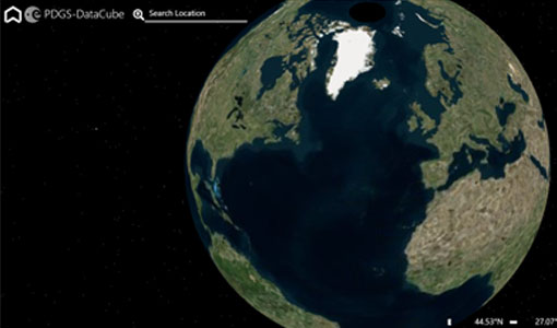
ESA PDGS DataCube
ESA's DataCube is a data catalogue that enables multi-temporal and pixel-based access to a subset of data available from ESA
Tools - Catalogues
EO CAT
EO CAT is a data catalogue, offering a Next Generation Earth Observation system designed to manage end-user Earth Observation services.
Document - Proceedings
EO-Summer-School-2-Overview-of-land-surface-parameters-from-EO.pdf
Overview of land surface parameters from Earth Observation
Activity - General activities
MUltisource data package tools and SErvices (MUSE)
The MUSE project aims to develop and integrate a tool to simultaneously manipulate geospatial data products, satellite, model and in-situ data.
Event - Workshop
ESA/MERIS Workshop 2008
The ESA/MERIS Workshop 2008 covered the use of Envisat/MERIS data and the wider ESA-NASA-NOAA plans and collaboration.
Tools - Visualisation
EVDC Orbit Prediction Tool
The EVDC Orbit Prediction and Overpass Tool generates and visualises satellite's overpasses.
News - Data Release news
SPOT 4-5 Take 5 ESA archive online dataset
ESA is pleased to announce the availability of SPOT 4-5 Take 5 products to the scientific community.
Data - EO Sign In Authentication (Open)
SPOT 4-5 Take5 ESA archive
At the end of SPOT-4 mission, the Take5 experiment was launched and the satellite was moved to a lower orbit to obtain a 5 day repeat cycle, same repetition of Sentinel-2. Thanks to this orbit, from 1 February to 19 June 2013 a time series of images acquired every 5 days with constant angle and over 45 different sites were observed. In analogy to the previous SPOT-4 Take-5 experiment, also SPOT-5 was placed in a 5 days cycle orbit and 145 selected sites were acquired every 5 days under constant angles from 8 April to 31 August 2015. With a resolution of 10 m, the following processing levels are available: Level 1A: reflectance at the top of atmosphere (TOA), not orthorectified products Level 1C: data orthorectified reflectance at the top of atmosphere (TOA) Level 2A: data orthorectified surface reflectance after atmospheric correction (BOA), along with clouds mask and their shadow, and mask of water and snow. Spatial coverage: Check the spatial coverage of the collection on a map available on the Third Party Missions Dissemination Service.
Data - Fast Registration with approval (Restrained)
SPOT 1-5 ESA archive
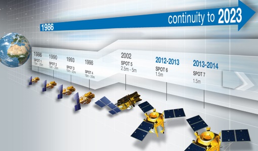
The ESA SPOT 1-5 collection is a dataset of SPOT 1 to 5 Panchromatic and Multispectral products that ESA collected over the years. The HRV(IR) sensor onboard SPOT 1-4 provides data at 10 m spatial resolution Panchromatic mode (-1 band) and 20 m (Multispectral mode -3 or 4 bands). The HRG sensor on board of SPOT-5 provides spatial resolution of the imagery to < 3 m in the panchromatic band and to 10 m in the multispectral mode (3 bands). The SWIR band imagery remains at 20 m. The dataset mainly focuses on European and African sites but some American, Asian and Greenland areas are also covered. Spatial coverage: Check the spatial coverage of the collection on a map available on the Third Party Missions Dissemination Service. The SPOT Collection
Data - Fast Registration with approval (Restrained)
Image 2006 European coverage
The Image 2006 collection is a SPOT-4, SPOT-5 and ResourceSat-1 (also known as IRS-P6) cloud free coverage over 38 European countries in 2006 (from February 2005 to November 2007). The Level 1 data provided in this collection originate from the SPOT-4 HRVIR instrument (with 20 m spatial resolution), from SPOT-5 HRG (with 10 m spatial resolution resampled to 20 m) and IRS-P6 LISS III (with 23 m spatial resolution), each with four spectral bands. The swath is of about 60 km for the SPOT satellites and 140 km for the IRS-P6 satellite. In addition to the Level 1, the collection provides the same data geometrically corrected towards a European Map Projection with 25 m resolution. Spatial coverage: Check the spatial coverage of the collection on a map available on the Third Party Missions Dissemination Service.
Data - External Data (Restrained)
ADAM Surface Reflectance Database v4.0
ADAM enables generating typical monthly variations of the global Earth surface reflectance at 0.1° spatial resolution (Plate Carree projection) and over the spectral range 240-4000 nm. The ADAM product is made of gridded monthly mean climatologies over land and ocean surfaces, and of a companion API toolkit that enables the calculation of hyperspectral (at 1 nm resolution over the whole 240-4000 nm spectral range) and multidirectional reflectances (i.e. in any illumination/viewing geometry) depending on user choices. The ADAM climatologies that feed the ADAM calculation tools are: For ocean: Monthly chlorophyll concentration derived from SeaWiFS-OrbView-2 (1999-2009); it is used to compute the water column reflectance (which shows large spectral variations in the visible, but is insignificant in the near and mid infrared). Monthly wind speed derived from SeaWinds-QuikSCAT-(1999-2009); it is used to calculate the ocean glint reflectance. For land: Monthly normalized surface reflectances in the 7 MODIS narrow spectral bands derived from FondsdeSol processing chain of MOD09A1 products (derived from Aqua and Terra observations), on which relies the modelling of the hyperspectral/multidirectional surface (soil/vegetation/snow) reflectance. Uncertainty variance-covariance matrix for the 7 spectral bands associated to the normalized surface reflectance. For sea-ice: Sea ice pixels (masked in the original MOD09A1 products) have been accounted for by a gap-filling approach relying on the spatial-temporal distribution of sea ice coverage provided by the CryoClim climatology for year 2005.
Tools - Analysis
Sentinel-3 Toolbox
The Toolbox consists of a set of visualisation, analysis and processing tools for the exploitation of OLCI and SLSTR data.
Tools - Analysis
Sentinel-2 Toolbox
The Toolbox consists of a rich set of visualisation, analysis and processing tools for the exploitation of optical high-resolution products including the Sentinel-2 MSI sensor.
Data - Campaigns (Open)
THERMOPOLIS
The THERMOPOLIS 2009 campaign mainly served the DUE “Urban Heat islands (UHI) and Urban Thermography (UT) Project”
Campaign
THERMOPOLIS
The THERMOPOLIS 2009 campaign mainly served the DUE “Urban Heat islands (UHI) and Urban Thermography (UT) Project”
Mission - Heritage Missions
SPOT
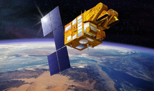
The SPOT (from French "Satellite pour l'Observation de la Terre") series of missions has been supplying high-resolution, wide-area optical imagery since 1986.
Document - Algorithms Theoretical Baseline Document
cawa-requirements-baseline.pdf
CAWA (Advanced Clouds, Aerosols and WAter vapour products for Sentinel-3/OLCI) requirements baseline document provides information about the physical background, technical structure and the functional principle of the CAWA total column water vapour retrieval as defined within the CAWA project, which aims to the development and improvement of advanced atmospheric retrieval algorithms for the Envisat/MERIS and Sentinel-3/OLCI mission.

