- All Categories (33)
- Data (6)
- News (12)
- Missions (1)
- Events (3)
- Campaigns (9)
- Documents (2)
Mission - Third Party Missions
SkySat
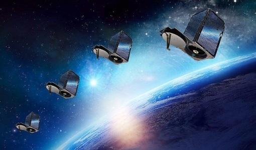
SkySat is a constellation of high-resolution Earth imaging satellites from the commercial company Planet Labs.
Event - Meeting
Fluorescence (FLEX) 2019
The FLEX 2019 meeting consisted of a series of events addressing remote sensing of vegetation fluorescence.
Event - Meeting
VH-RODA and CEOS SAR workshop
The workshop provided an open forum for the presentation and discussion of current status and future developments related to the calibration and validation of space borne very high-resolution SAR and optical sensors and data products.
Campaign
FLEX-US
The primary goal of the 2013 joint ESA/NASA airborne campaign was to record an unprecedented FLEX-like dataset containing maps of sun-induced fluorescence, hyperspectral reflectance, surface temperature, and canopy structure.
Campaign
HYFLEX
This HYFLEX campaign aimed to deliver maps of sun-induced fluorescence recorded from airborne measurements using the approaches of the spaceborne FLEX mission.
Campaign
SPARC
ESA's SPectra bARrax Campaign (SPARC) activity was part of the preparatory study for a proposed ESA Earth Explorer mission called SPECTRA. The objective was to collect a CHRIS/PROBA reference dataset for SPECTRA-related studies.
Campaign
CEFLES2
The objective of the CEFLES2 campaigns was to provide key reference data and background knowledge for the preparatory phases of the Sentinel‐2 and FLEX missions.
Data - Campaigns (Open)
PhotoProxy 2019
The Photosynthetic-Proxy Experiment campaign address relevant open aspects that are related to the quantitative assessment of vegetation photosynthesis and vegetation stress from space.
Data - Campaigns (Open)
HYFLEX
This HYFLEX campaign aimed to deliver maps of sun-induced fluorescence recorded from airborne measurements using the approaches of the spaceborne FLEX mission.
Data - Campaigns (Open)
FLEXSense 2019
The FLEXSense 2019 campaign activities were undertaken in Germany and Italy with the goal of providing a complete set of high-resolution experimental data, including all relevant elements required for the preparation of the FLEX satellite mission.
Data - Campaigns (Open)
FLEXSense 2018
The 2018 Fluorescence Explorer Sense (FLEXSense) campaign combined various field activities in preparation for the FLEX satellite mission.
Data - Campaigns (Open)
FLEX-US
The primary goal of the 2013 joint ESA/NASA airborne campaign was to record an unprecedented FLEX-like dataset containing maps of sun-induced fluorescence, hyperspectral reflectance, surface temperature, and canopy structure.
Data - Campaigns (Open)
FLEX EU 2014
The FLEX-EU Campaign was carried out in 2014 over an agricultural area around Jülich, Germany, Latisana, Italy and forest sites in Czech Republic
Campaign
FLEX EU 2014
The FLEX-EU Campaign was carried out in 2014 over an agricultural area around Jülich, Germany, Latisana, Italy and forest sites in Czech Republic
Campaign
SoyFLEX II 2016
The SoyFLEX II experiment was a repetition of an experiment that took place during the 2015 campaign in Germany.
News - Data Release news
New Campaign datasets available
A new set of datasets is available, acquired during airborne campaigns conducted between 2014 and 2019
News - Thematic area articles
Satellite data boost global understanding of land surface
Understanding our changing land surface is essential in the study of climate change. Satellites are used to monitor changes to the material that covers Earth’s surface, so-called land cover, such as vegetation and water.
News - Infographics
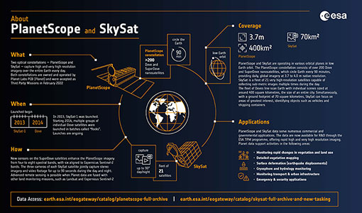
PlanetScope and SkySat - The high-resolution nanosatellite constellation
Find out more about the PlanetScope and SkySat missions in our new infographic.
News - Success Stories
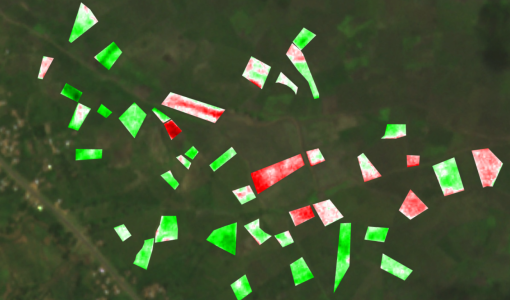
Predicting crop yield using Planet data
The world’s population continues to grow, while the climate crisis is raising Earth’s temperatures and increasing the likelihood of extreme weather events – all of which affect food security.
News - Data Release news
PlanetScope and Skysat data available through ESA’s Third Party Missions Programme
Through ESA’s Third Party Missions Programme, researchers, scientists and companies from around the world can apply to access Planet’s high-frequency, high-resolution satellite data for non-commercial use.


