- All Categories (39)
- Data (6)
- News (14)
- Missions (2)
- Events (14)
- Tools (1)
- Campaigns (1)
- Documents (1)
News - Success Stories

Using Satellite Data to Predict Floods and Droughts
Scientists are turning to remote sensing to fill the in-situ data gap in hydrological data models in some parts of the world.
News - Success Stories
TPM data help advance plastic litter detection from space
Several innovative ESA Discovery element projects exploring remote sensing of plastic marine litter lean on commercial satellite data disseminated via the Agency’s Third Party Mission programme.
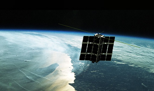
News - Data Release news
Spire data now open to users
Following the submission of a project proposal, data from the Spire mission are now available.
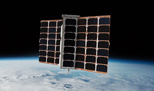
Mission - Third Party Missions
Spire
Spire Global's constellation of Lemur nanosatellites offer satellite-based maritime, aviation and weather tracking.
News - Thematic area articles
Space data support Earth’s ecosystems
ESA’s Earth observation (EO) missions are making a critical contribution to monitoring transformations in our planet’s ecosystems, helping track changes in the vegetation, soil, and ocean that affect these systems.
Data - EO Sign In Authentication (Open)
SMOS Tropical Cyclone Wind Radii Fixes
The SMOS WRF product is available in Near Real Time to support tropical cyclones (TC) forecasts. It is generated within 4 to 6 hours from sensing from the SMOS L2 swath wind speed products, in the so-called "Fix (F-deck)" format compatible with the US Navy's ATCF (Automated Tropical Cyclone Forecasting) System. The SMOS WRF "fixes" to the best-track forecasts contain: the SMOS 10-min maximum-sustained winds (in knots) and wind radii (in nautical miles) for the 34 kt (17 m/s), 50 kt (25 m/s) and 64 kt (33 m/s) winds per geographical storm quadrants, and for each SMOS pass intercepting a TC in all the active ocean basins.
Data - EO Sign In Authentication (Open)
SMOS NRT L2 Swath Wind Speed
SMOS retrieved surface wind speed gridded maps (with a spatial sampling of 1/4 x 1/4 degrees) are available in NetCDF format. Each product contains parts of ascending and descending orbits and it is generated by Ifremer, starting from the SMOS L1B data products, in Near Real Time i.e. within 4 to 6 hours from sensing time. Before using this dataset, please check the read-me-first note available in the Resources section below.
Data - EO Sign In Authentication (Open)
SMOS L3 Daily Wind Speed
SMOS L3WS products are daily composite maps of the collected SMOS L2 swath wind products for a specific day, provided with the same grid than the Level 2 wind data (SMOS L2WS NRT) but separated into ascending and descending passes. This product is available the day after sensing from Ifremer, in NetCDF format. Before using this dataset, please check the read-me-first note available in the Resources section below.
Event - Workshop

SEASAR 2012
The European Space Agency and the Norwegian Space Centre jointly organised the fourth SAR oceanography workshop, 'SEASAR 2012', entitled 'Advances in SAR Oceanography'.
Event - Workshop

SEASAR 2008
The "Advances in SAR Oceanography from Envisat and ERS missions" was a thematic workshop on SAR remote sensing techniques for oceanography.
News - Success Stories

SAR synergy data for maritime surveillance
With the aim of safeguarding our oceans, a recent study uses a synergy of synthetic aperture radar (SAR) images to improve maritime surveillance.
Event - Workshop
POLinSAR 2019
ESA organised POLinSAR 2019, the 9th International Workshop on Science and Applications of SAR Polarimetry and Polarimetric Interferometry.
Event - Workshop
POLinSAR 2009
The 2009 workshop focused on theory and methods in the fields of SAR Polarimetry and Polarimetric Interferometry
News - Data Release news

New CryoSat Ice Baseline-E Reprocessed Data – Available now!
The CryoSat Ice Baseline-E Reprocessing campaign is now complete.
News - Success Stories
New CryoSat data to boost understanding of the oceans
A new CryoSat sea level anomaly product designed to enable ocean science and the development of operational marine applications has been released.
News - Thematic area articles
Monitoring water on Earth's surface
ESA's Earth observation satellites are playing a leading role in furthering our understanding of how Earth's terrestrial hydrosphere is being influenced by humankind.
Event - Conference
International Symposium on Sea Ice 2023
The International Glaciological Society, the Alfred-Wegener-Institute, Helmholtz-Zentrum für Polar- und Meeresforschung, and the University of Bremen jointly organize the symposium which will be held in Bremerhaven, Germany from 4 to 9 June 2023.
Event - Workshop
Insurance Industry Workshop on Earth Observation
This ESA workshop examined the potential value of satellite Earth Observation data to the insurance industry.
Document - Technical Note

ICEYE-Terms-Of-Applicability.pdf
This document contains the Terms of Applicability for accessing data from the ICEYE Third Party Mission.
News - Success Stories

ICEYE, the World’s First SAR New Space Constellation
ICEYE is a revolutionary Finnish company that developed and launched the world’s first under-100 kilogram synthetic-aperture radar (SAR) satellites into orbit.